
Snow Northwest
Discover your next winter adventure in Washington, Idaho & Oregon.
Snow NW
Your source for all of the information you need to plan and navigate your next winter adventure. Snowmobile, Nordic and Fat Bike trails in Washington, Idaho and Oregon.
Use the web map that you can access from any browser or buy a GeoPDF map that you can print or use to navigate off-line.
More than 15,000 miles of winter trails and 400+ trailheads, Sno-Parks, and winter recreation facilities in Washington, Idaho, and Oregon. Snowmobiling | Tracked ATVs | Nordic & Alpine Skiing | Snowshoeing | Snowboarding | Sledding | Fat Tire Biking | Dog Sledding
Printable/GeoPDF maps
Download maps to print, view in your browser or use with a GeoPDF reader such as Avenza Maps.
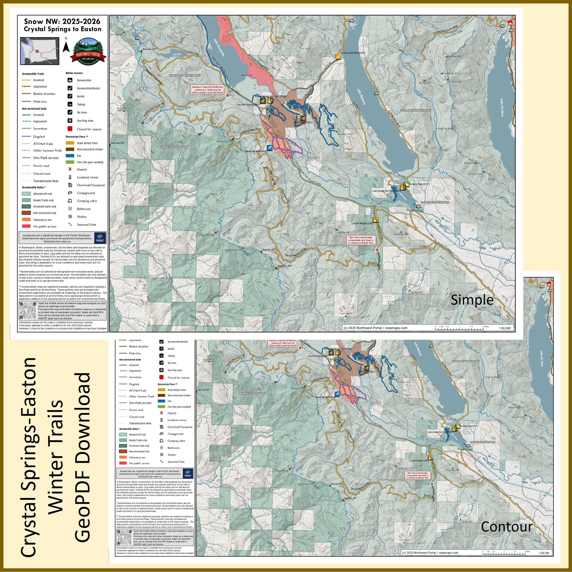
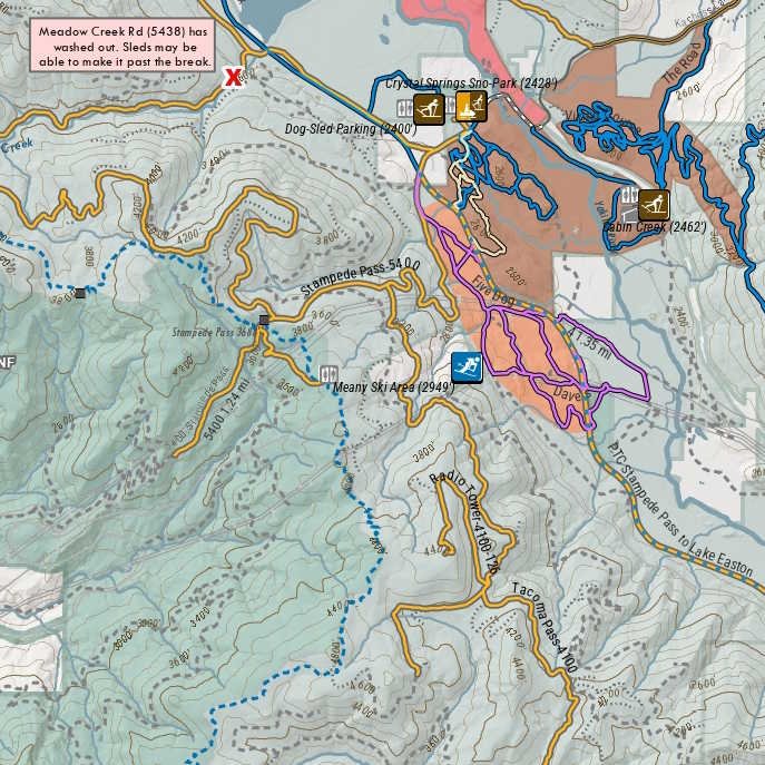
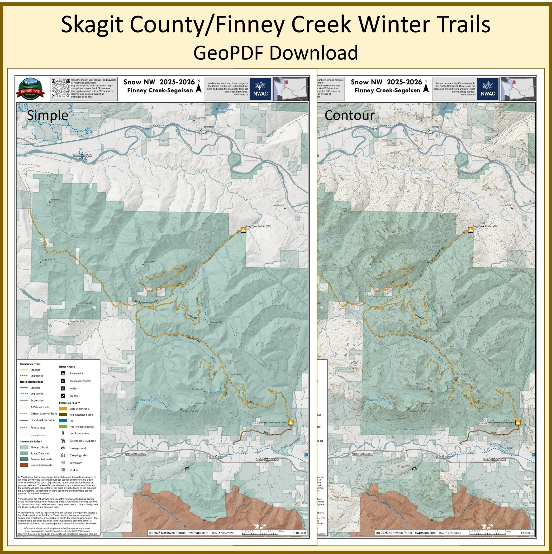
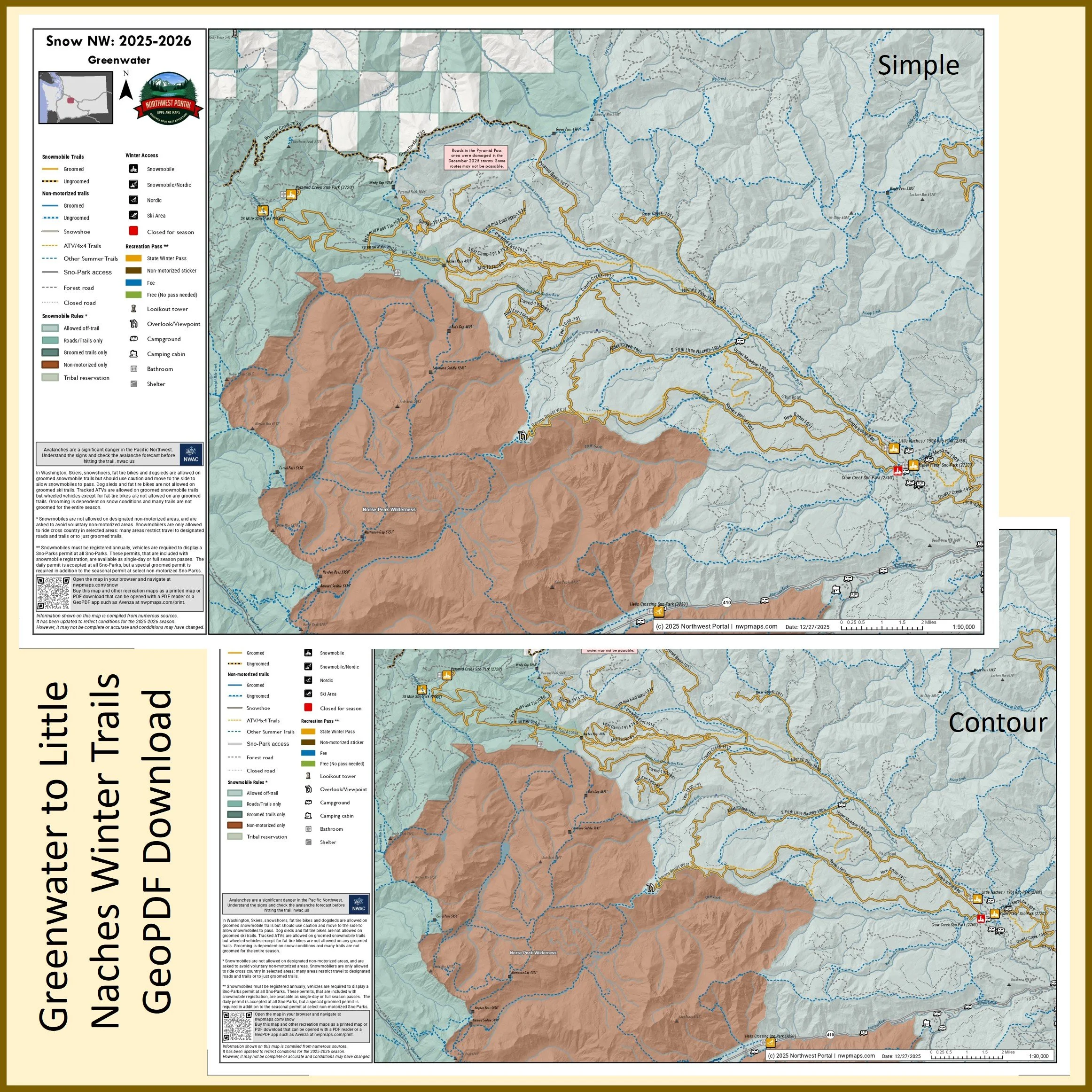
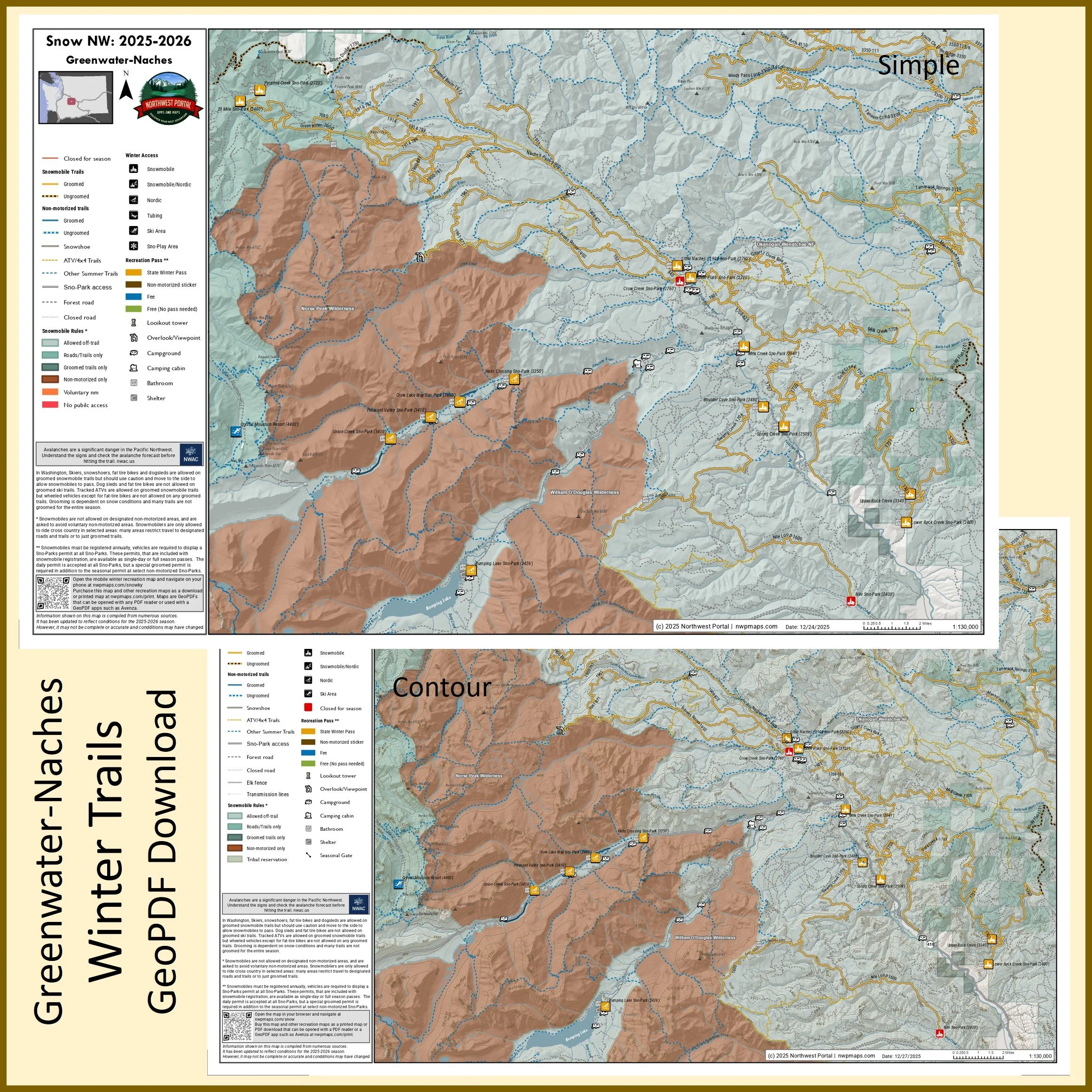
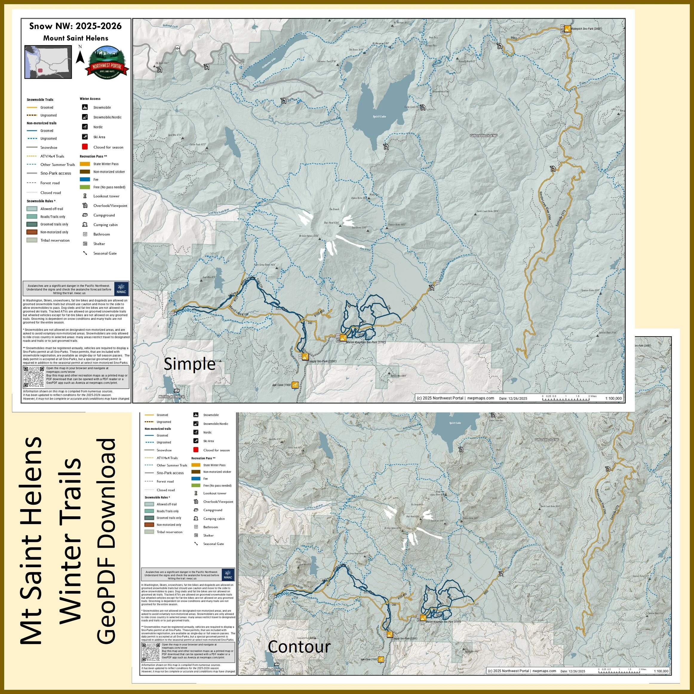
Northwest Portal has created a set of maps covering all groomed snowmobile trails in Washington State and will be adding maps of Nordic areas and selected snowmobile trails in Oregon and Idaho. The maps are updated for the 2025-2026 season, including temporary closures and changes to groomed routes.
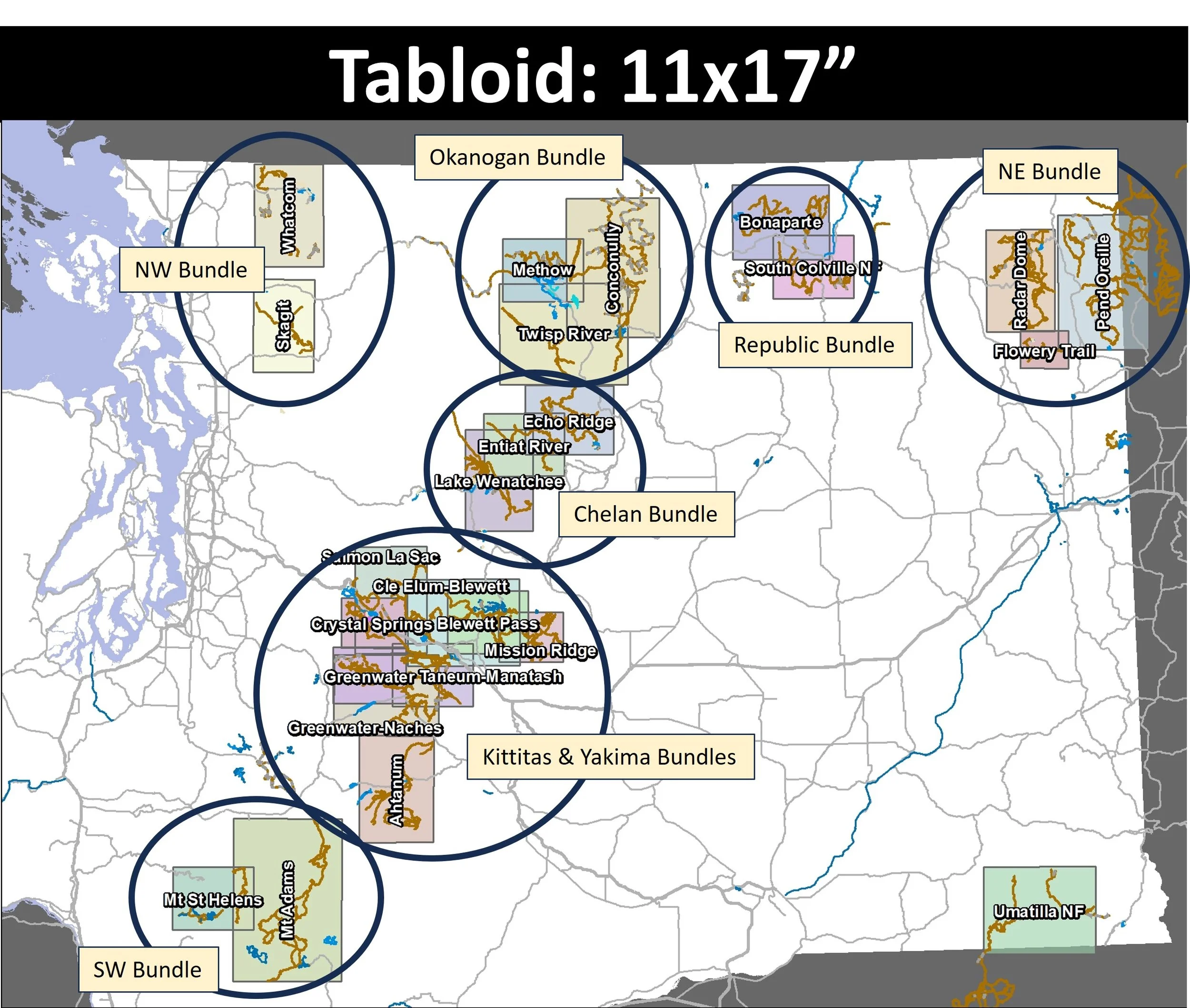
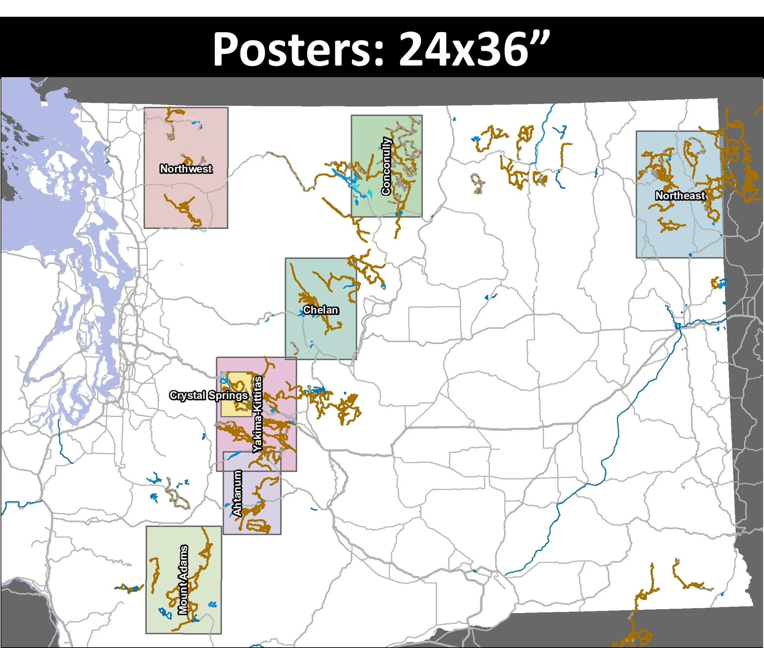
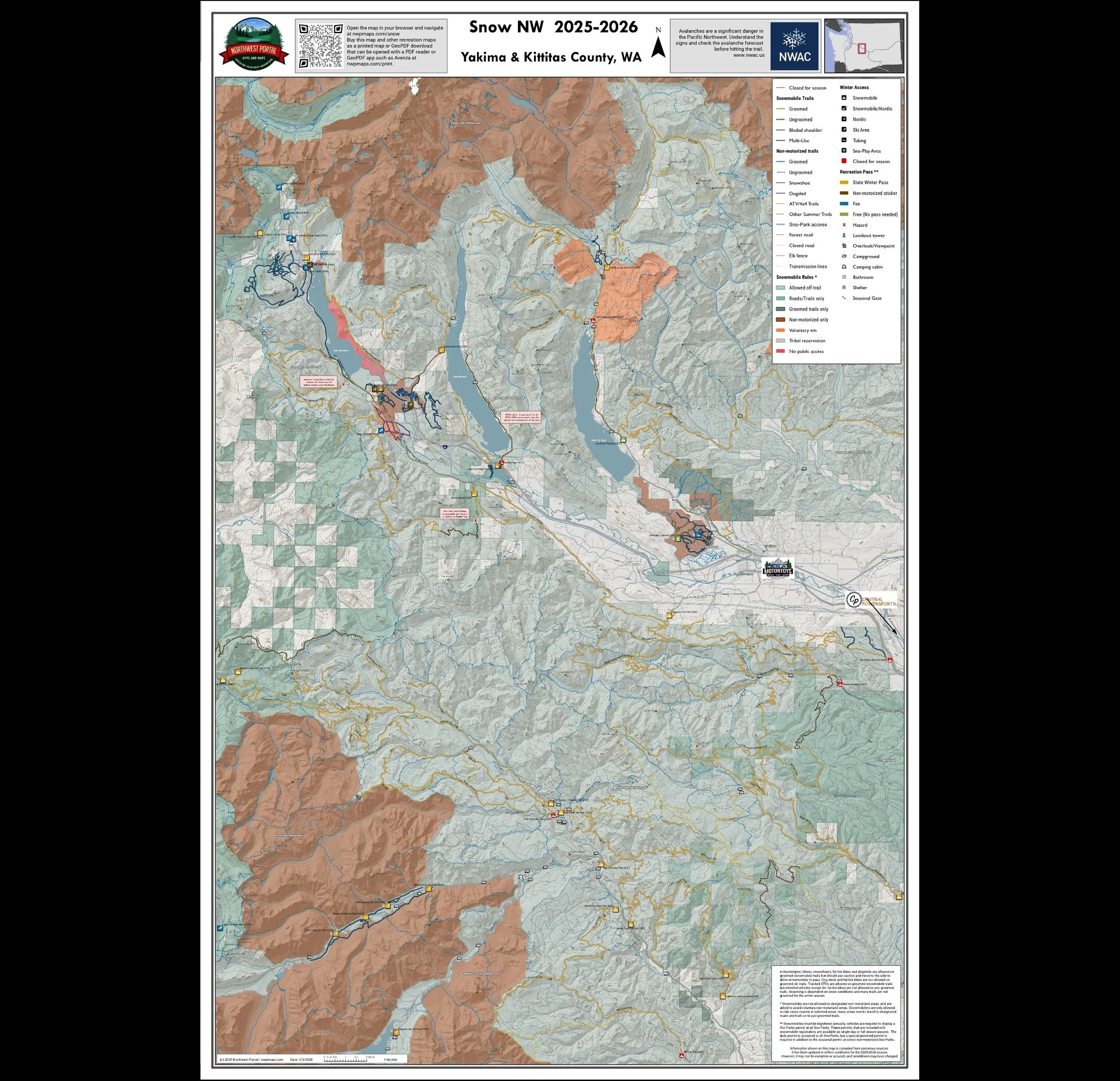
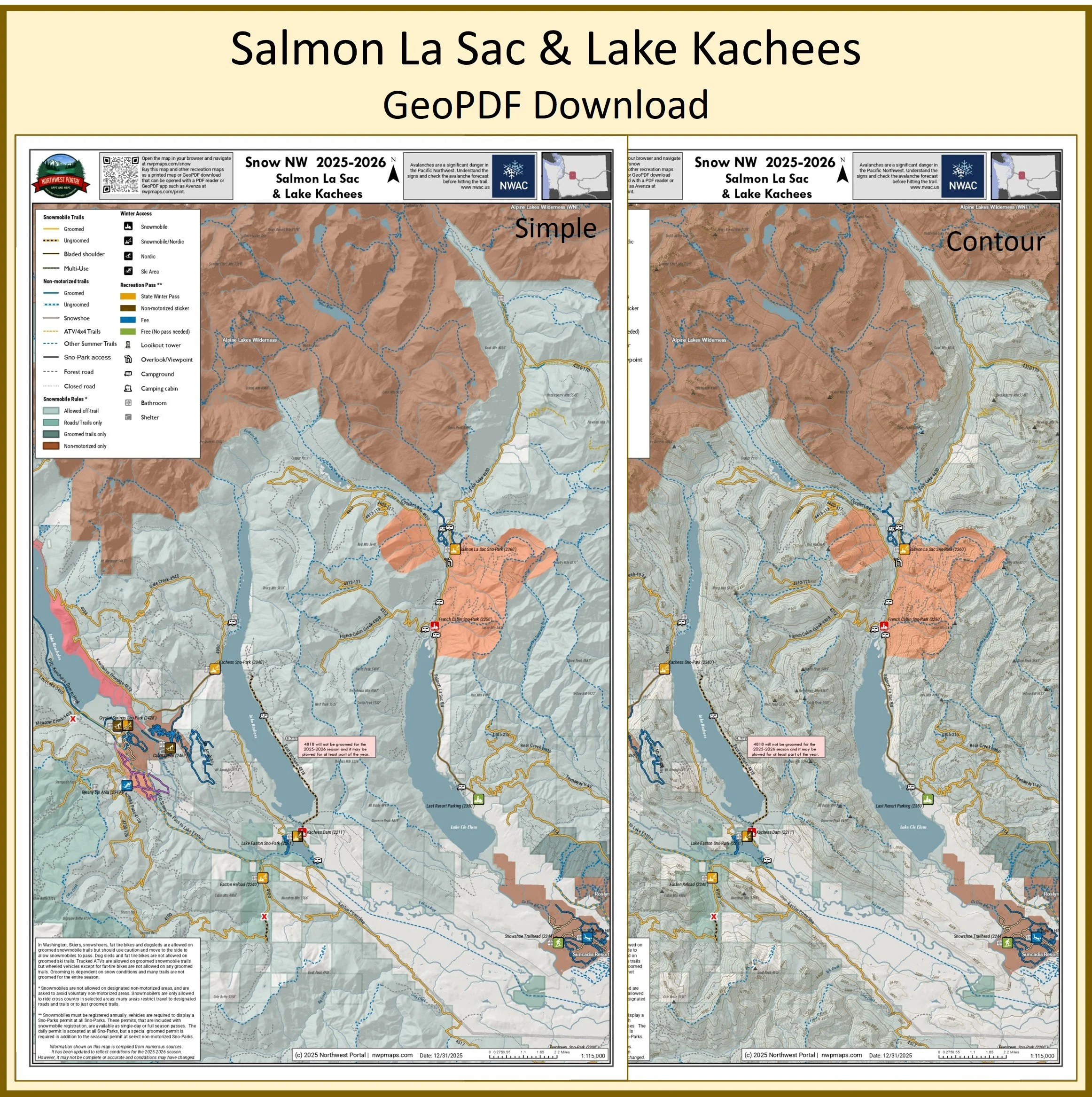
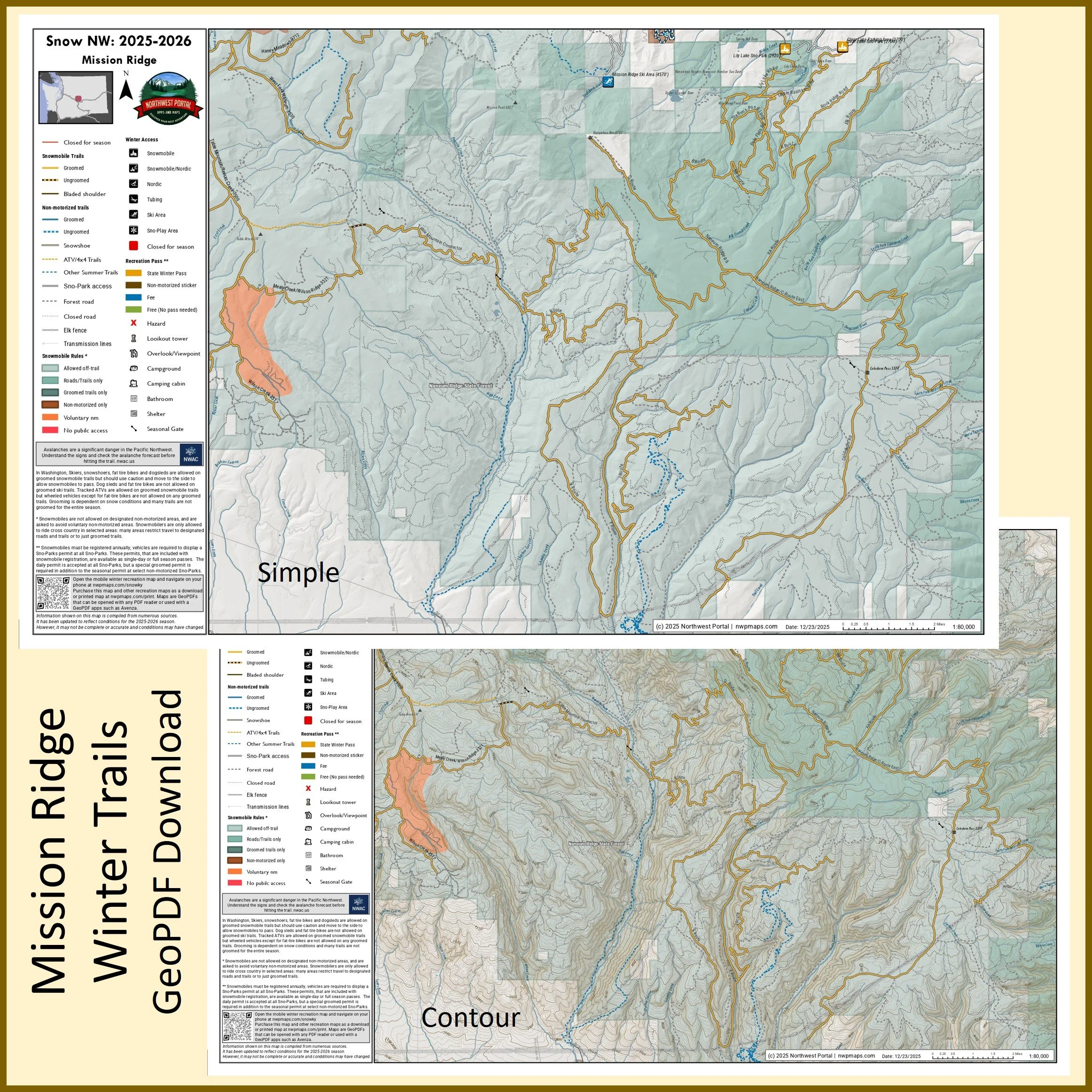
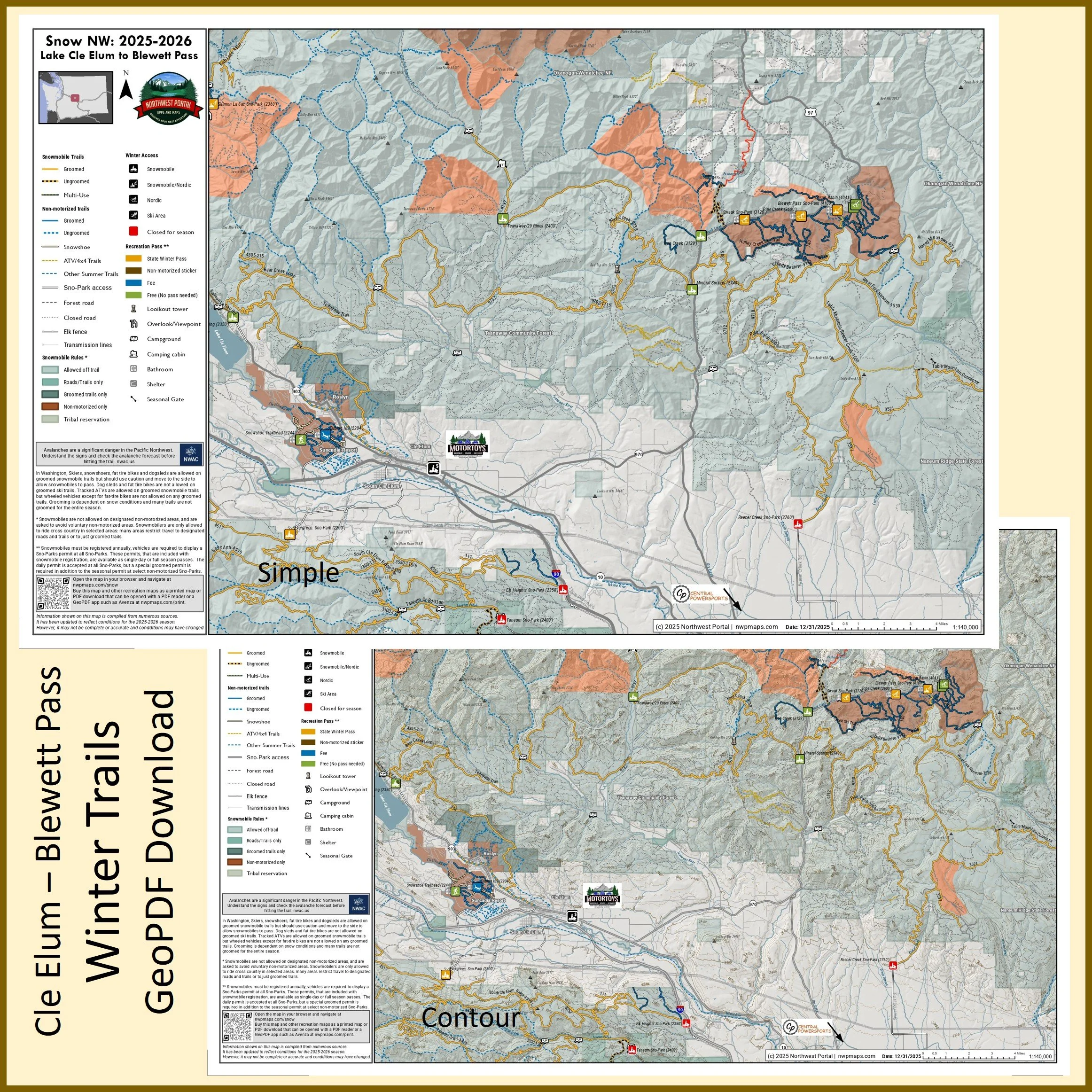
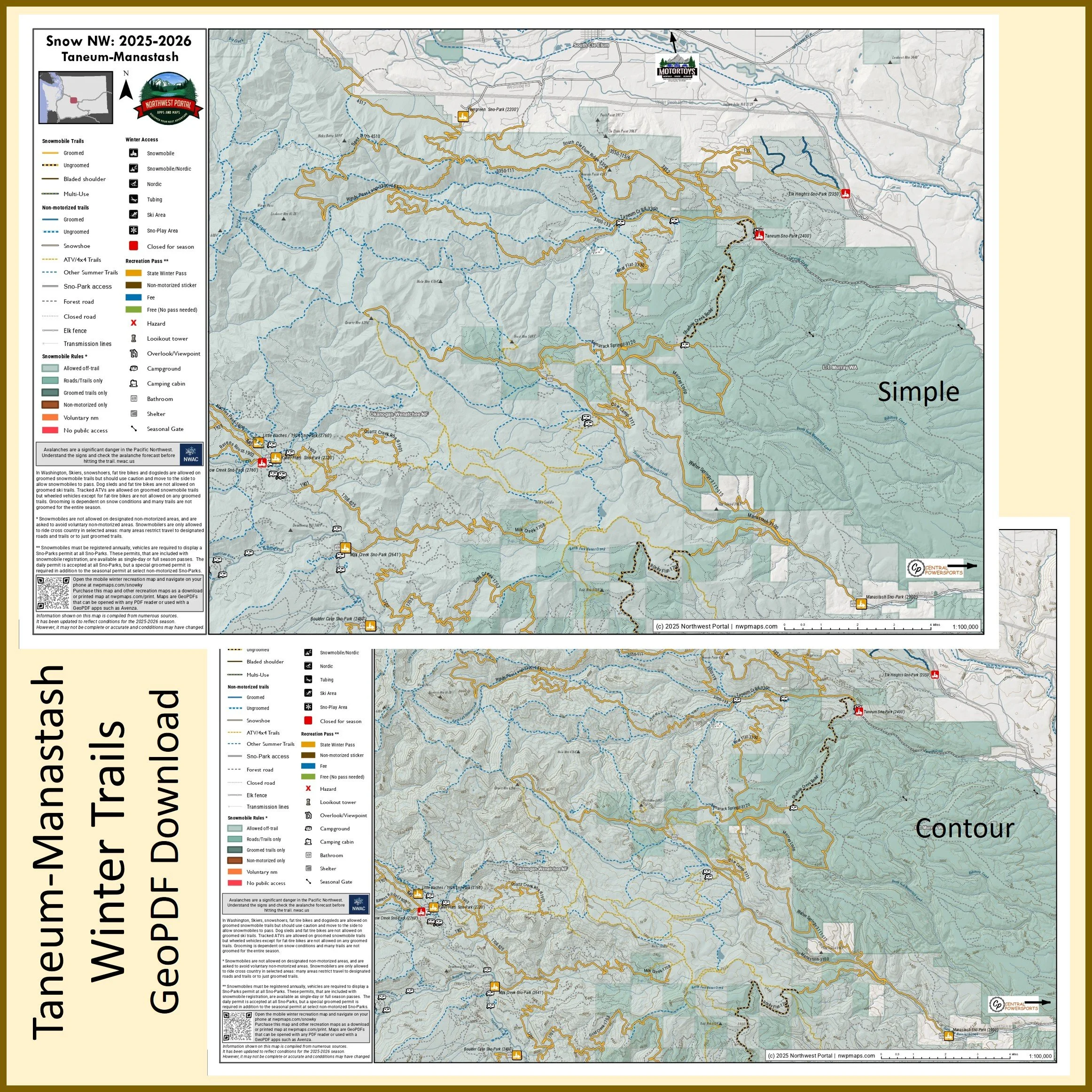
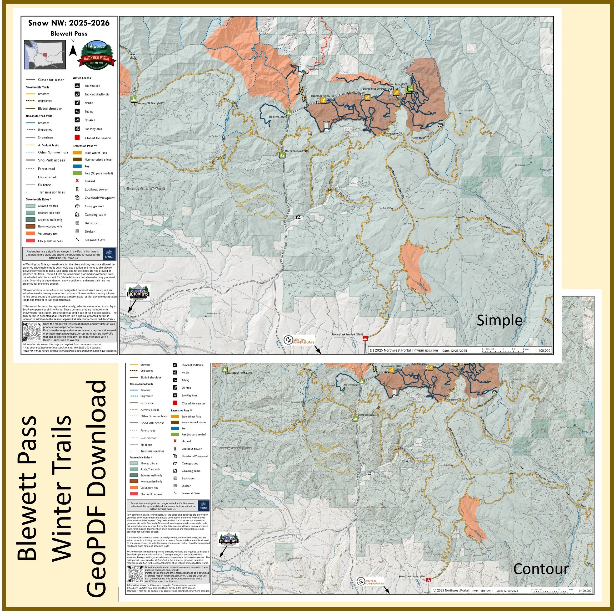
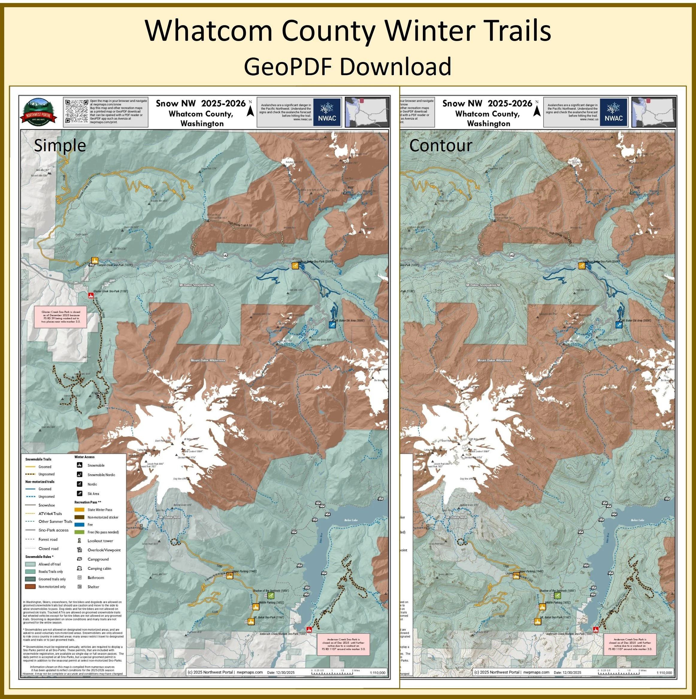
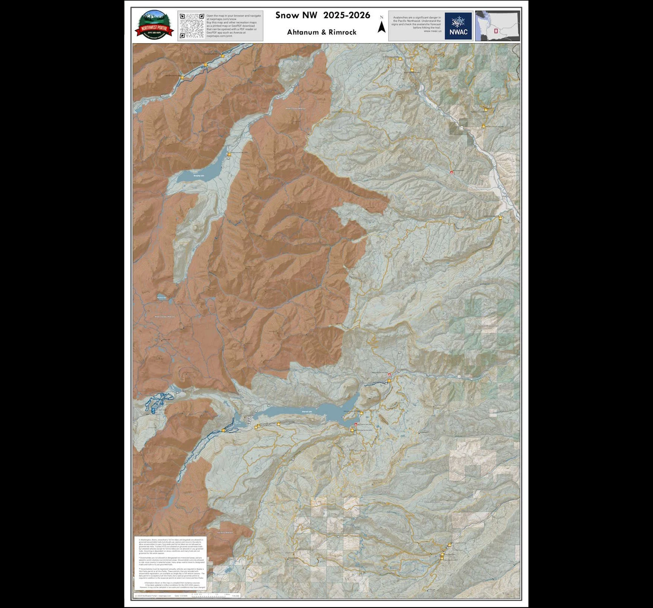
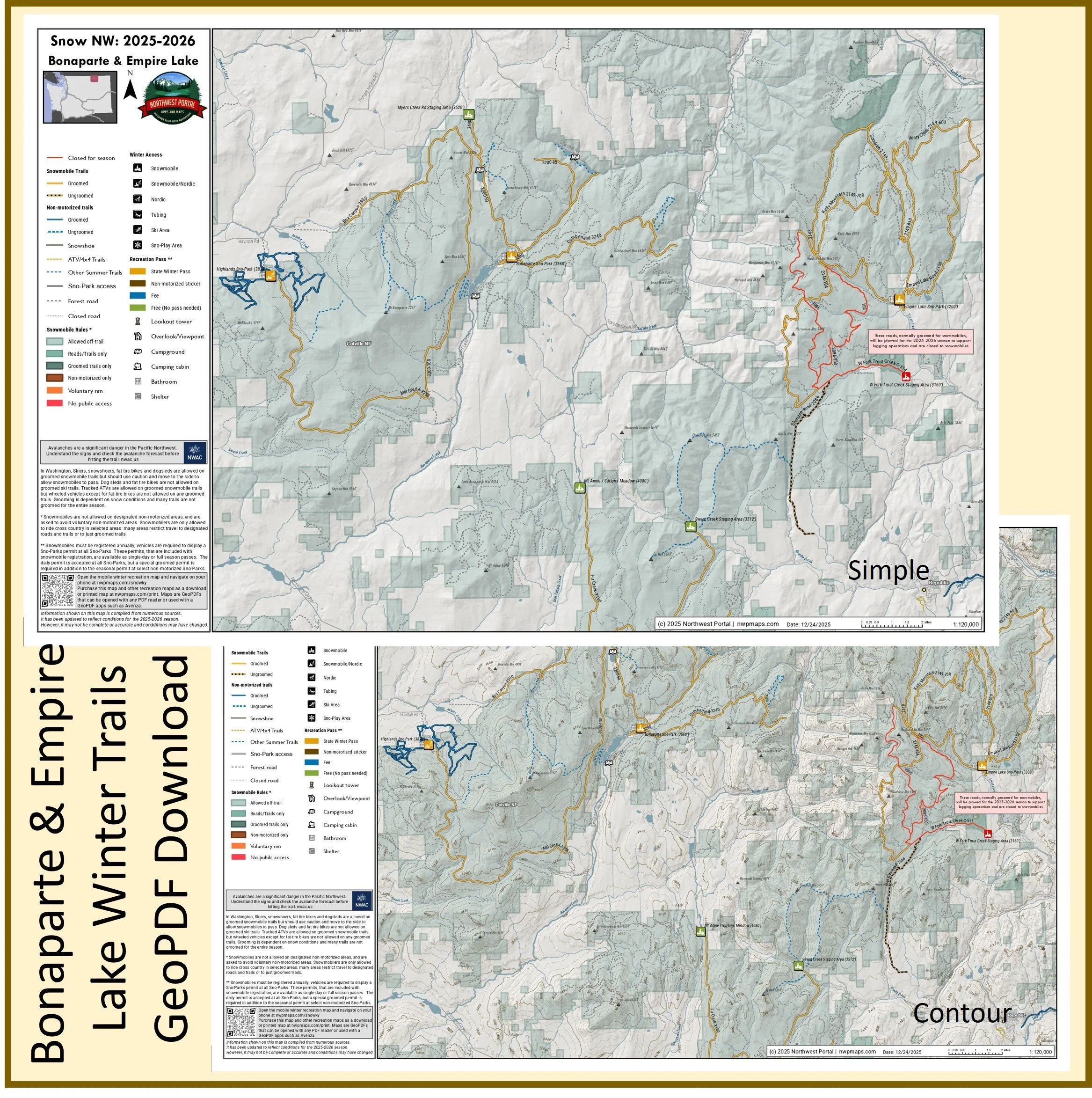
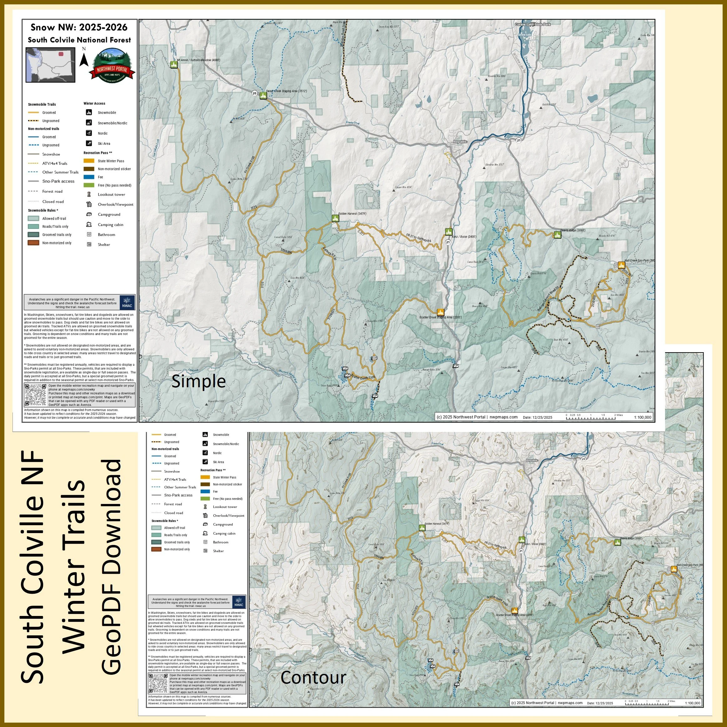
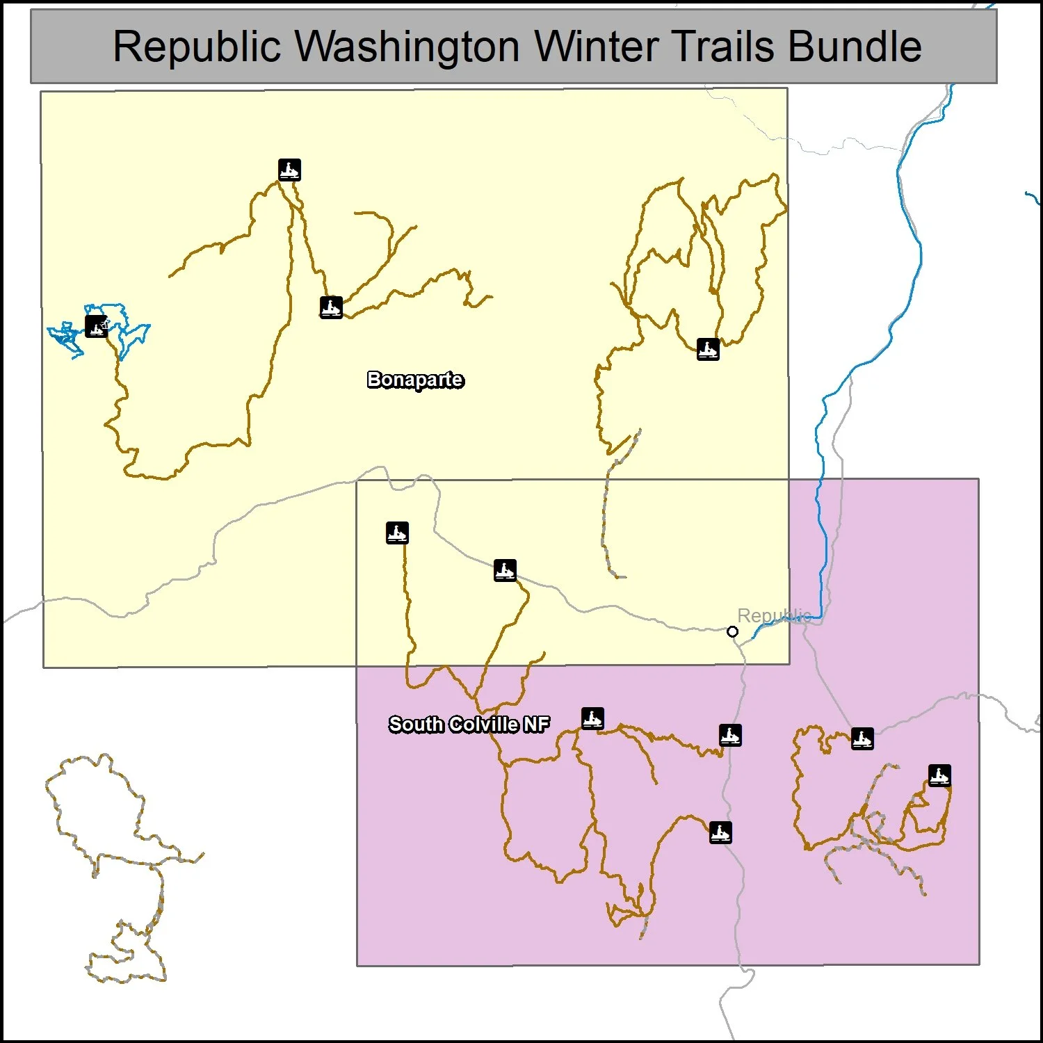
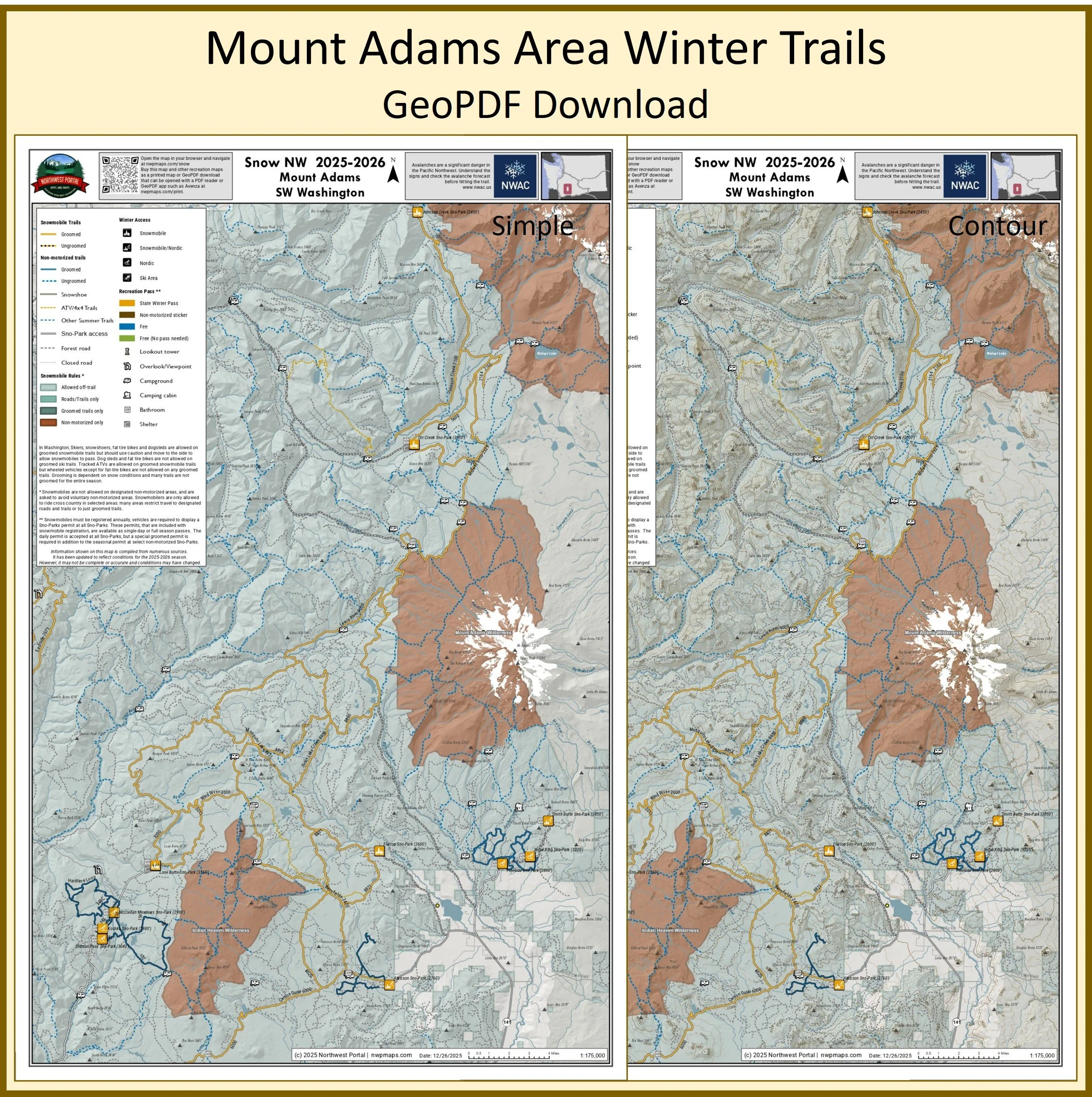
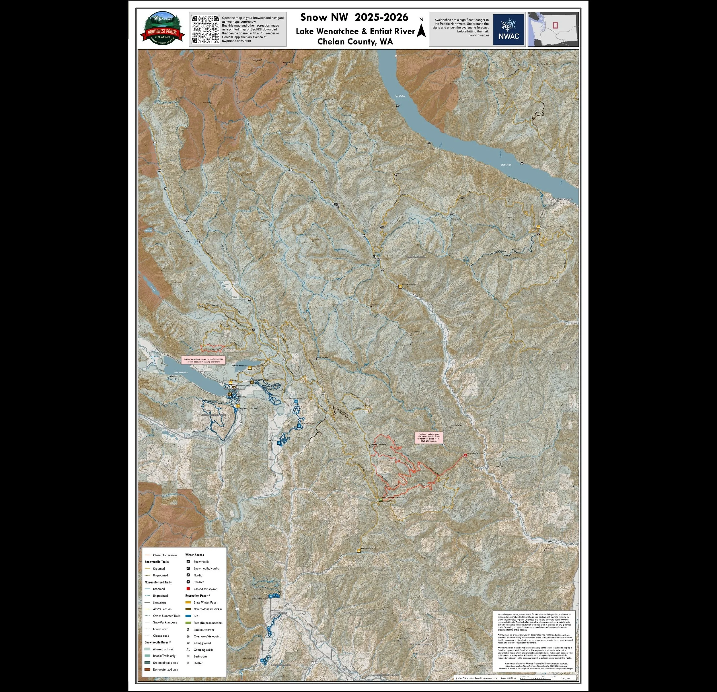
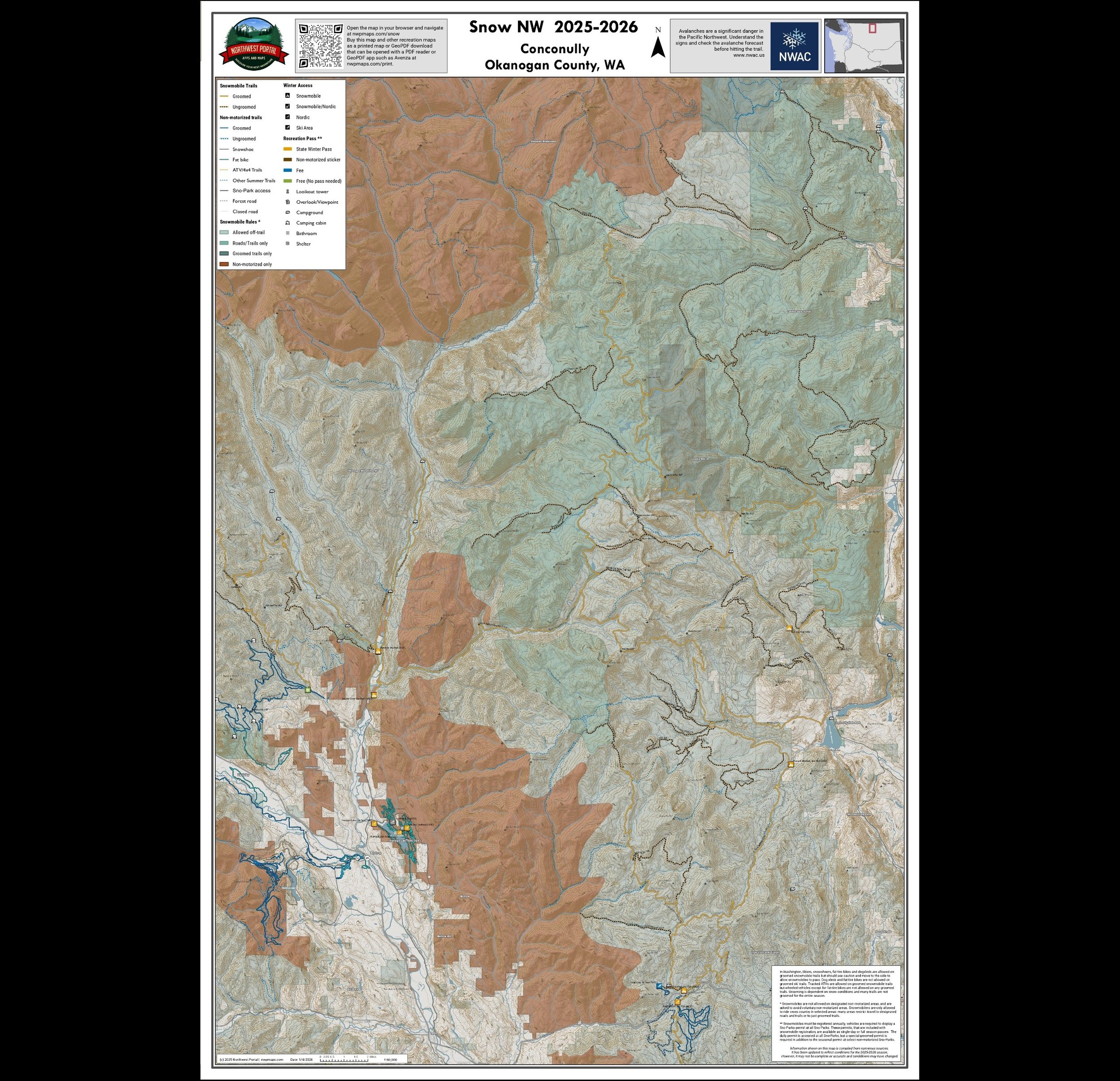
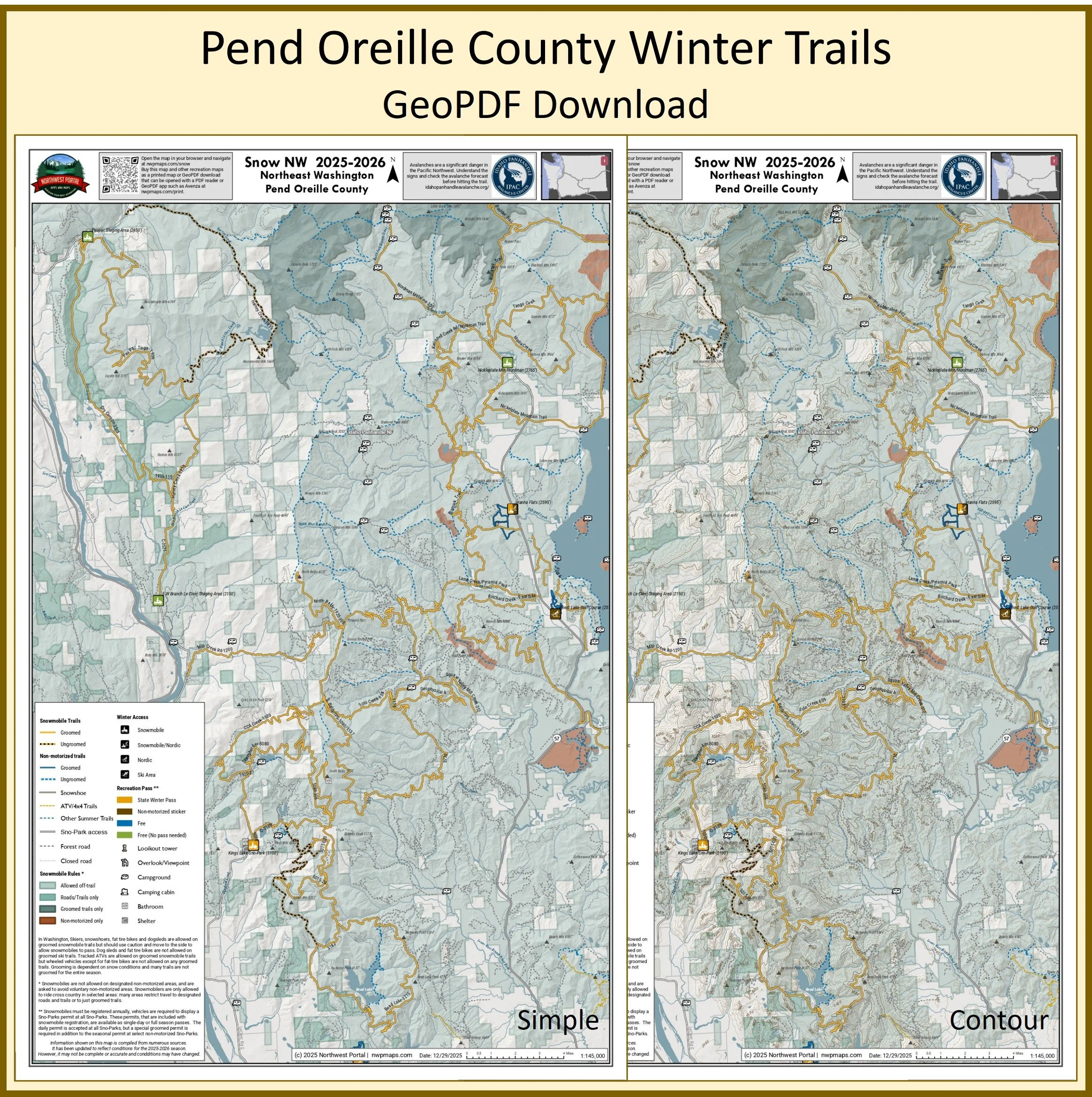
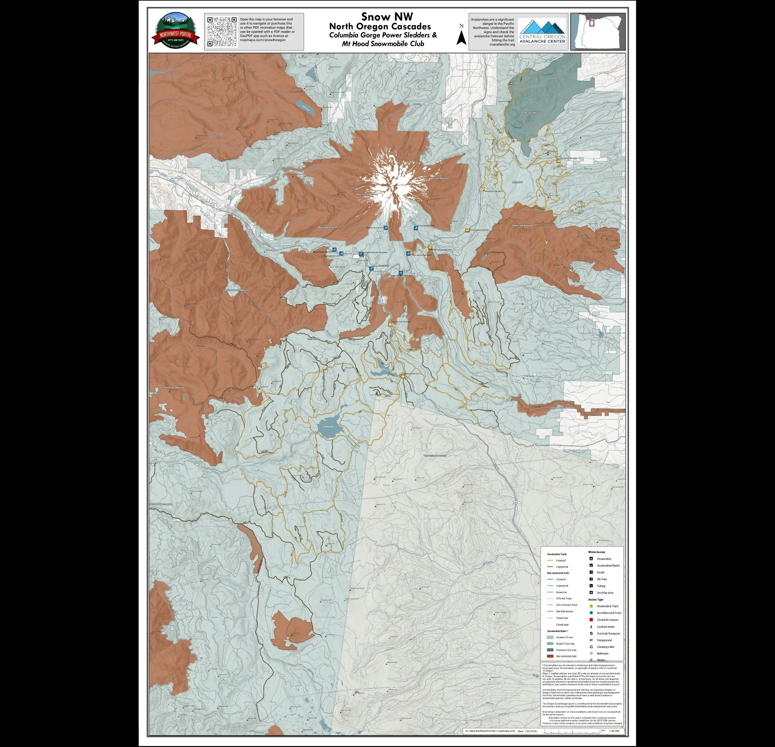
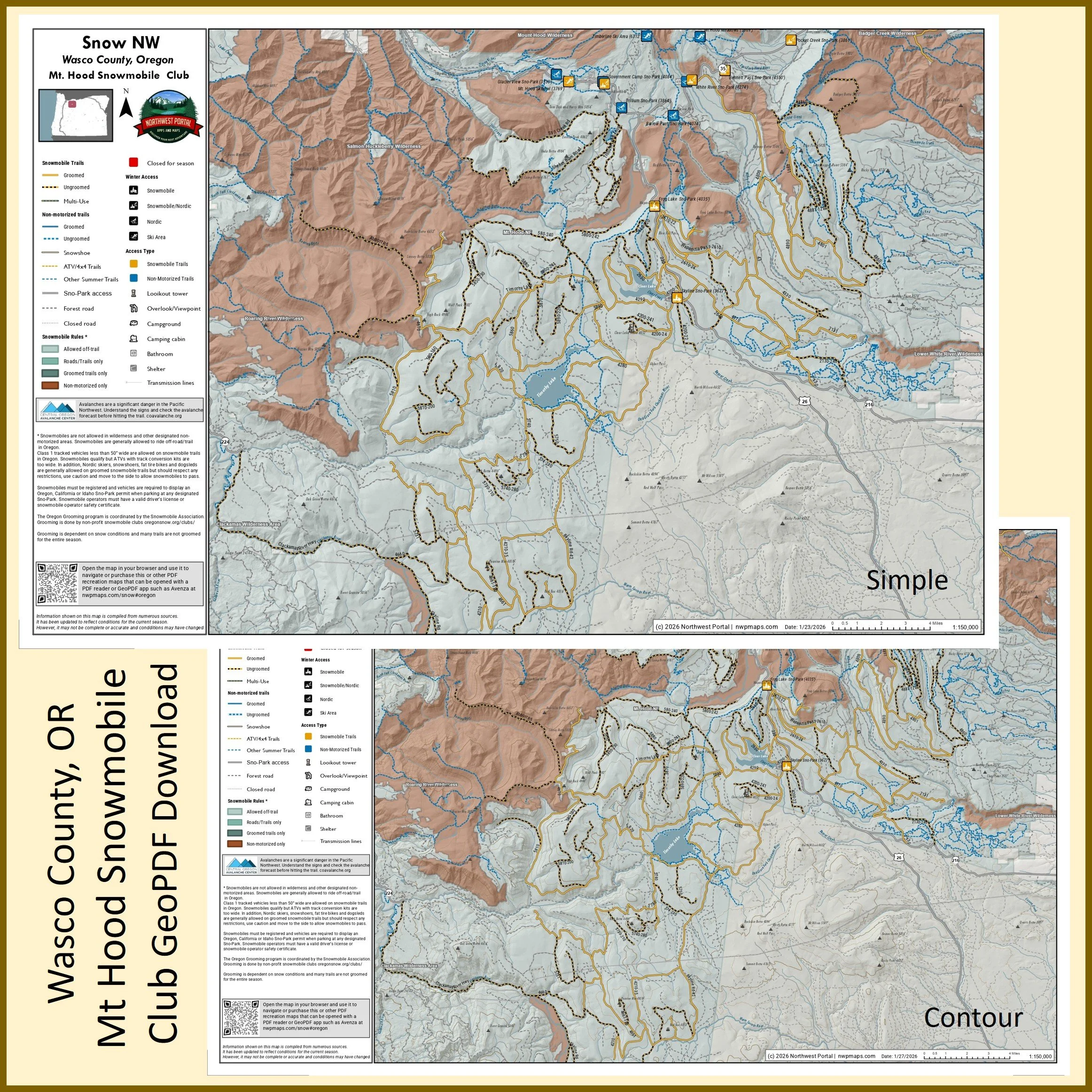
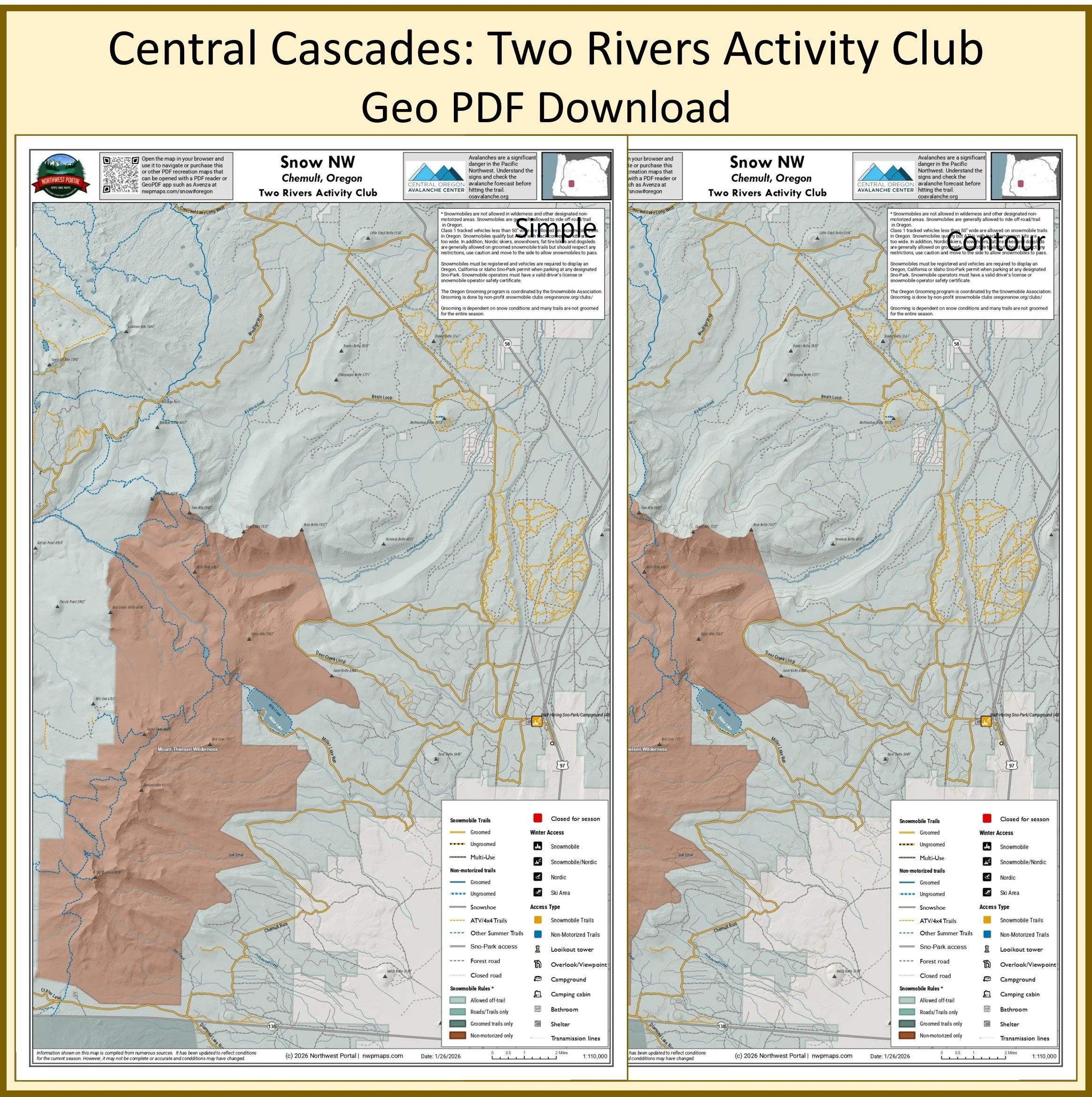
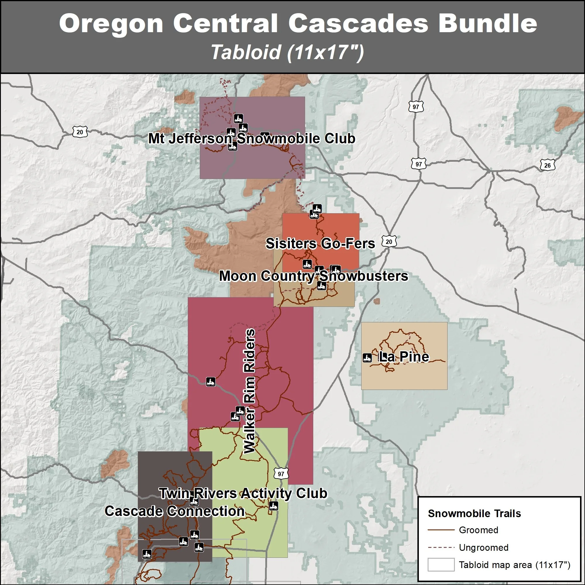
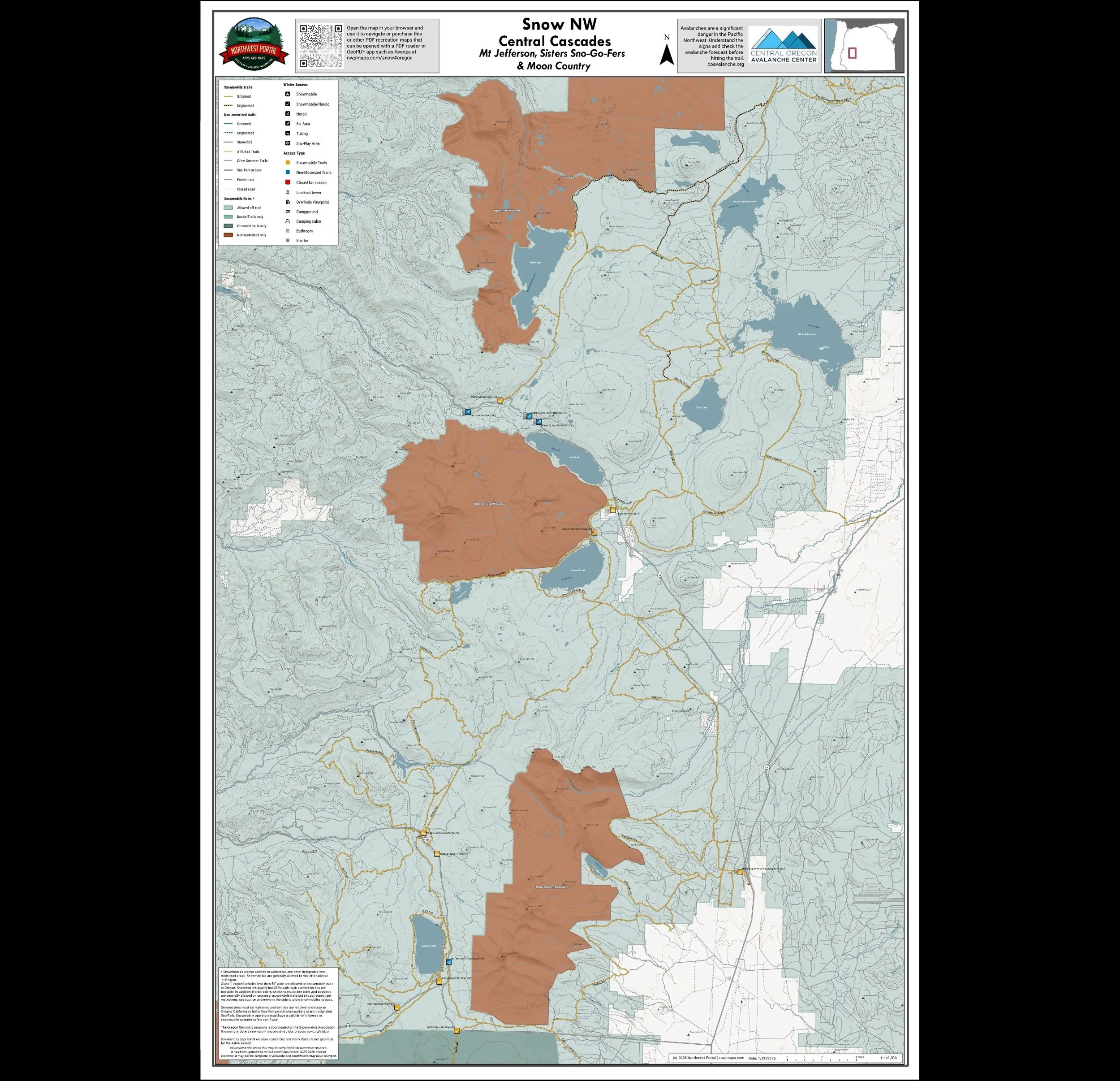
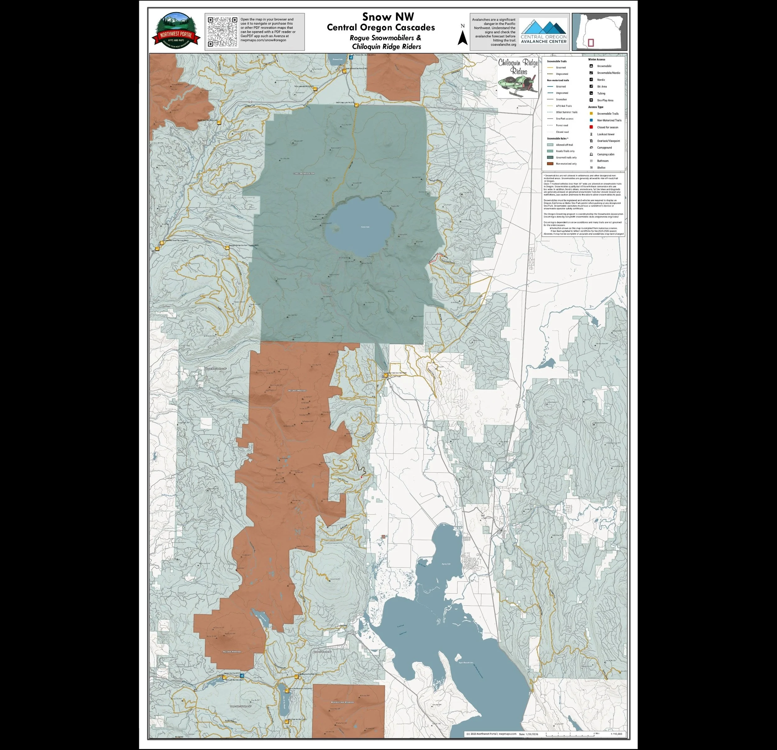
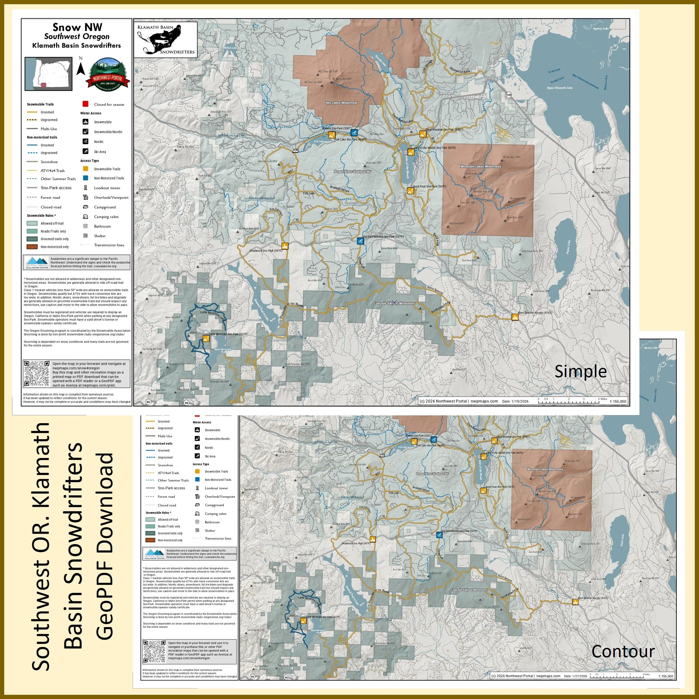
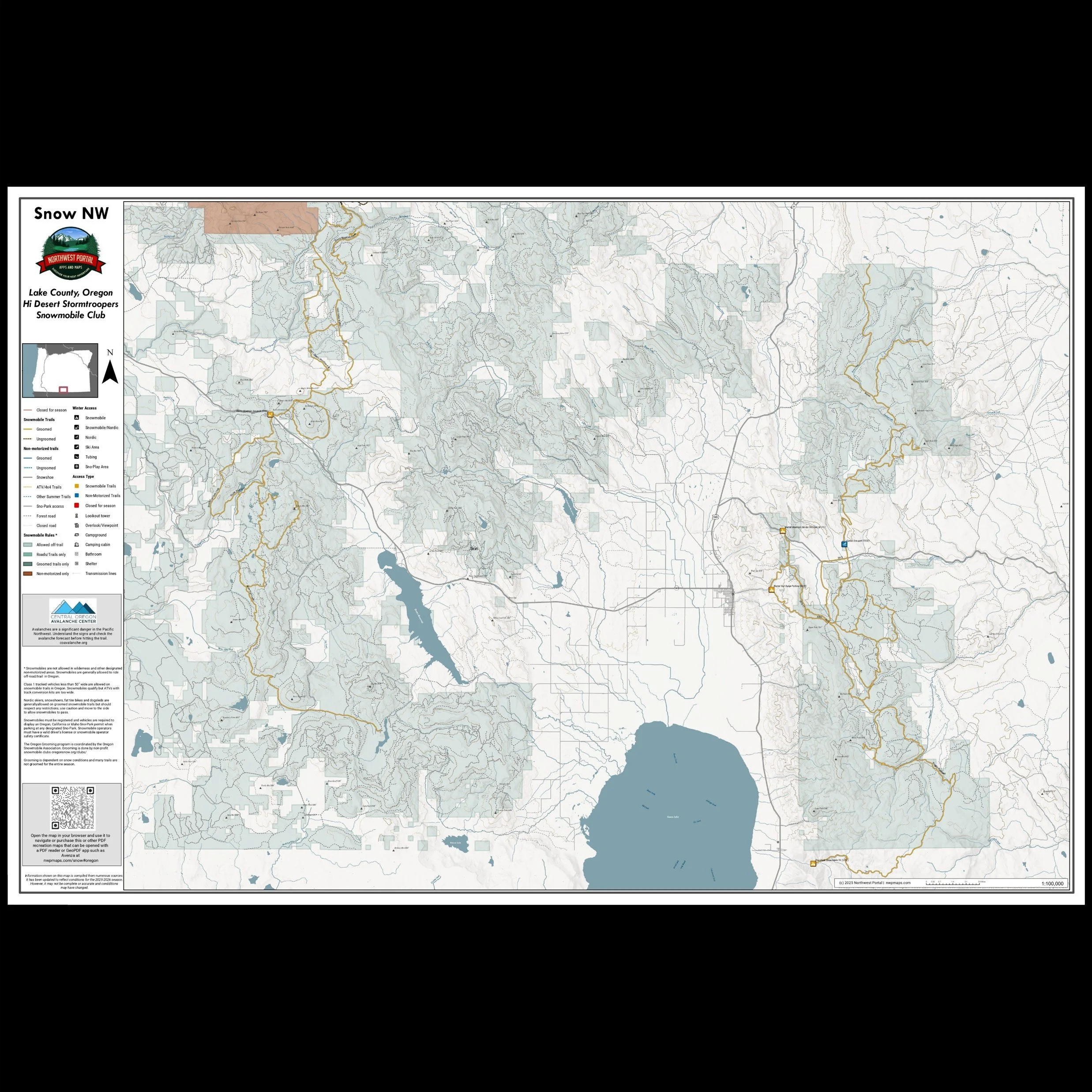
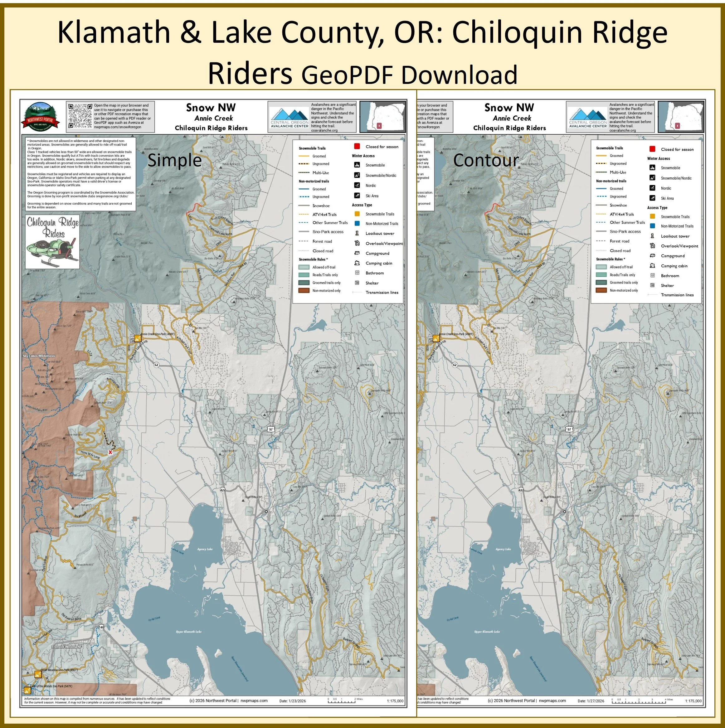
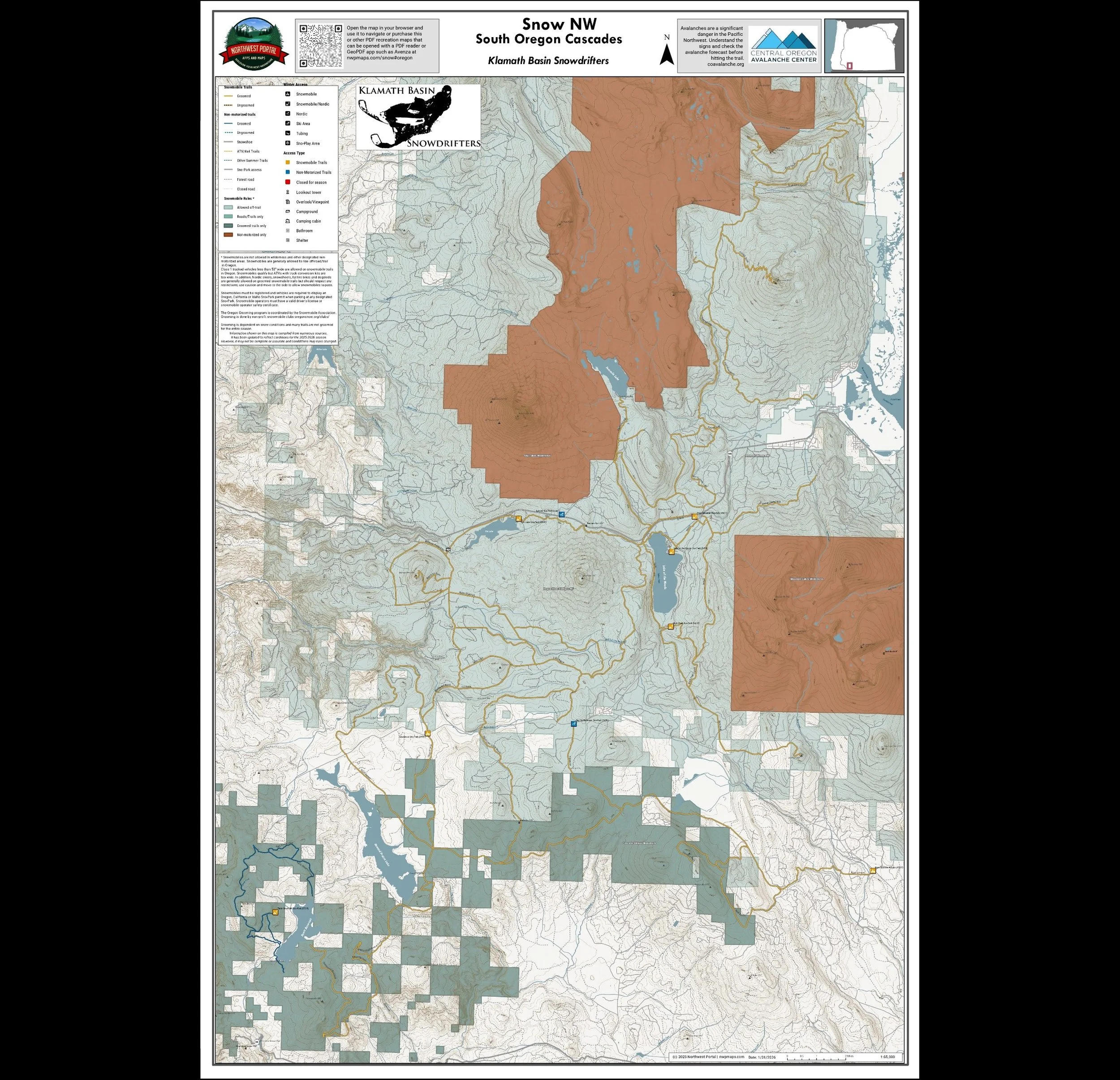
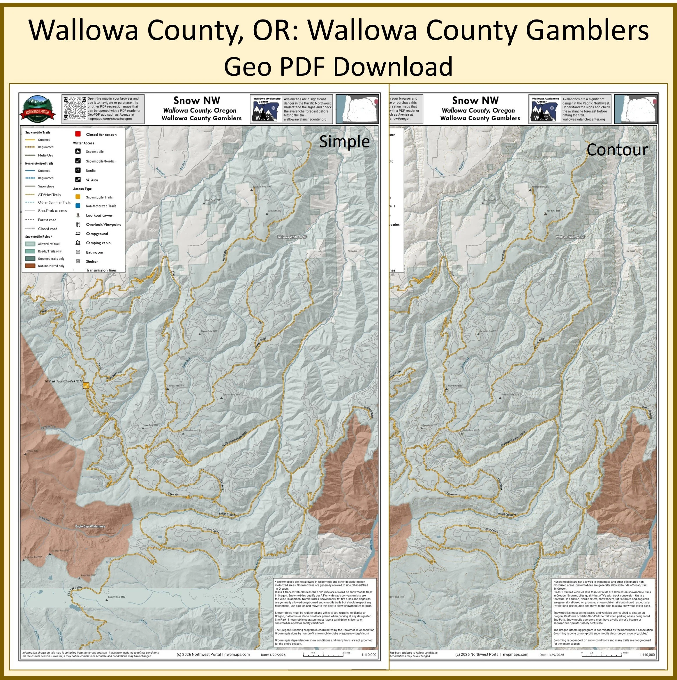
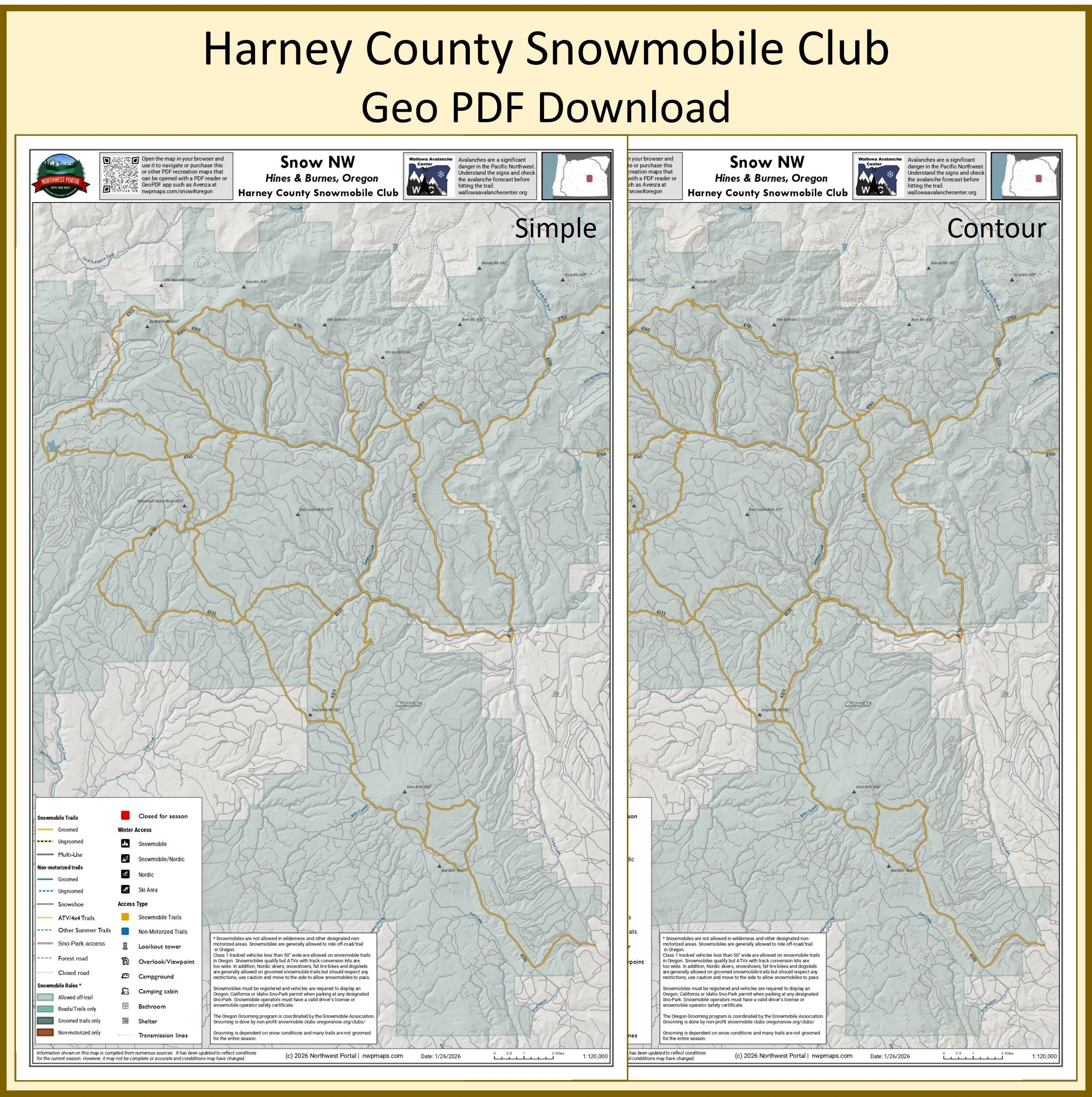
Maps purchased from the Northwest Portal store are available in both tabloid (11x17”) and poster (24x36”). Tabloid maps include two versions of the map, one with contour lines and one without. All poster sized maps have contours. The maps can downloaded and opened with any PDF reader, printed, or used with a GeoPDF reader such as Avenza. The maps have all groomed snowmobile trails, un-groomed routes identified by local snowmobile clubs, Nordic trails, snowshoe routes, recreation roads and summer trails as those are often used for winter recreation. Recreation lands are symbolized to show the rules are for snowmobiles (allowed off trail, on road or trail only, and no-motorized use) and trail access shows which recreation pass is required for parking. The maps also have campgrounds, view points, fire towers and state parks. They are designed to capture complete riding areas (where possible)
The poster sized maps with contour lines can also be purchased on the Northwest Portal Store on Avenza Maps. Map purchased directly from Avenza do not count against your Avenza map limit, but can only be used in Avenza.
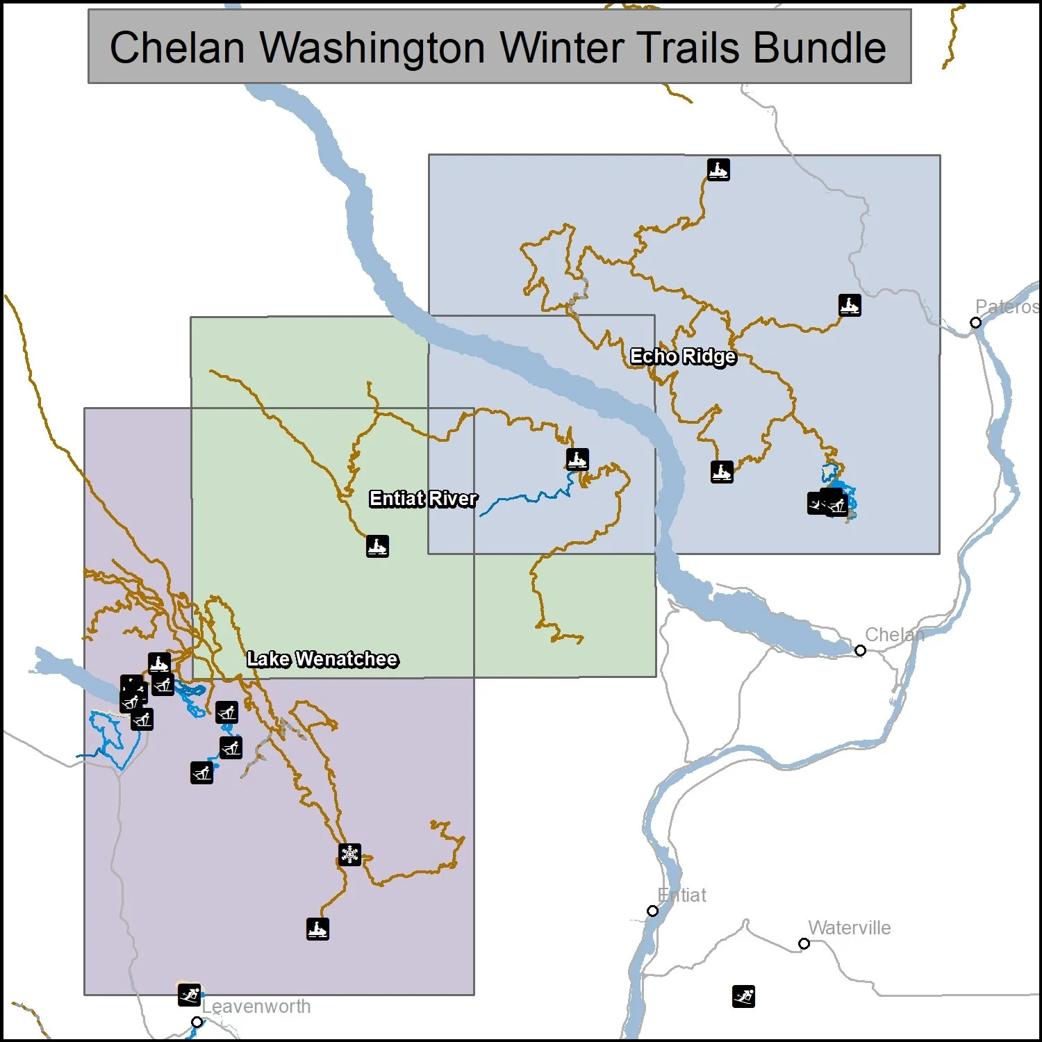
Want a different area: Use the CONTACT US form to tell us what are you want and we will send you a link once the map is in the store.
Washington State
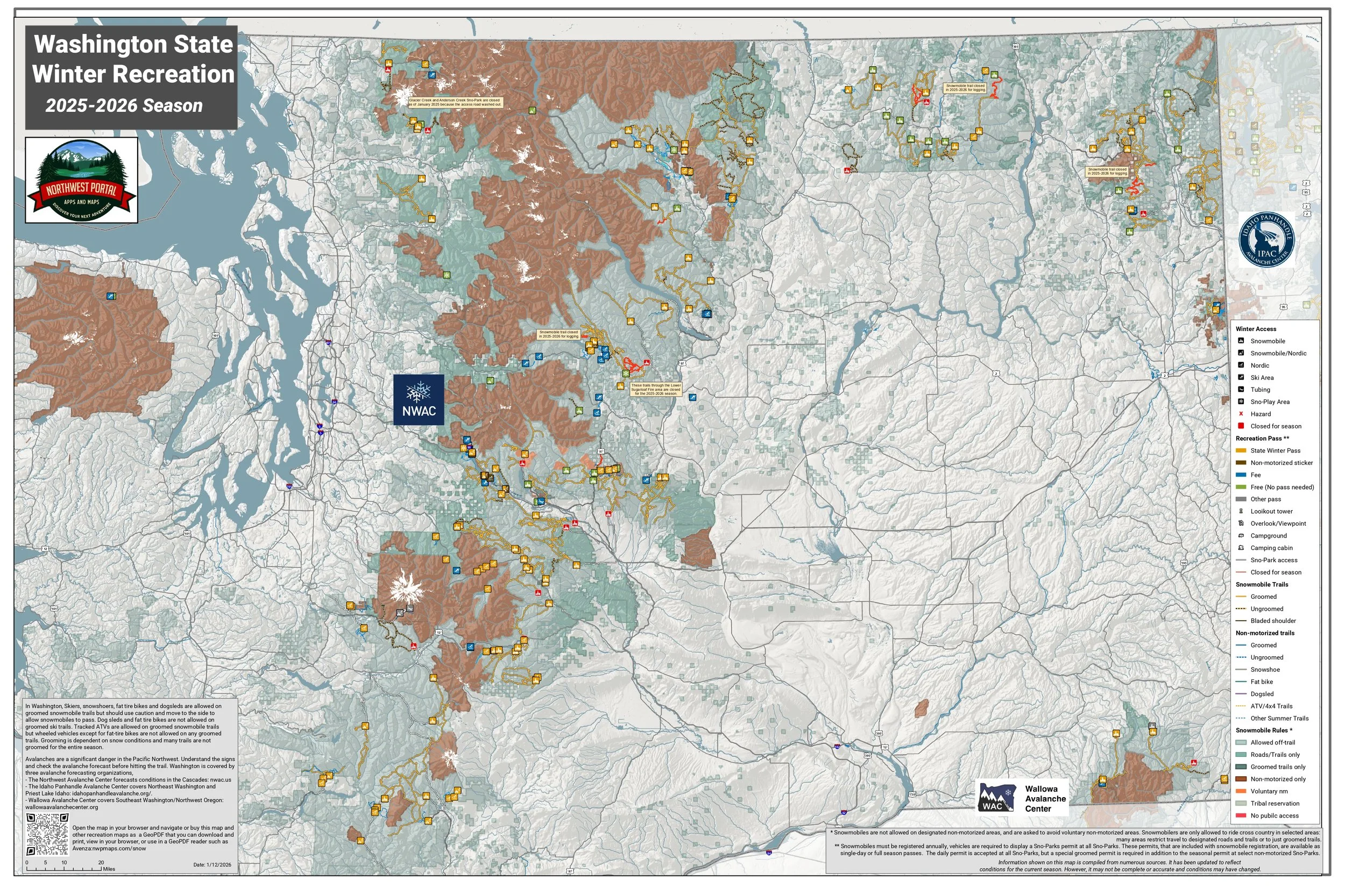
Overview Map - Download Free
GeoPDFs
Washington Tabloid and Poster sized maps and bundles for Sale
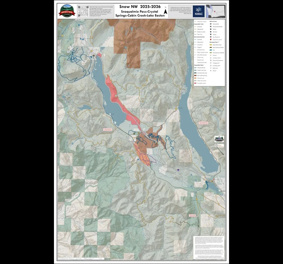
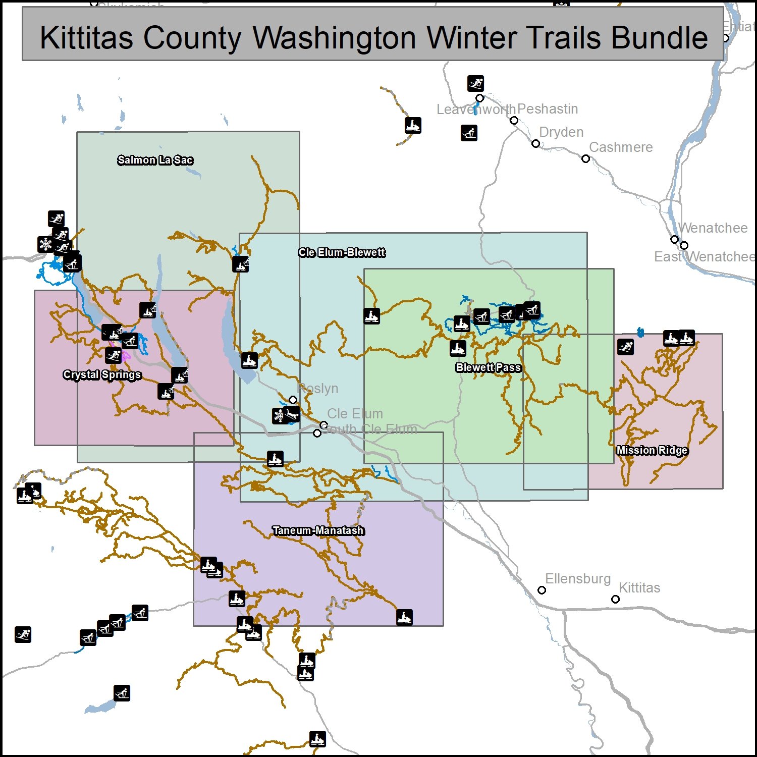
Kittitas County Washington
Crystal Springs, Manastash-Taneum, Salmon La Sac, Blewett Pass, Mission Ridge
Poster Sized Maps: 24x36”
Tabloid Size Maps: 11x17”

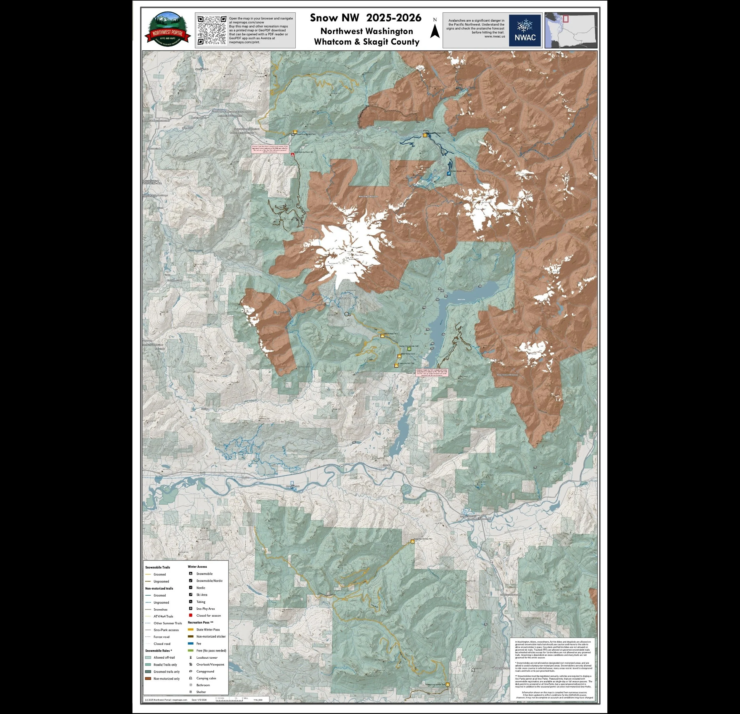
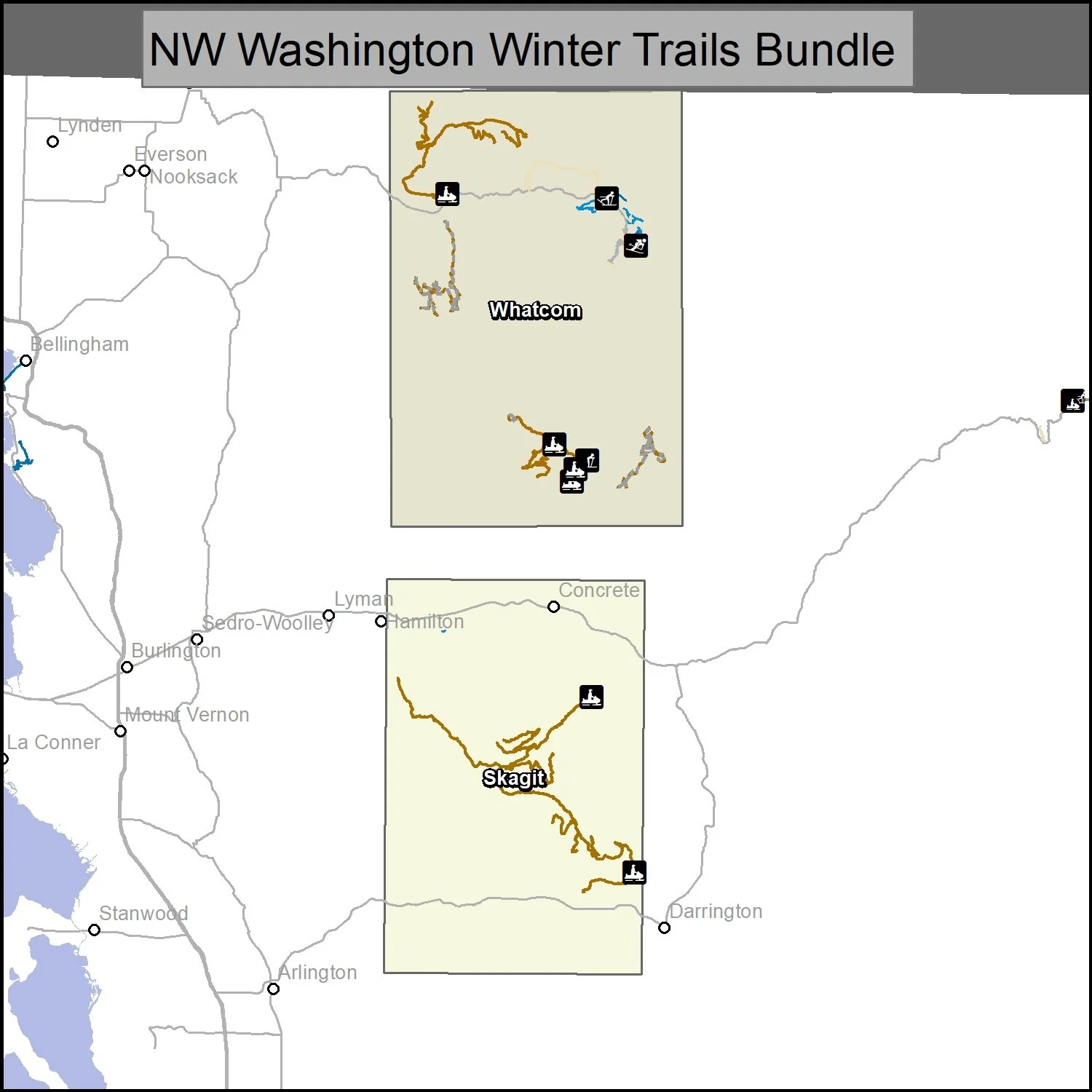
Northwest Washington
Whatcom & Skagit Counties
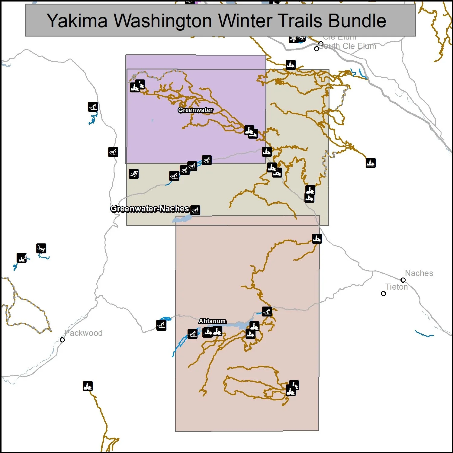
Yakima County Washington
Greenwater, Naches & Ahtanum State Forest
Tabloid
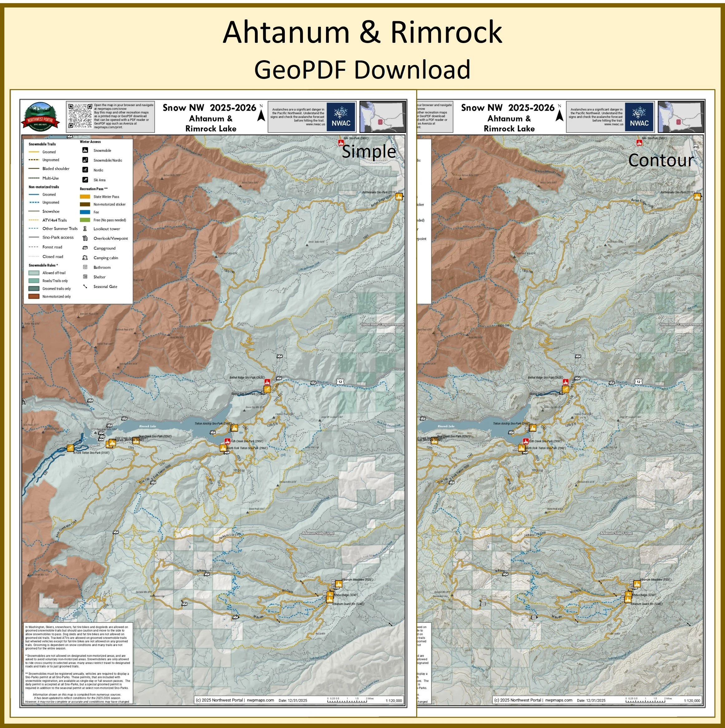
Poster
Republic Area
Colville National Forest
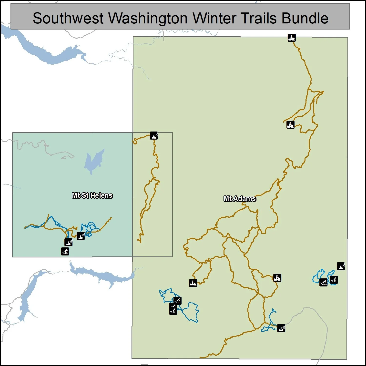
Southwest Washington
Gifford Pinchot National Forest
Poster (18x24”) and Tabloid (11x17”) maps
Chelan County Washington
Lake Wenatchee, Entiat River & Echo Ridge
Tabloid Size (11x17”)
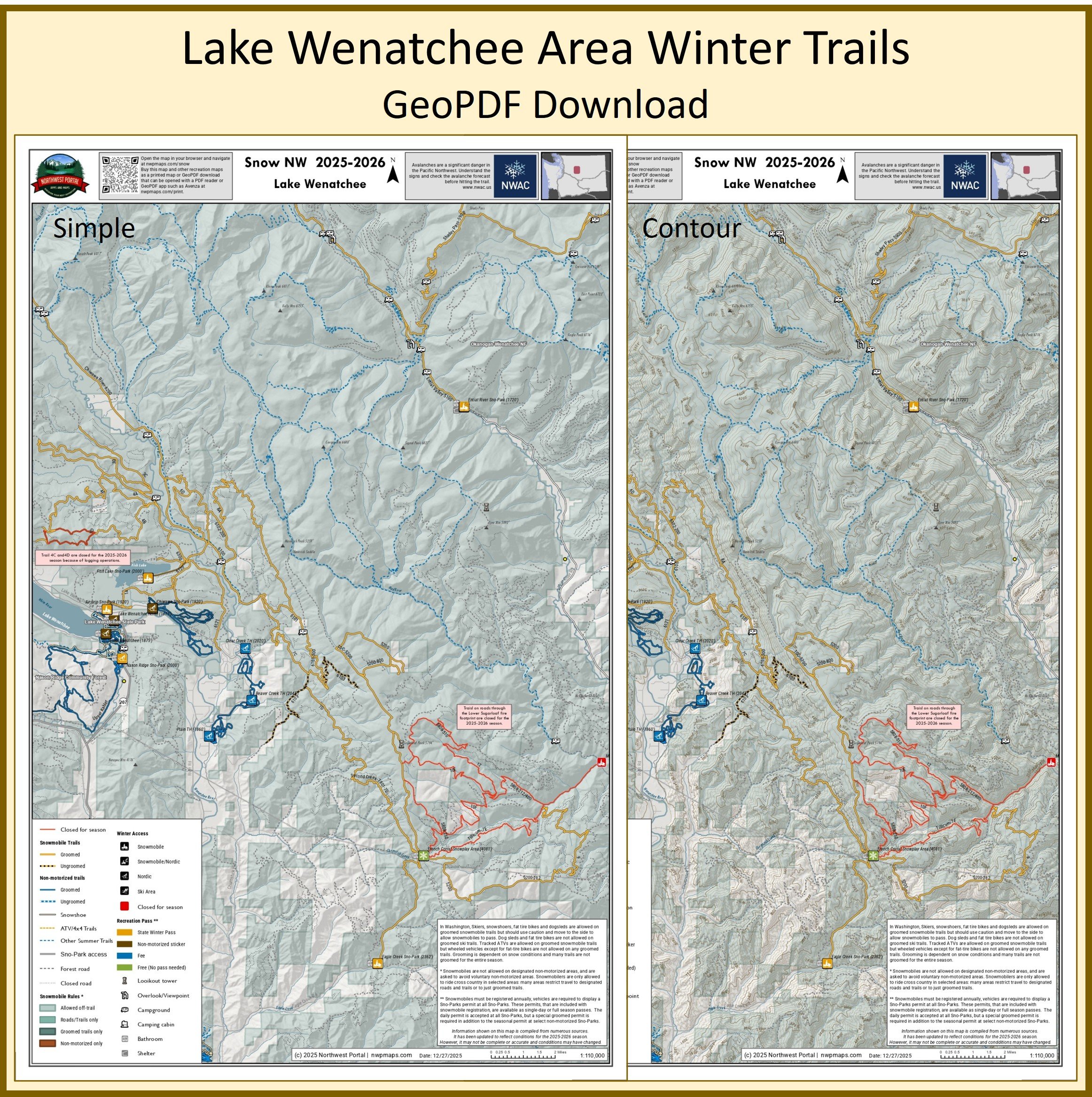
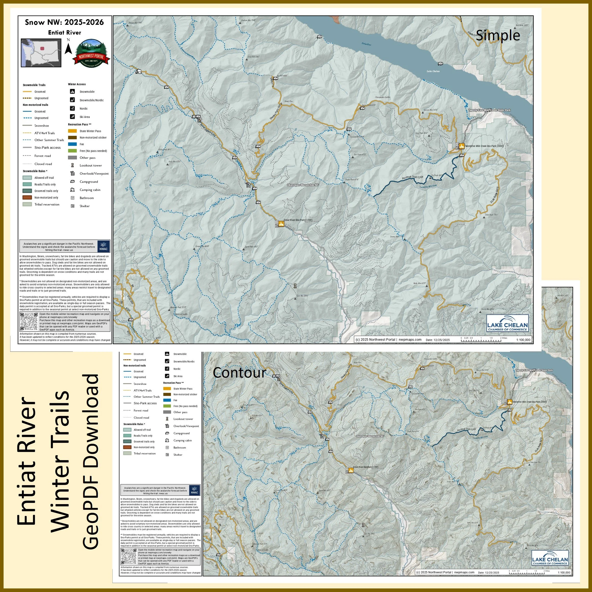
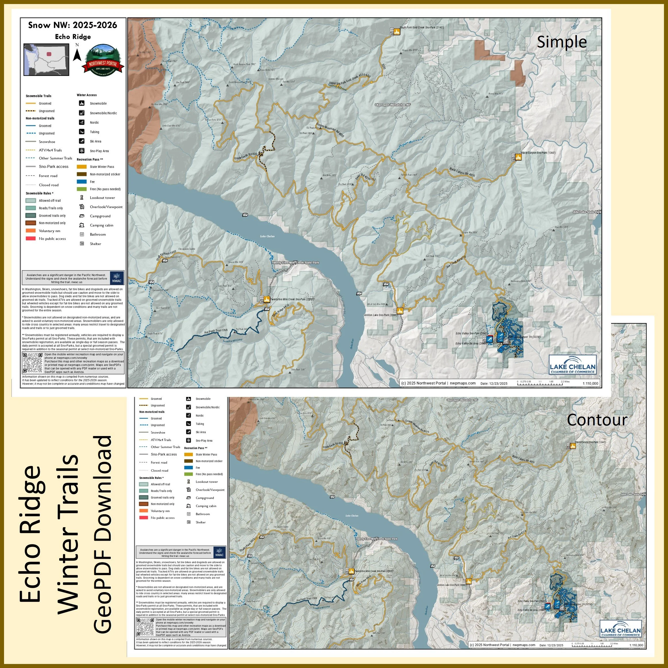
Poster Size (24x36”)
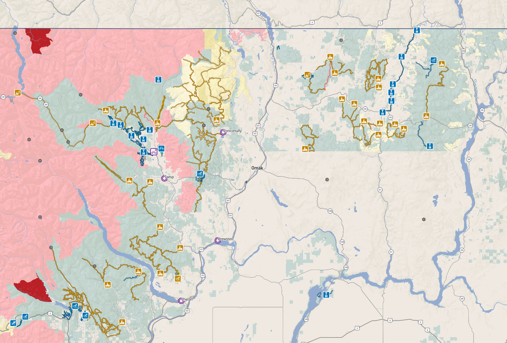
Okanogan County Washington
Methow, Conconully & Twisp River
Tabloid Size (11x17”)
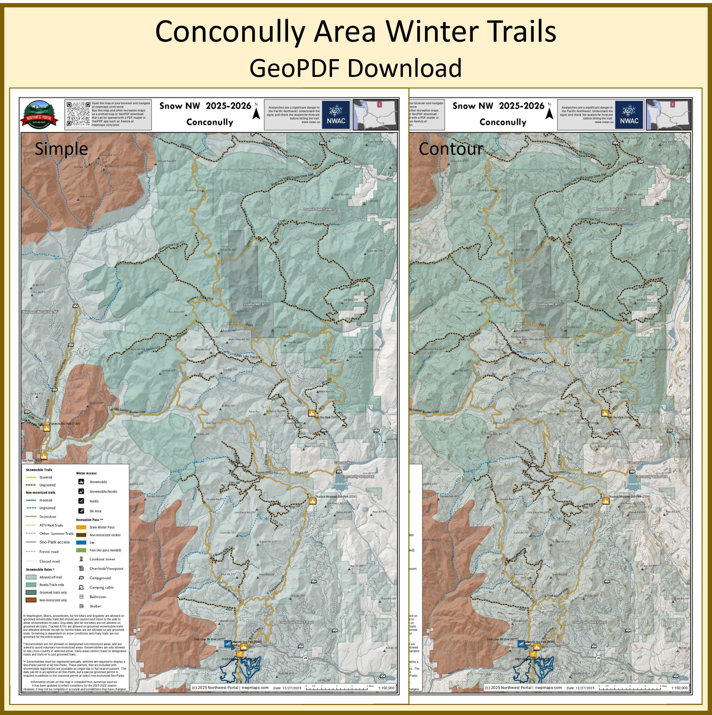
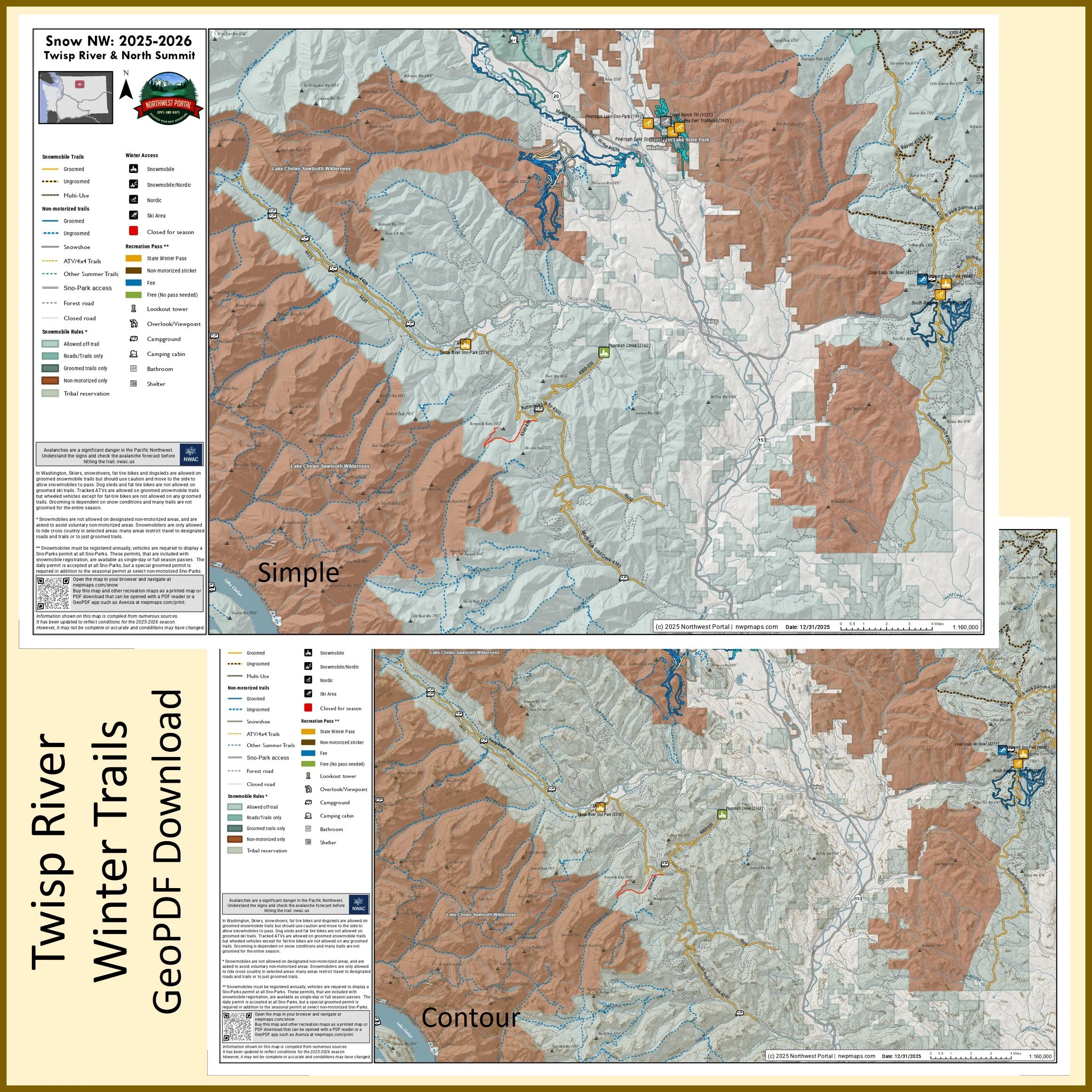
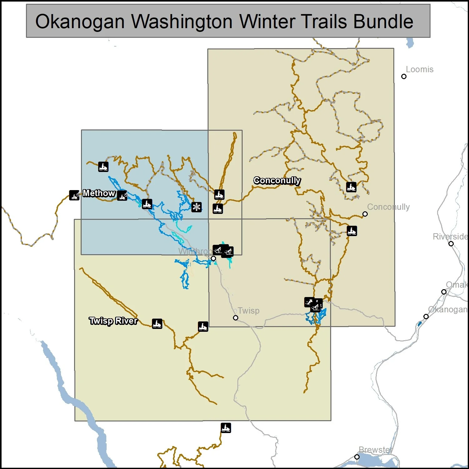
Poster Size (24x36”)
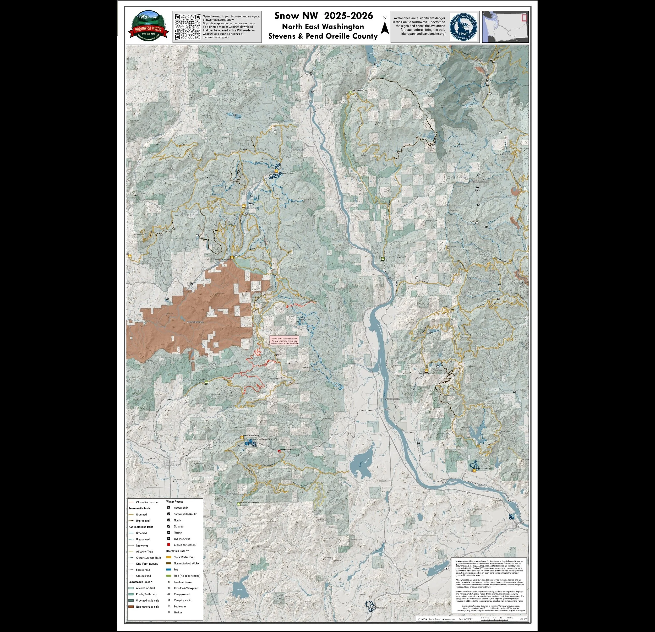
Eastern Washington
Stevens & Pend Oreille Counties/Northeast & Umatilla National Forest/Southeast
Snow NW - Oregon
Your source for all of the information you need to plan and navigate your next winter adventure. Snowmobile, Nordic and Fat Bike trails in Washington, Idaho and Oregon.
Use the web map that you can access from any browser or buy a GeoPDF map that you can print or use to navigate off-line.
More than 15,000 miles of winter trails and 400+ trailheads, Sno-Parks, and winter recreation facilities in Washington, Idaho, and Oregon. Snowmobiling | Tracked ATVs | Nordic & Alpine Skiing | Snowshoeing | Snowboarding | Sledding | Fat Tire Biking | Dog Sledding
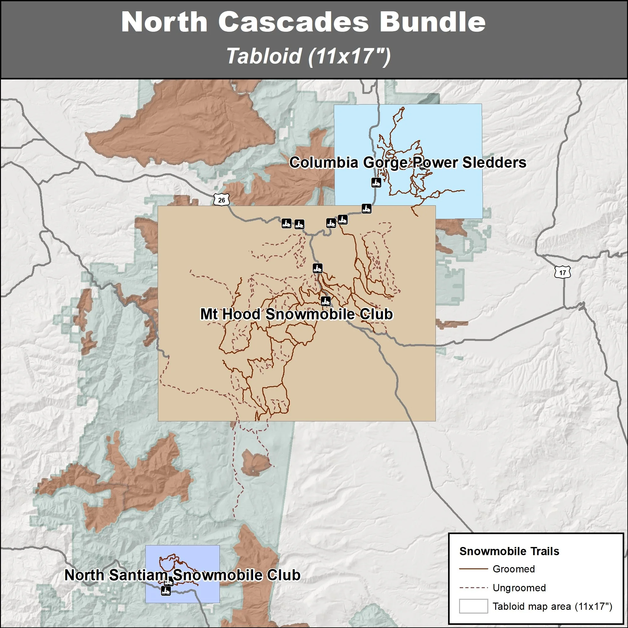
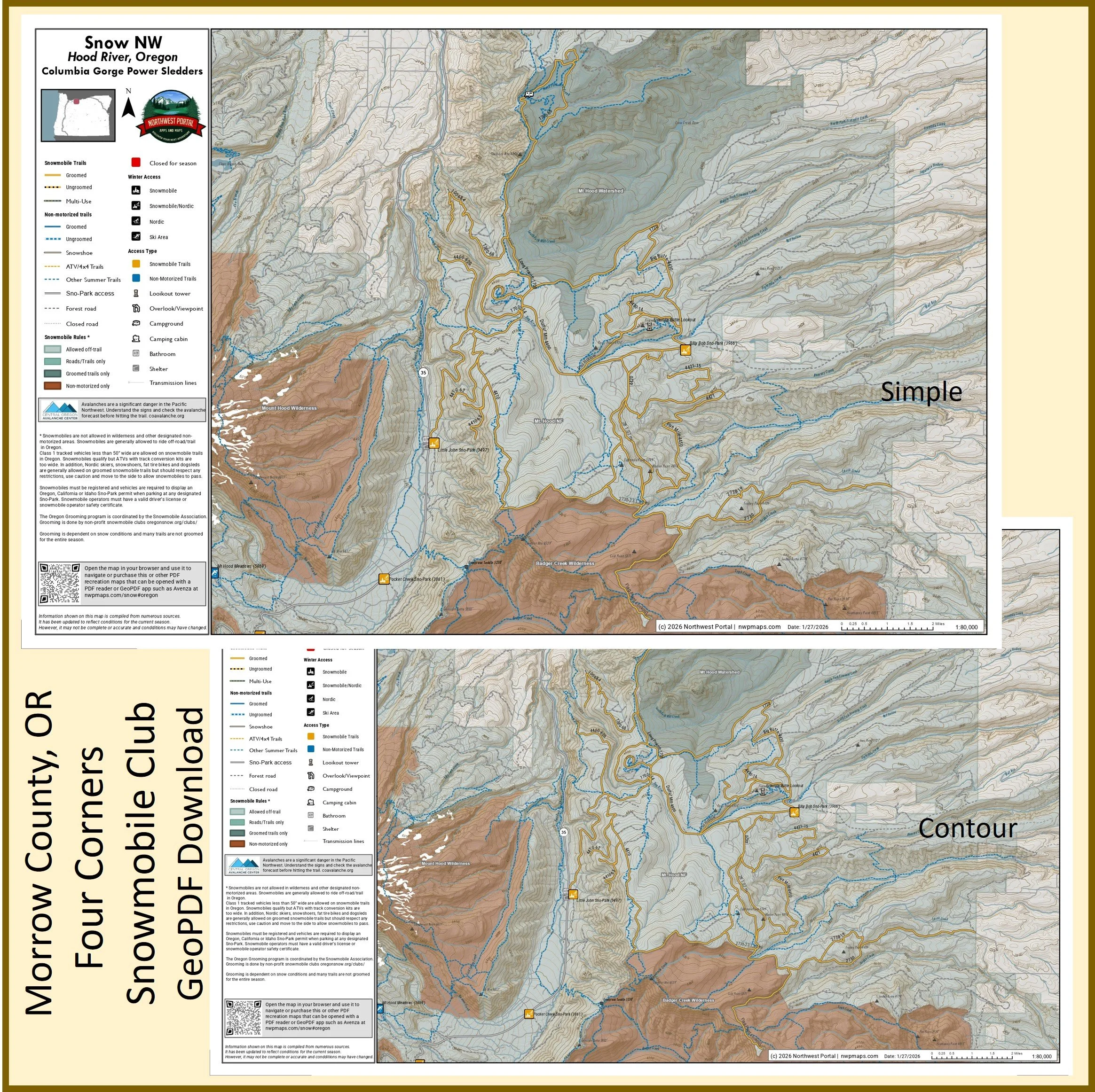
North Oregon Cascades
Hood River, Mount Hood and North Santiam
Tabloid Size (11x17”)
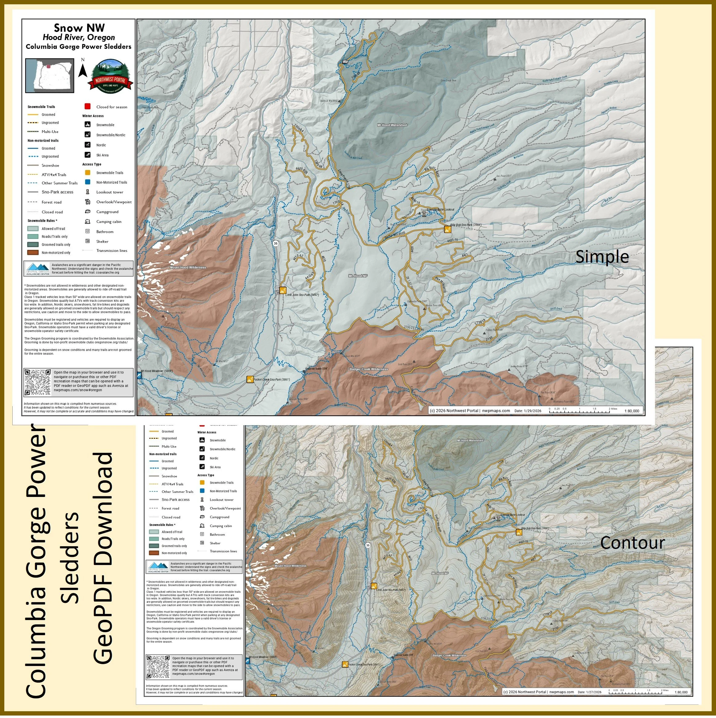
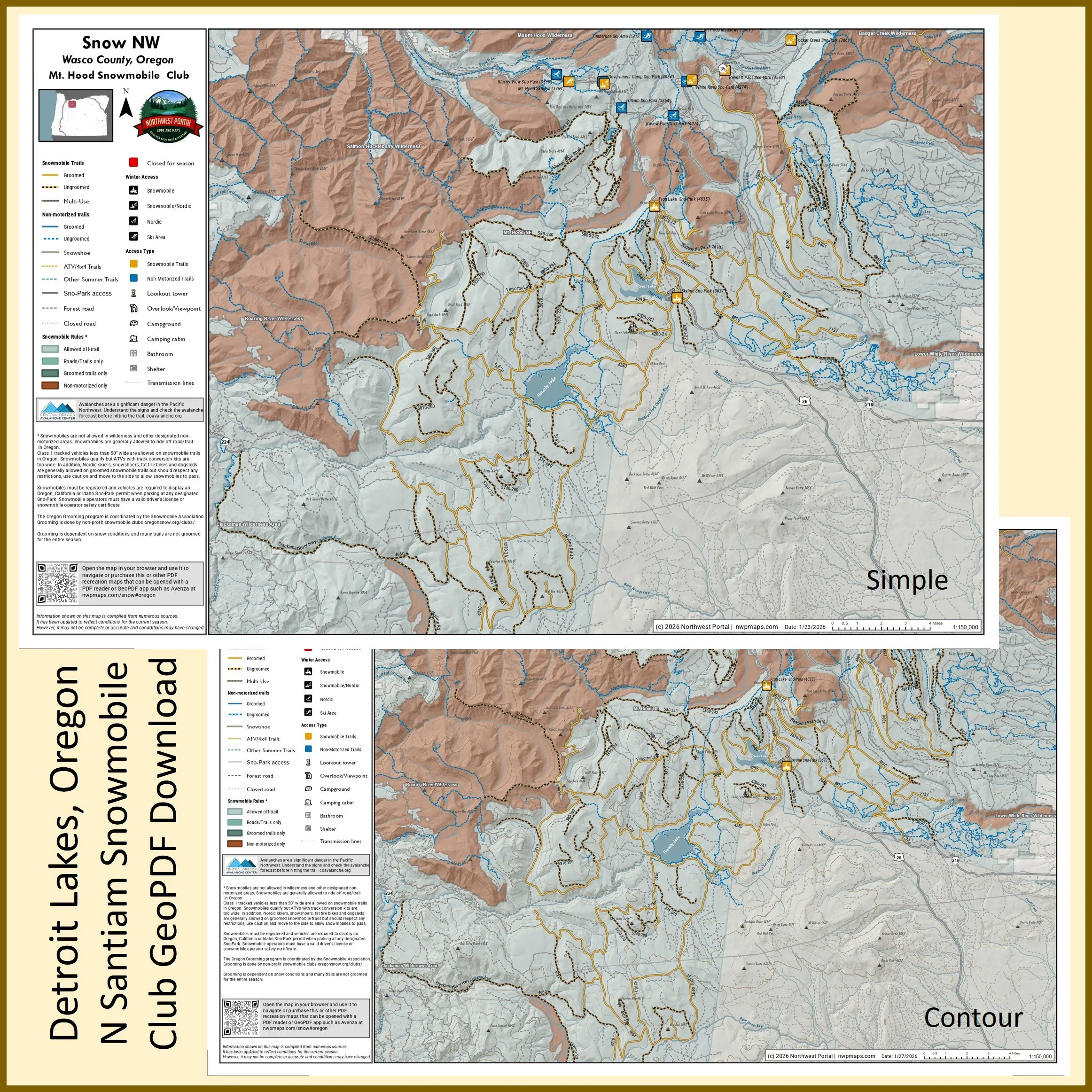
Poster (24x36”)
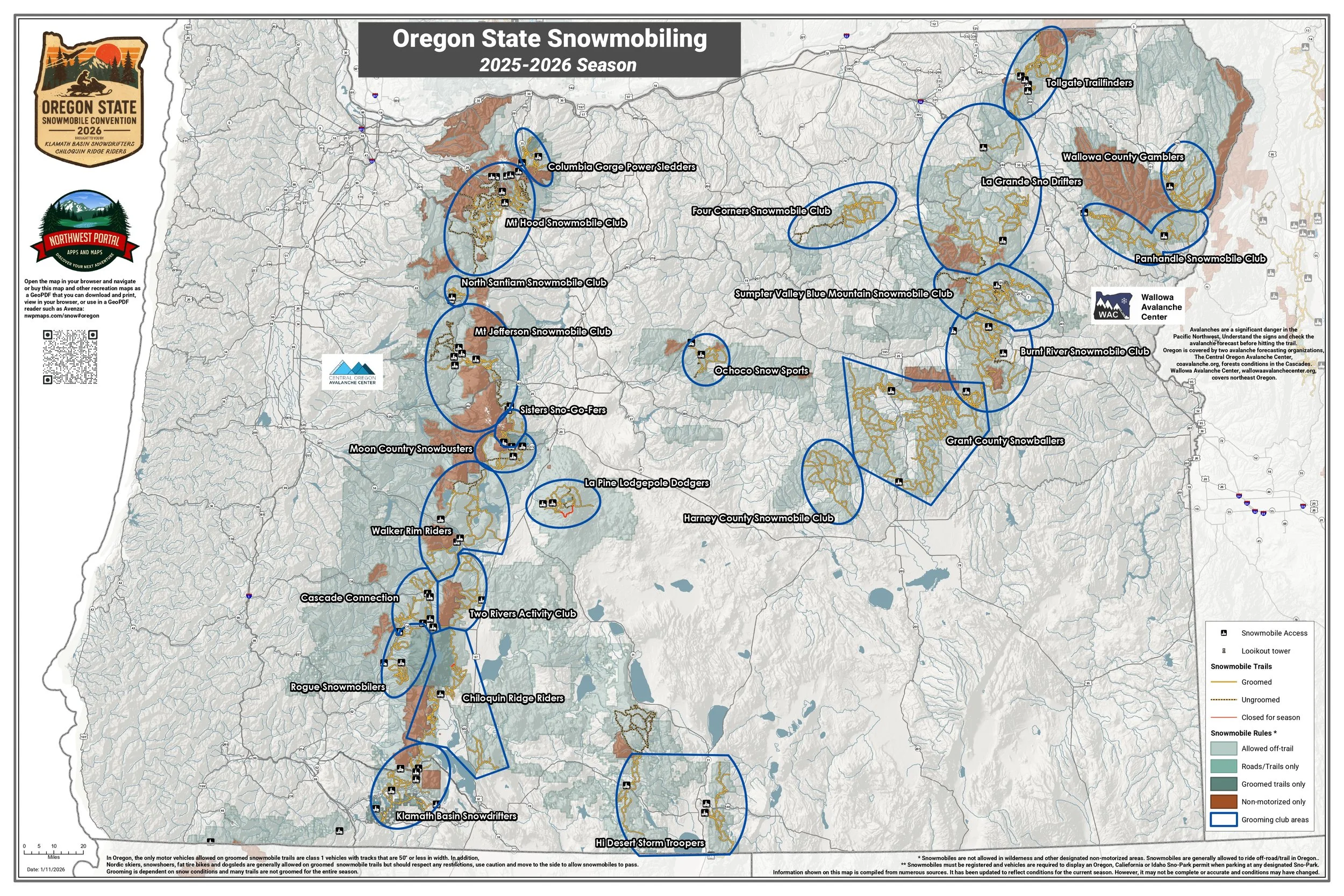
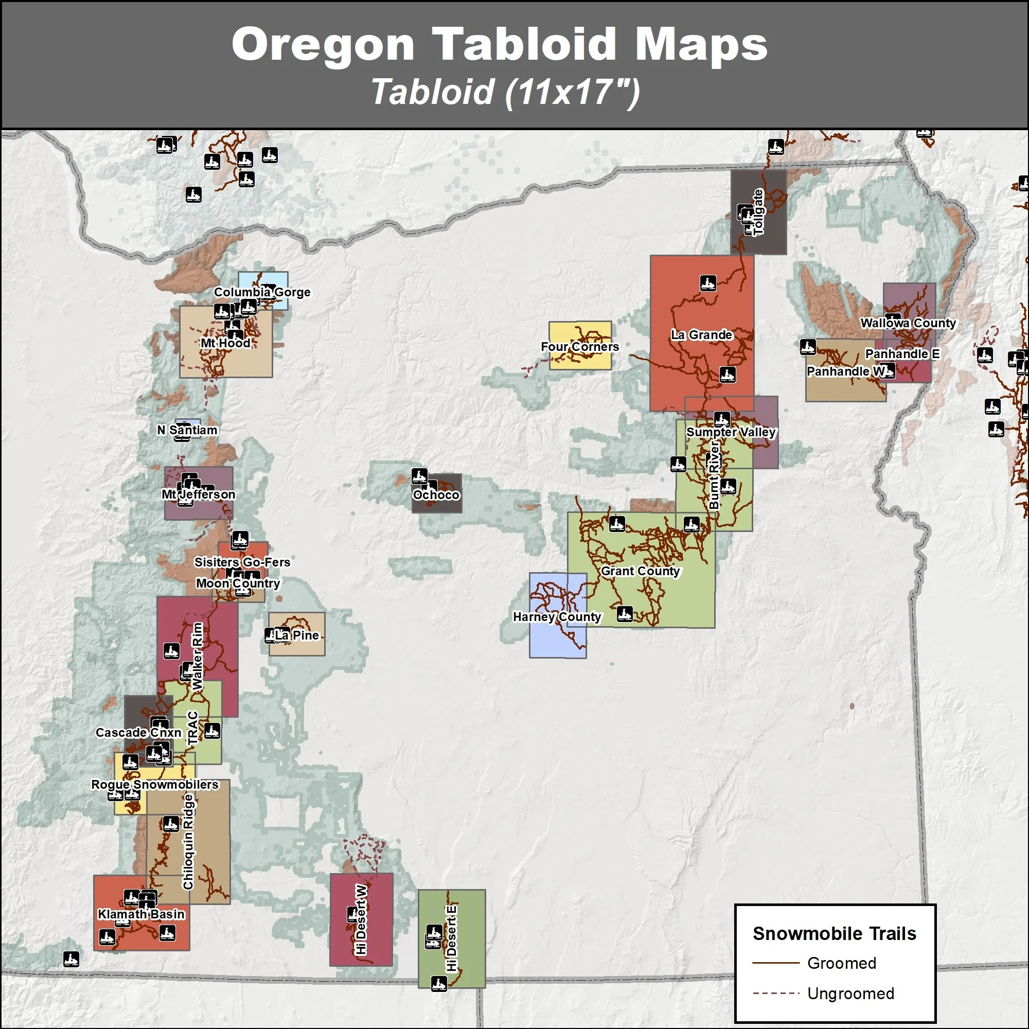
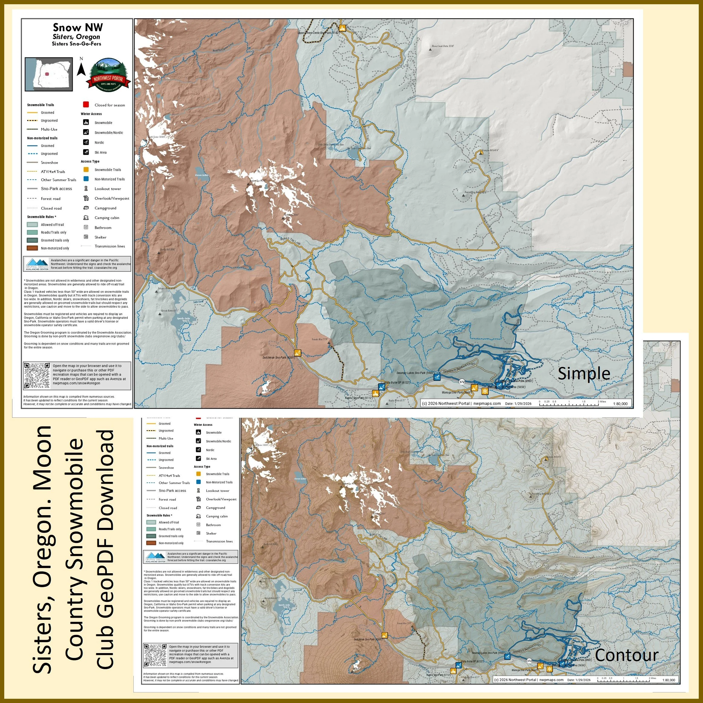
Central Oregon Cascades
Willamette National Forest, Deschutes National Forest, & Umpqua National Forest
Mt Jefferson Snowmobile Club, Sister’s Go-Fers, Moon Country Snow Busters, La Pine Lodgepole Dodgers, Walker Rim Riders, Cascade Connection and Two Rivers Activity Club
Tabloid Size (11x17”)
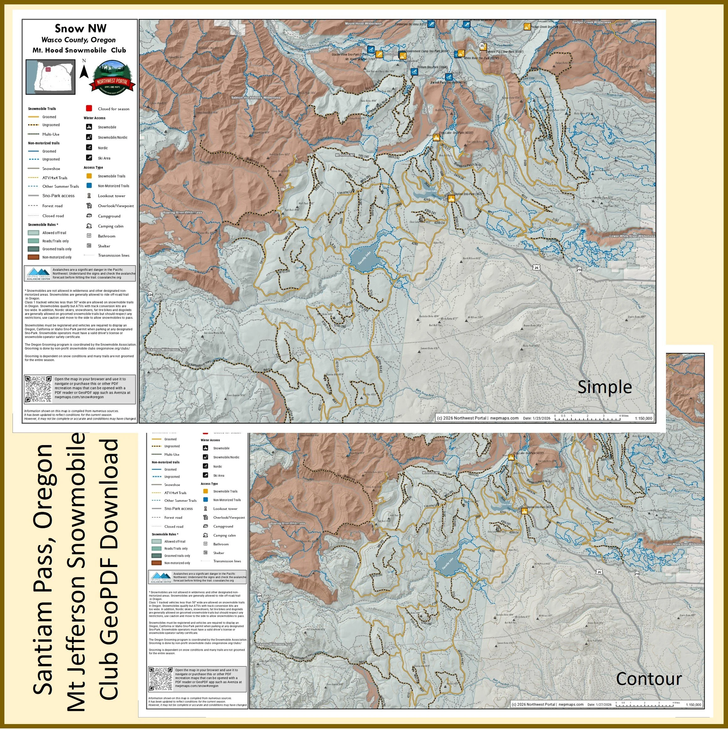
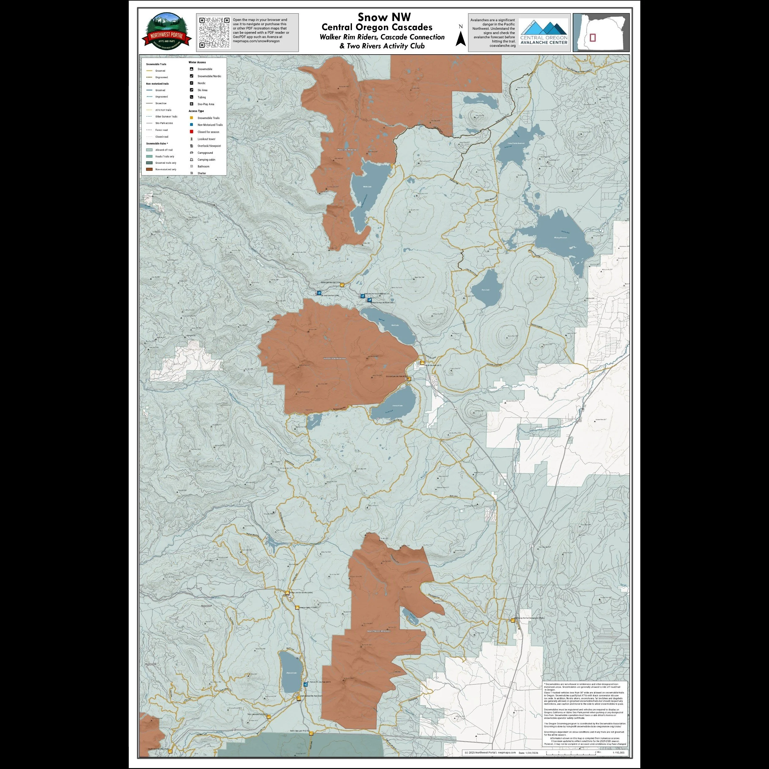
Poster (24x36”)
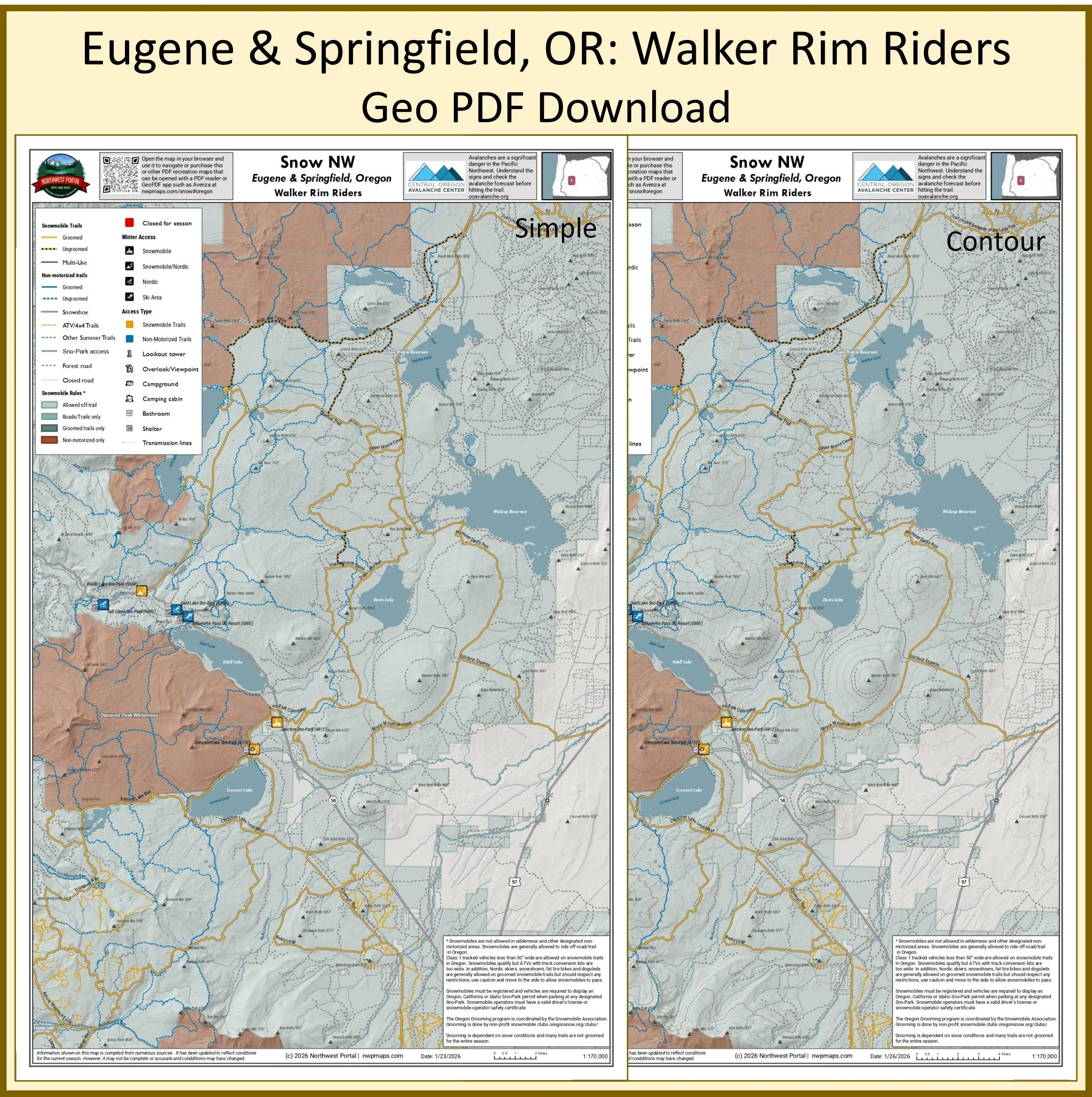
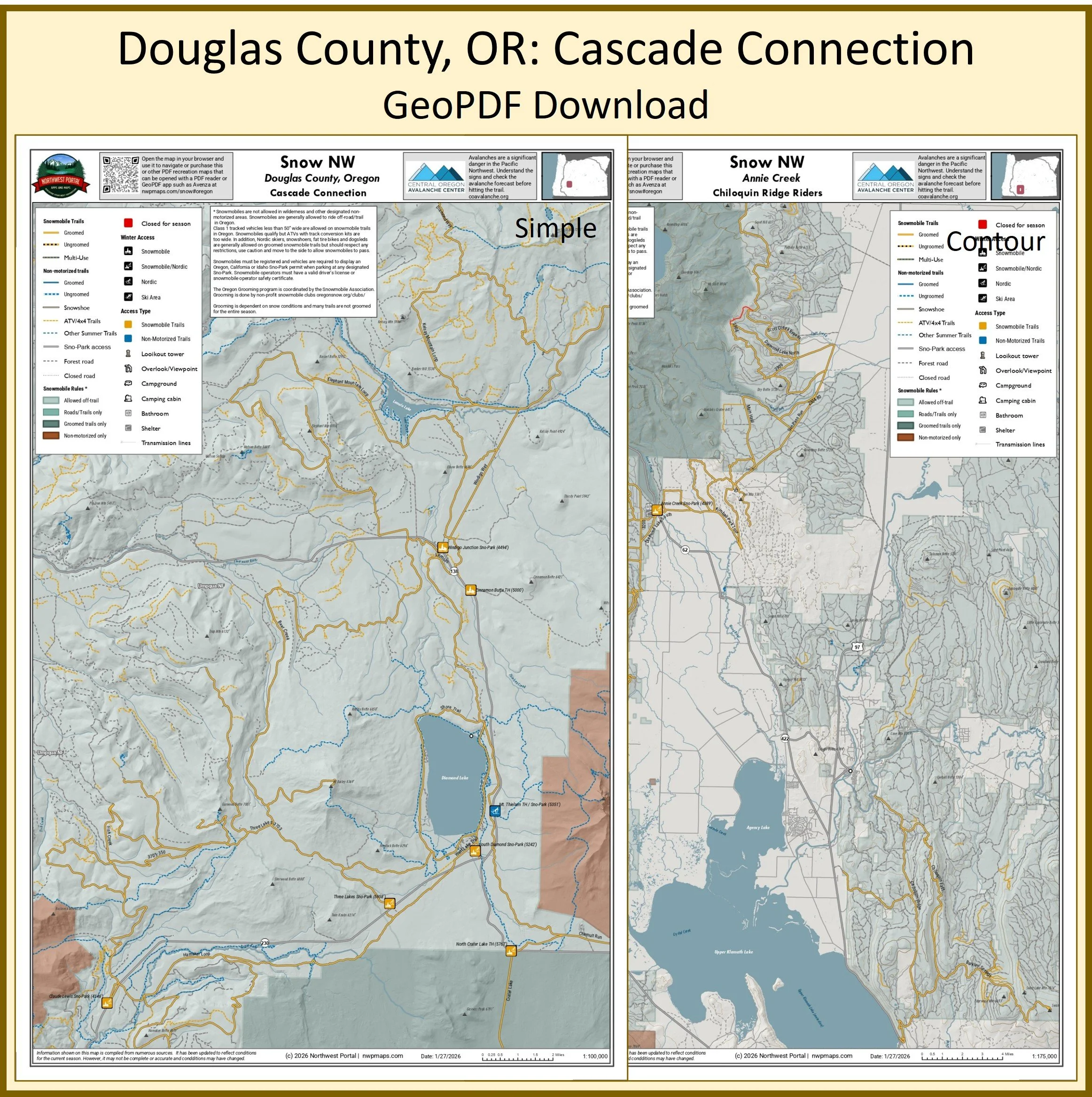
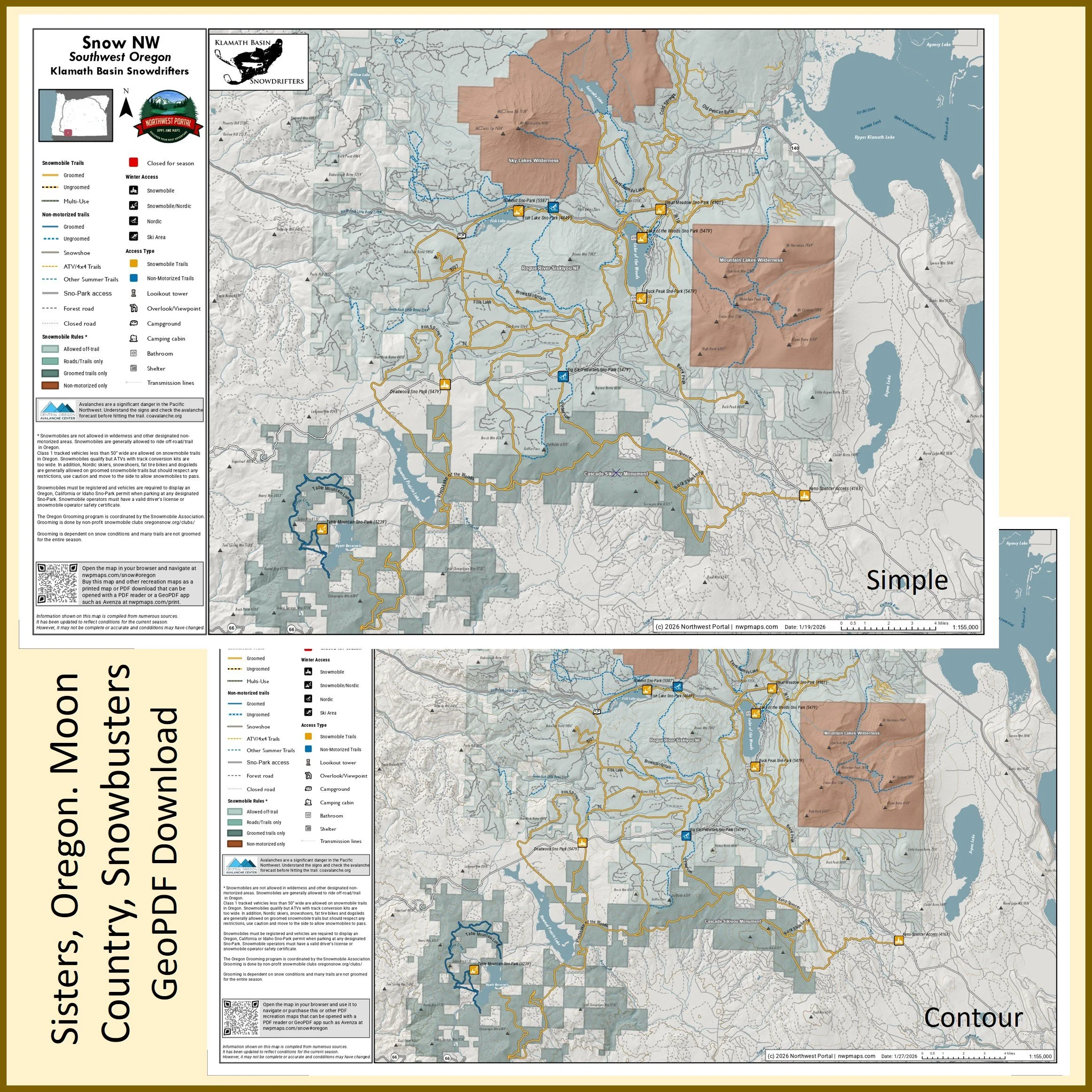
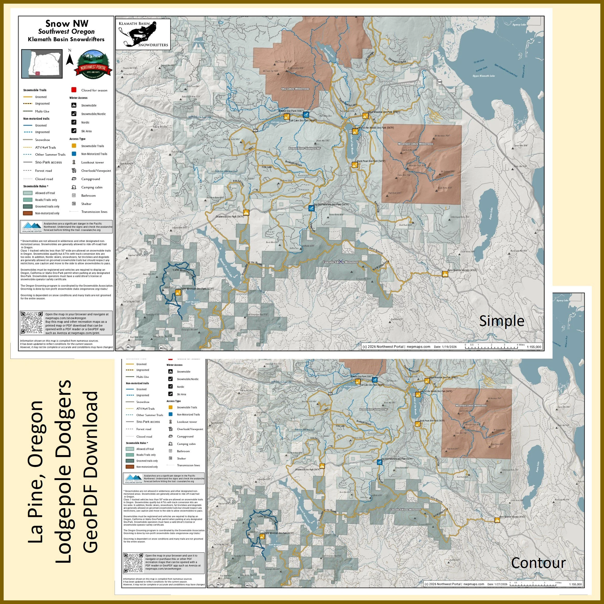
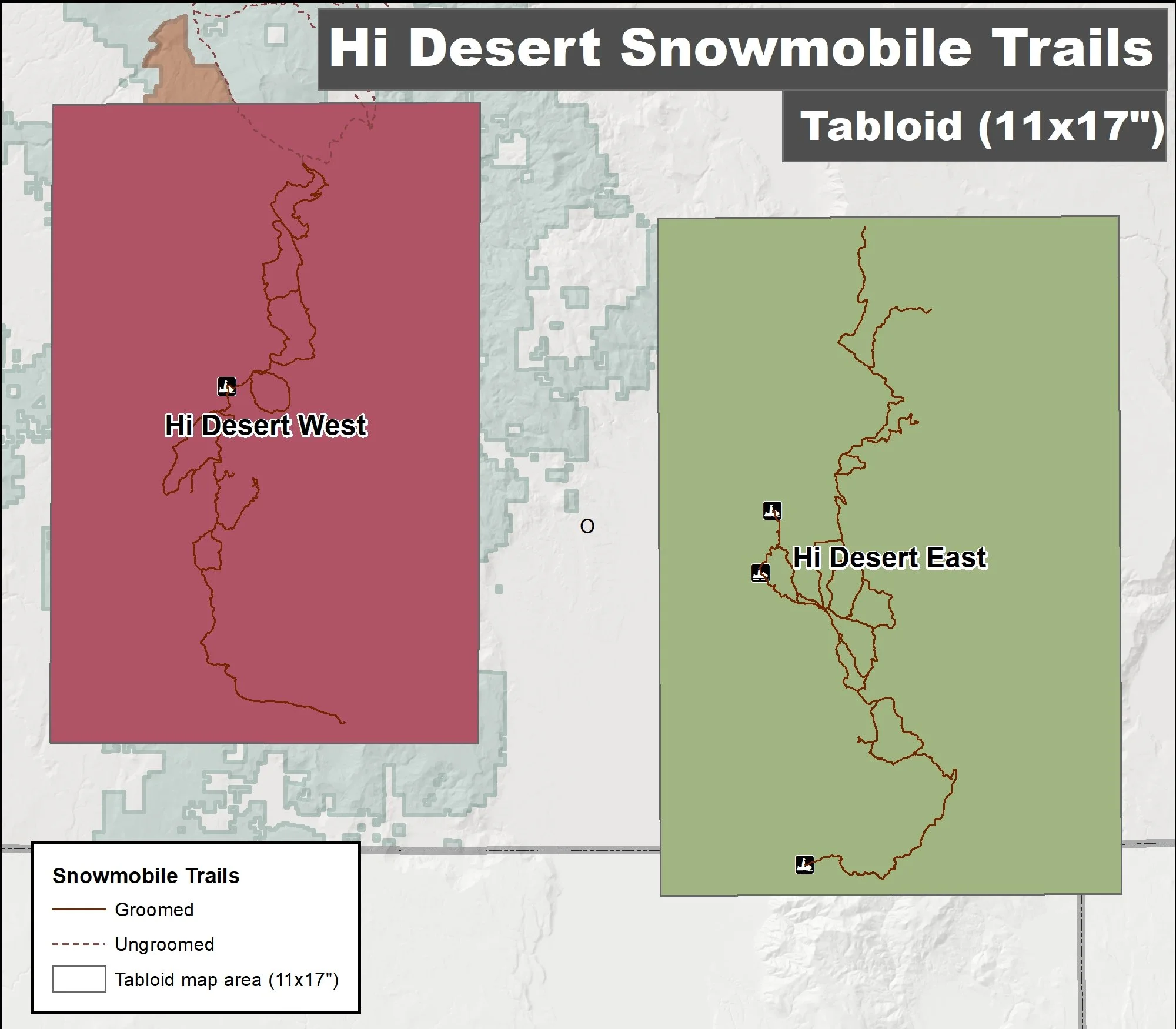
South Oregon Cascades
Umpqua, Rogue River-Siskiyou & Fremon-Winema National Forest and Cascade Siskiyou National Monument
Rogue Snowmobilers, Chiloquin Ridge Riders, Klamath Basin Snowdrifters & Hi Desert Stormtroopers
Tabloid Size (11x17”)
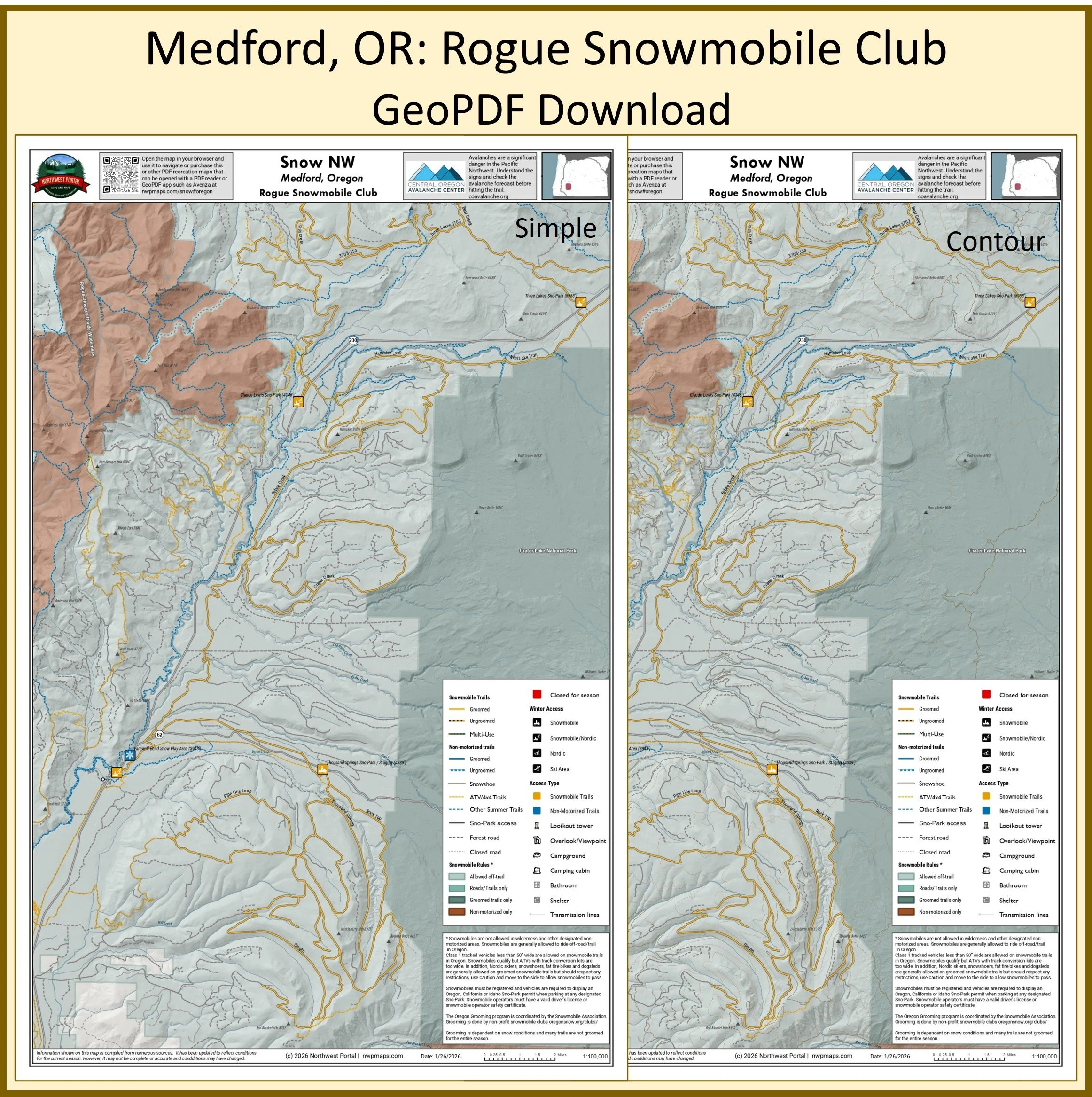
Poster (24x36”)
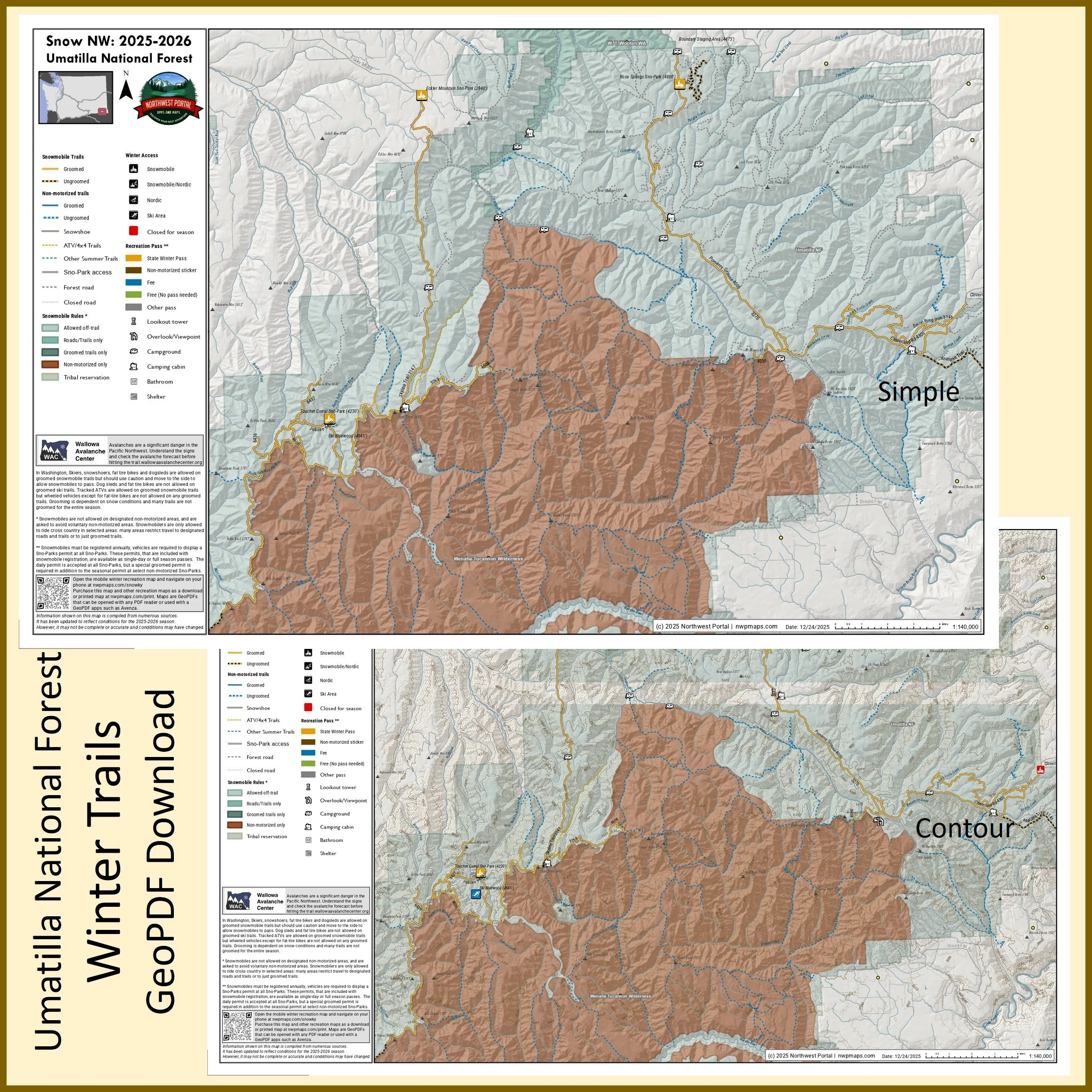
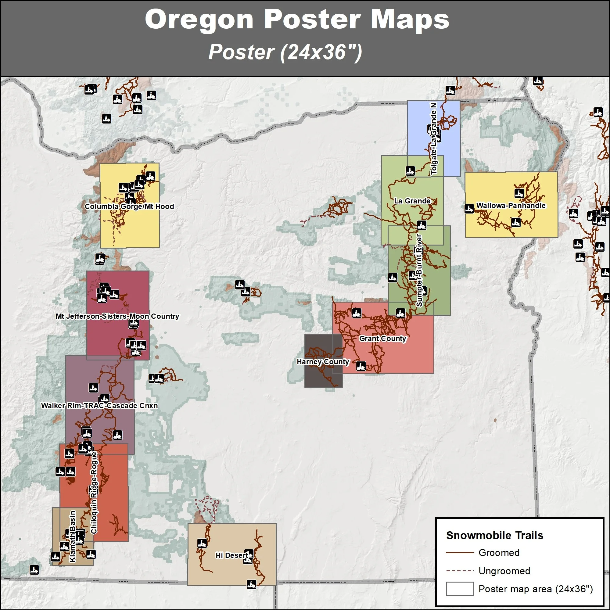
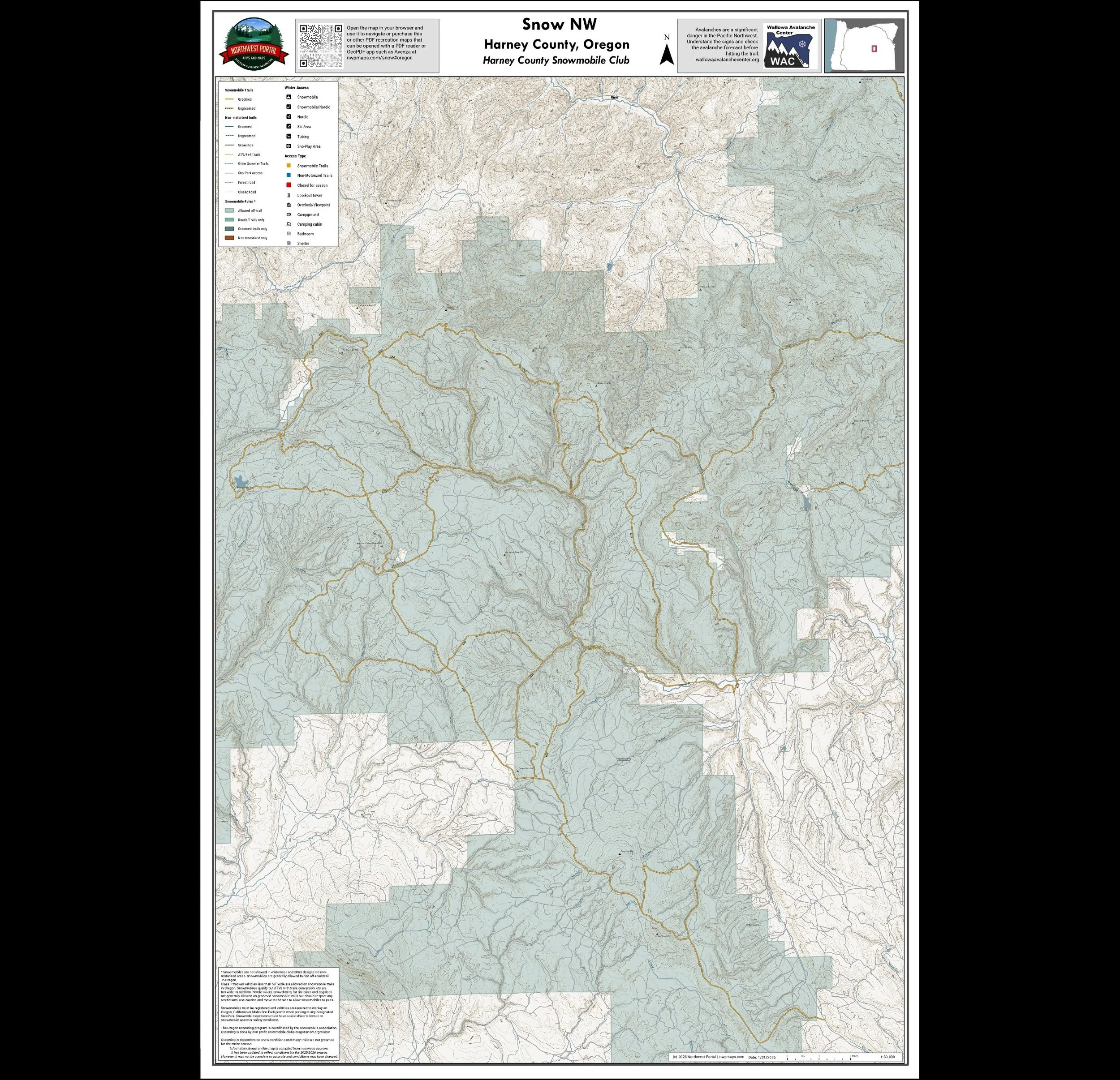
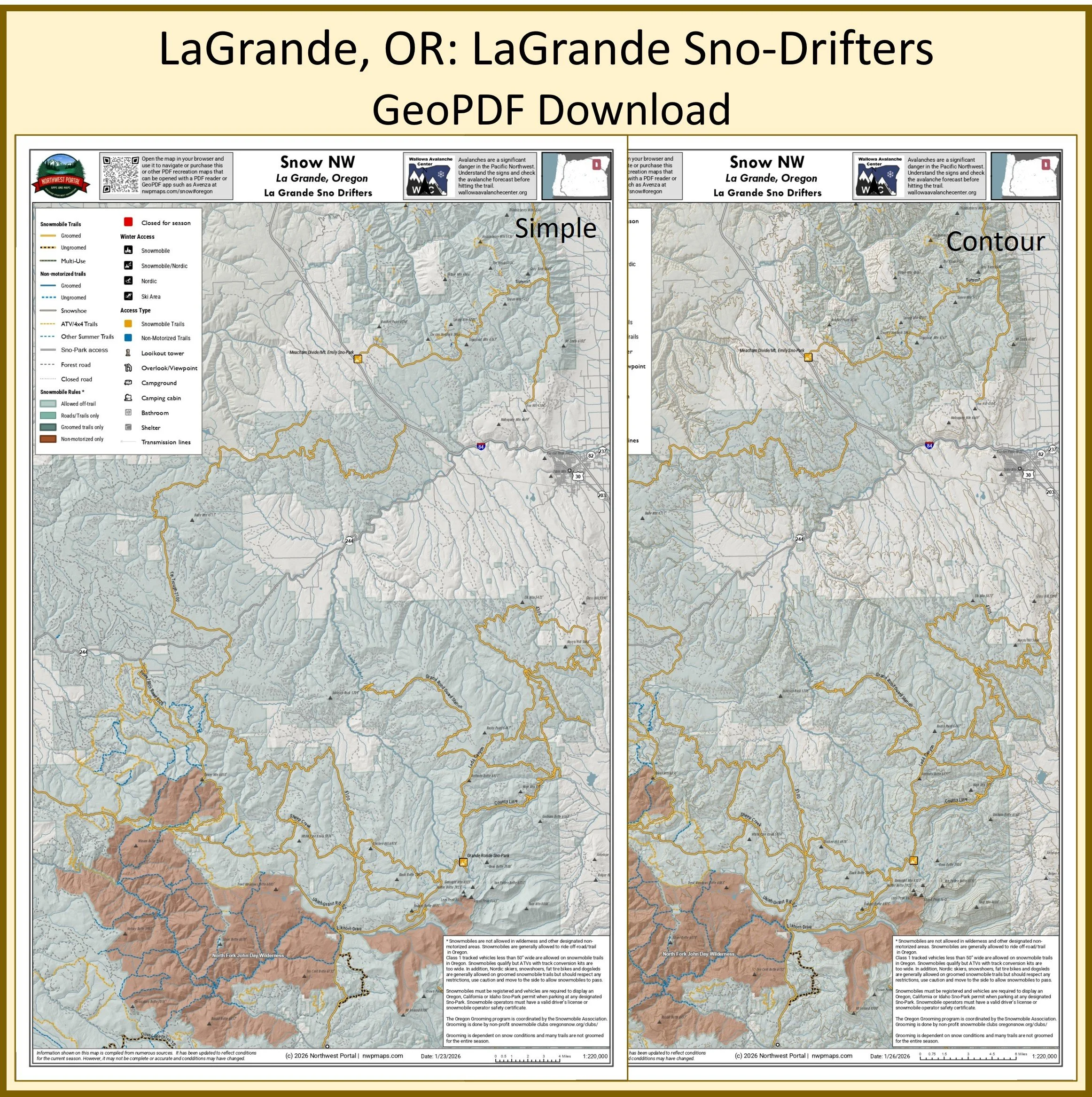
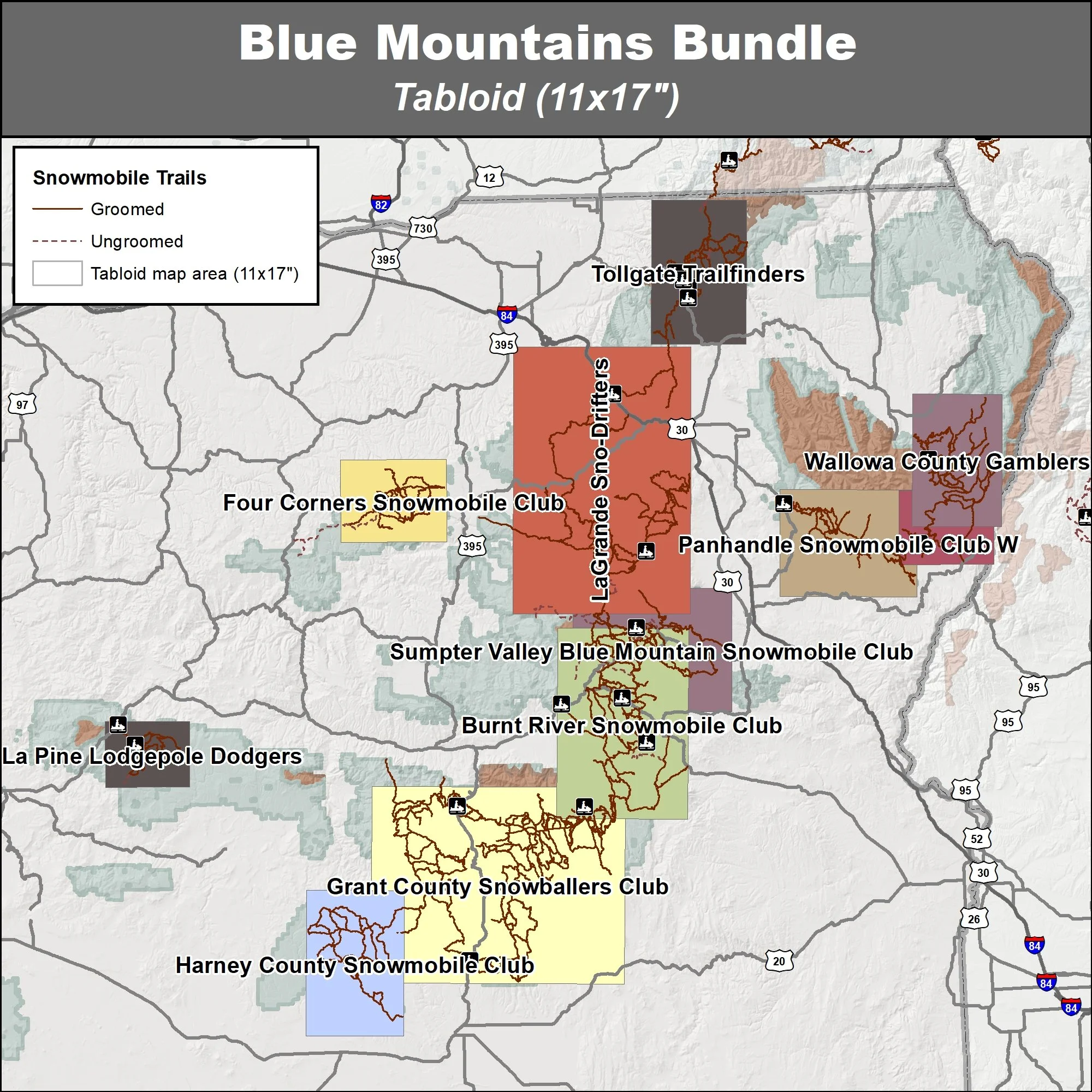
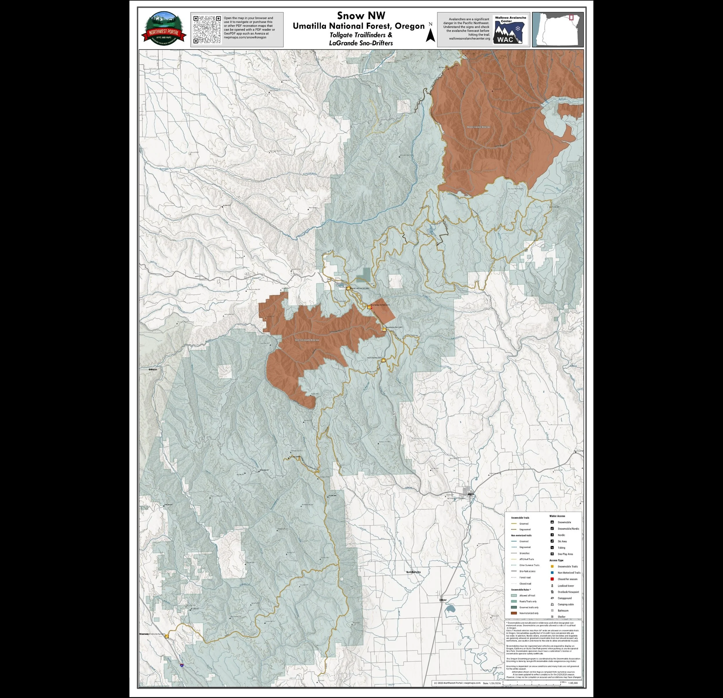
Eastern Oregon - Blue Mountains
Umatilla, Ochoco, Malheur & Wallowa-Whitman National Forest
Burnt River Snowmobile Club, Four Corners Snowmobile Club, Grant County Snowballers Club, Harney County Snowmobile Club, La Pine Lodgepole Dodgers, LaGrande Sno-Drifters, Panhandle Snowmobile Club E, Panhandle Snowmobile Club W, Sumpter Valley Blue Mountain Snowmobile Club, Tollgate Trailfinders and Wallowa County Gamblers.
Tabloid Size (11x17”)
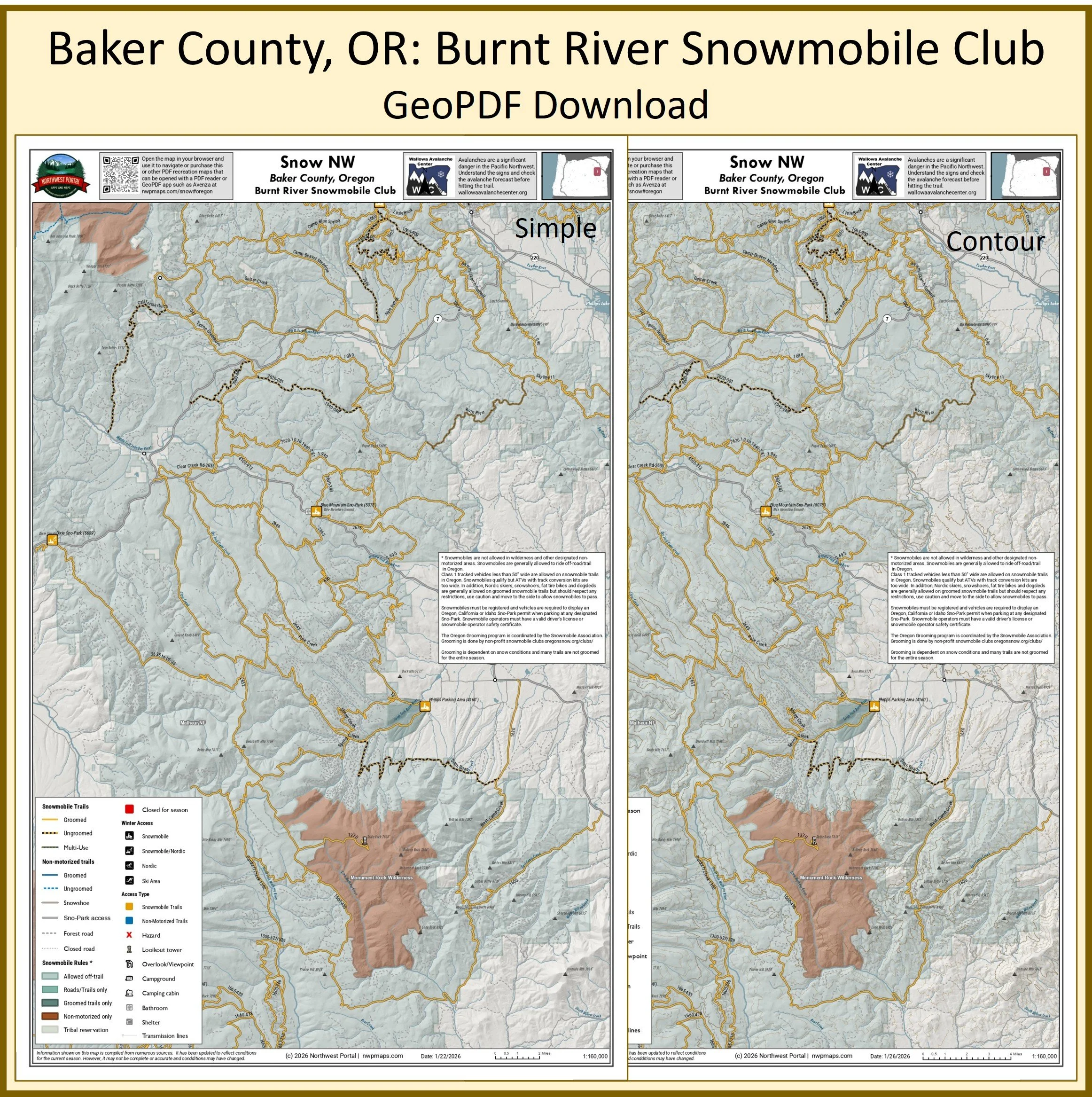
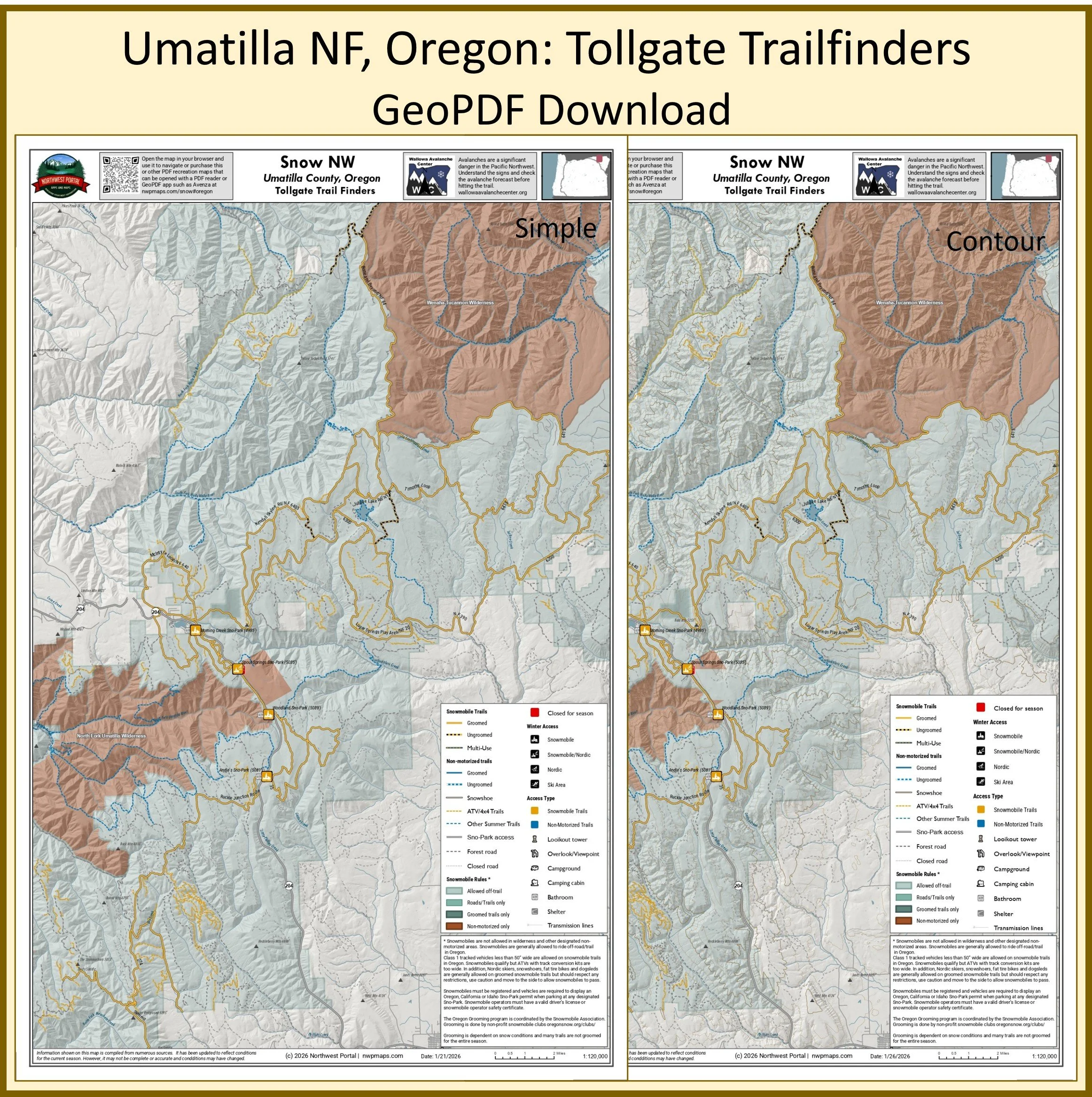
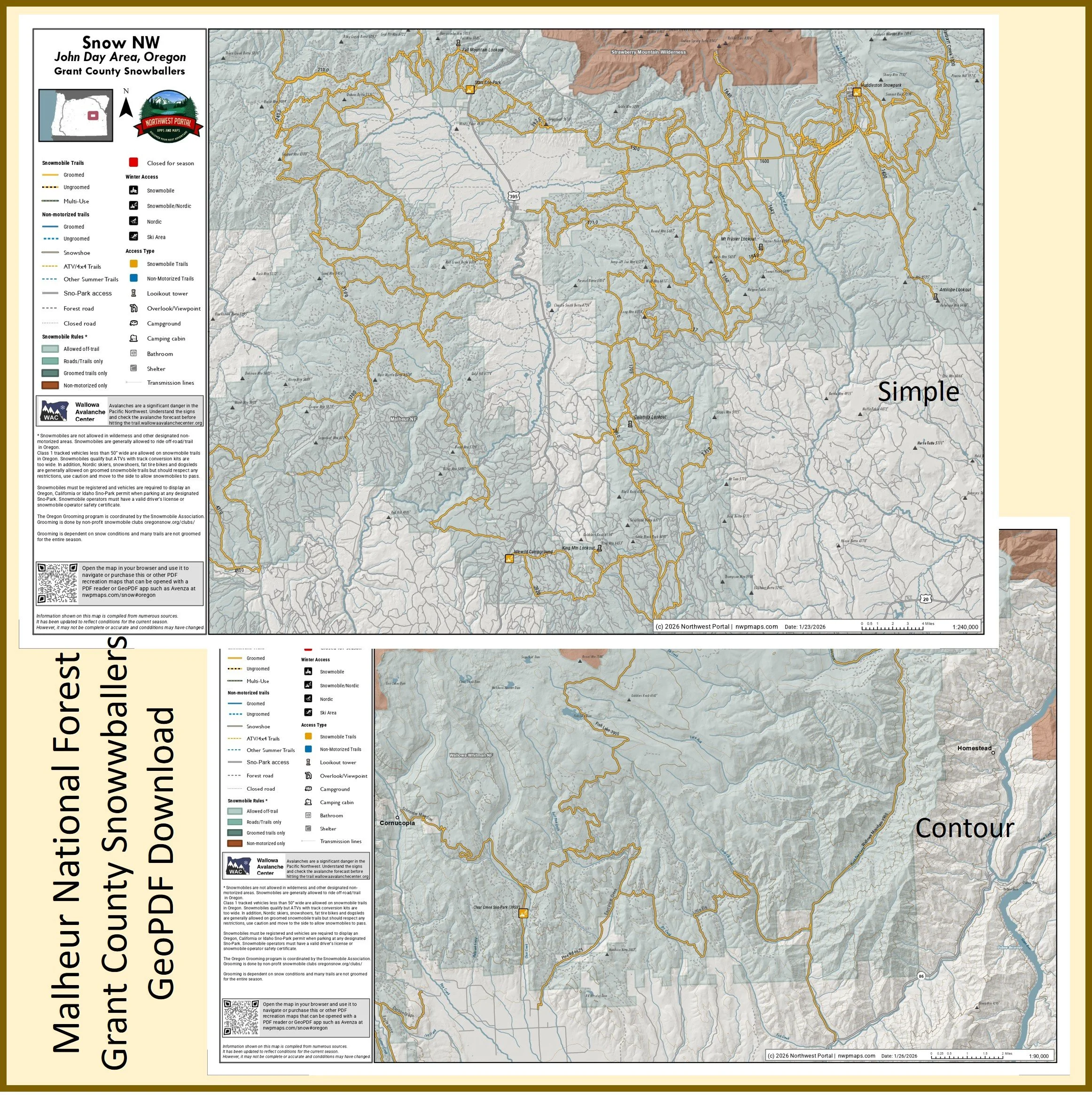
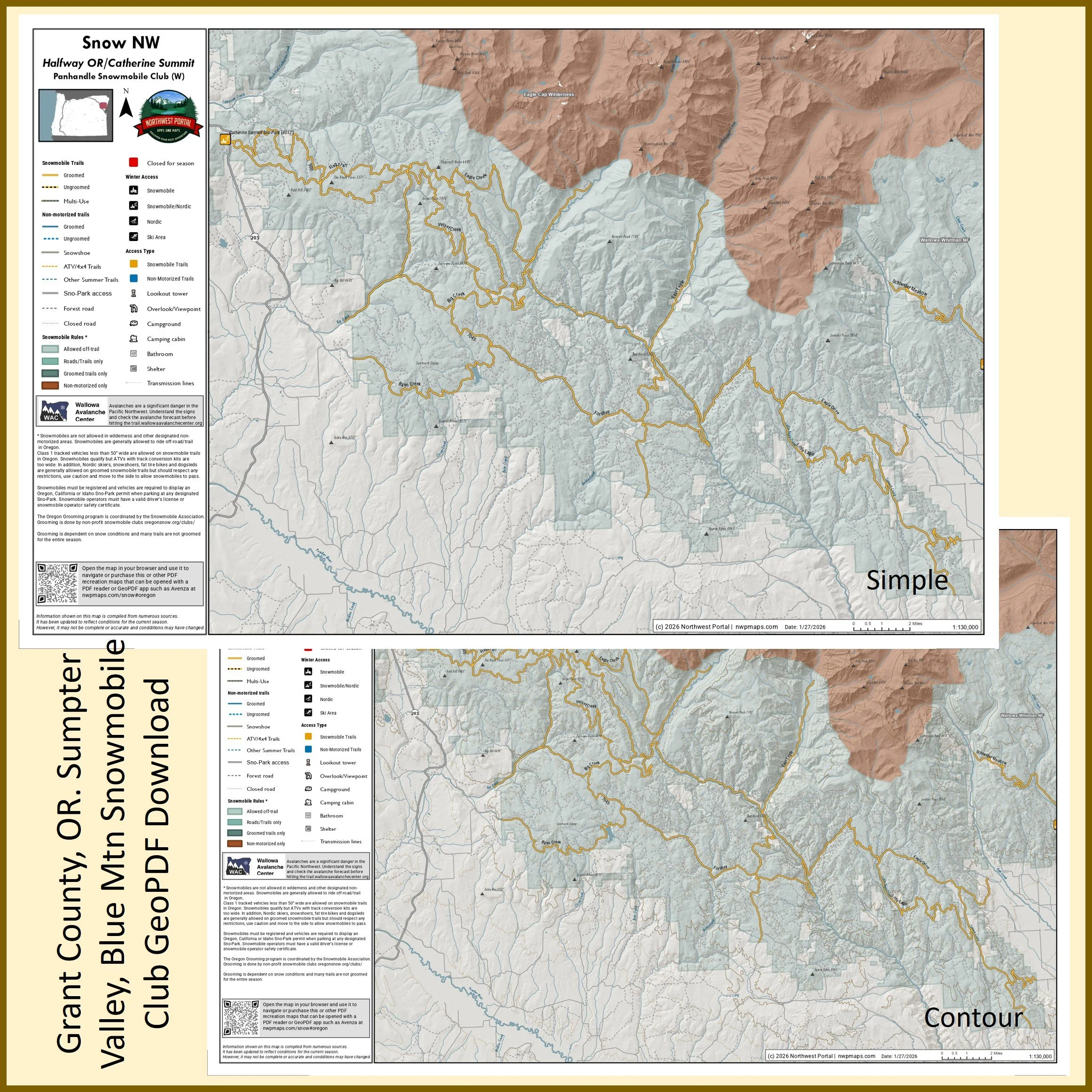
Poster (24x36”)
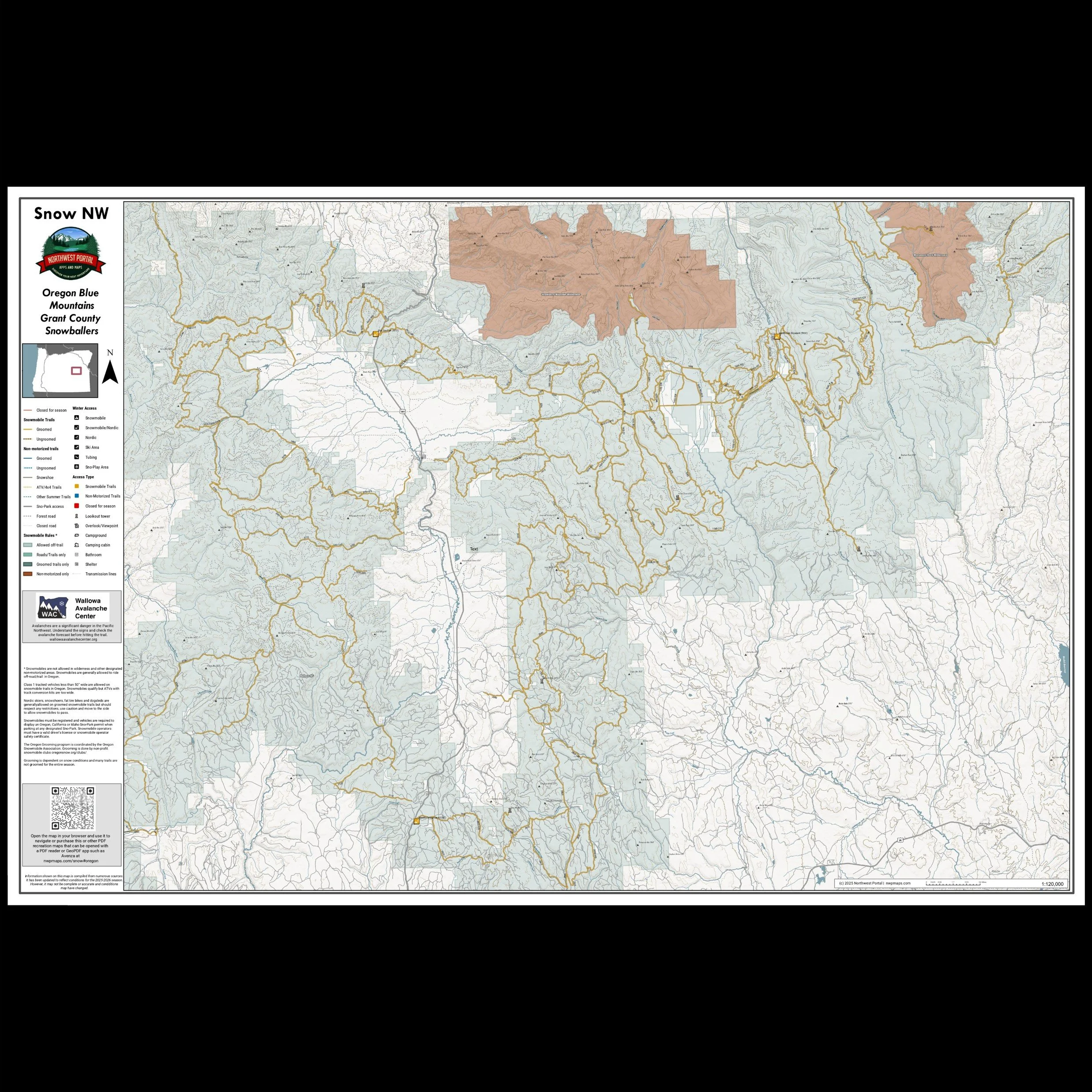
More maps coming soon
Check back for poster sized maps of Oregon
Support Snow NW
Get maps of your riding area and events
And Keep It Free For Users
The Snow NW maps is a public service of Northwest Portal. We need your support to keep them available for users. Join one of our supporting clubs and let them know you saw it on Northwest Portal or encourage your club to becoming a supporting member. Tell your friends about the web maps and GeoPDFs.
Clubs can become supporters for just $100 - and get a tabloid GeoPDF of their riding area with their club logo that they can share with their membesr, plus links to the club page from web maps and one map of a club event/year.

Northwest Portal’s Snow NW Blog Posts


Sponsors
The Snow NW App is entirely free to users - thanks to these supporting Sponsors, Clubs, and Advertisers

Participating Communities
Lake Chelan Chamber of Commerce
Participating Clubs
Cascade Drift Skippers, Sno-Jammers, North Central ATV Club, Junco Snowmoible Club, Klamath Basin Snowdrifters, Chiloquin Ridge Riders
Participating Businesses
Using the Map
Snow NW Legend


Snow NW Filters
Filters let you find the perfect destination by highlighting places that meet all of your conditions.
Filters are organized in groups to make them easier to find, but you can select from more than one group. Most groups highlight places that meet all of the conditions, but a few (Land Manager, Pass, and Days Open) let you see places that have any of the options you select.
On the app, use the Filter button in the upper right to open the filter menu; on the web map, use the Filter button to access the filter groups. Once you are done, use Clear (on the web map) or Reset (on the app).
Other Map Functions
Plot your location with your phone GPS.
Use the search function to highlight places by name. Hints: You can also search by the name of the water body and use search to highlight places written up in Northwest Portal Blogs and partner blogs. If you want to use search to find a city and only want to highlight the city, add “City of” to the search name (City of Ellensburg will give you just the city, Ellensburg will give you the city and any places with Ellensburg in the name).
Use the maps even when offline: On the apps, you can download regions for offline navigation. Hint: Make sure to update your downloads regularly to get the latest updates. Once you have downloaded a region, you will not see changes until you update. (Ending 12/31/2025).
Use Avenza maps to navigate off-line.
You can share the web maps with filters or search applied. You can also embed the maps on a page, with a specific location highlighted.
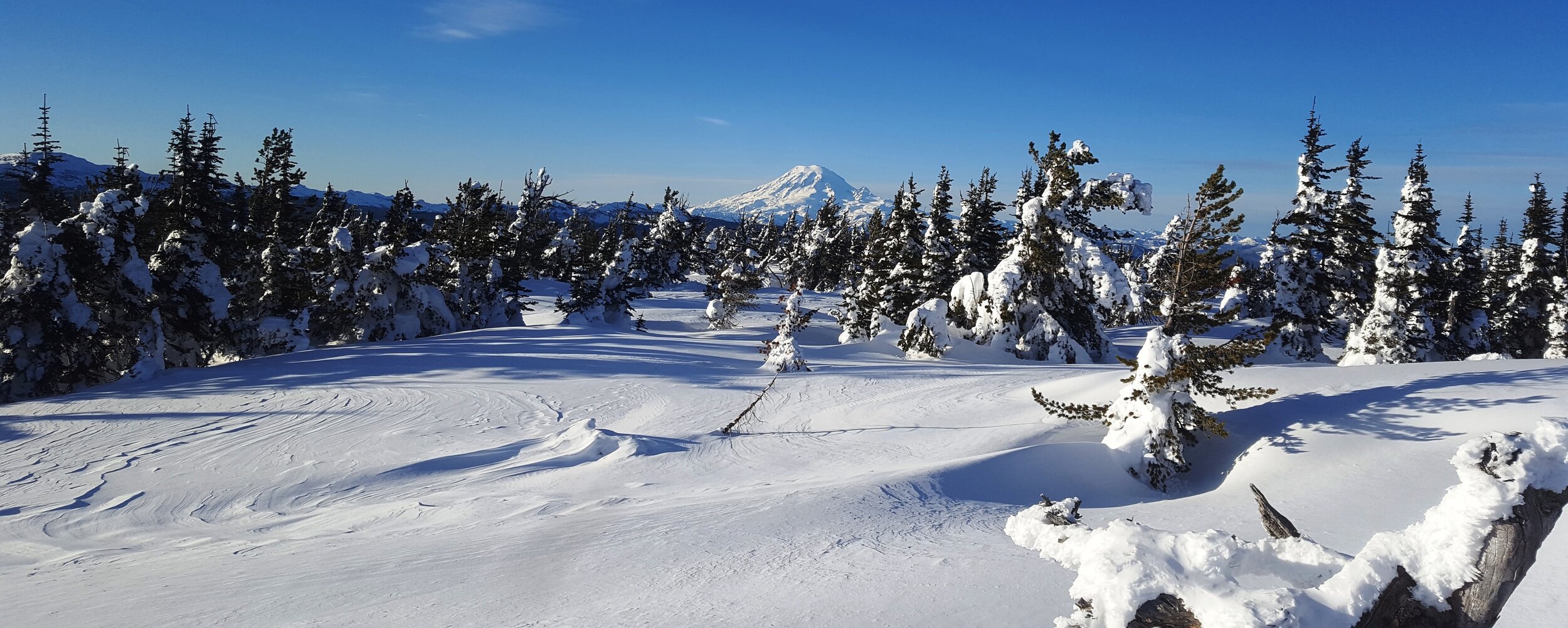
If you dream of riding through a winter wonderland in Washington’s Cascade mountains or want to trying snowmobiling before you invest in the equipment, treat yourself to a guided snowmobile tour or, if you have some experience, rent a snowmobile and explore on your own. Snowmobile Winthrop and Motor Toys Rental and Tours in Cle Elum will help you get out on the snow.