
 Image 1 of 5
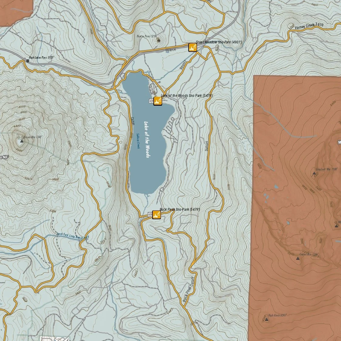 Image 2 of 5
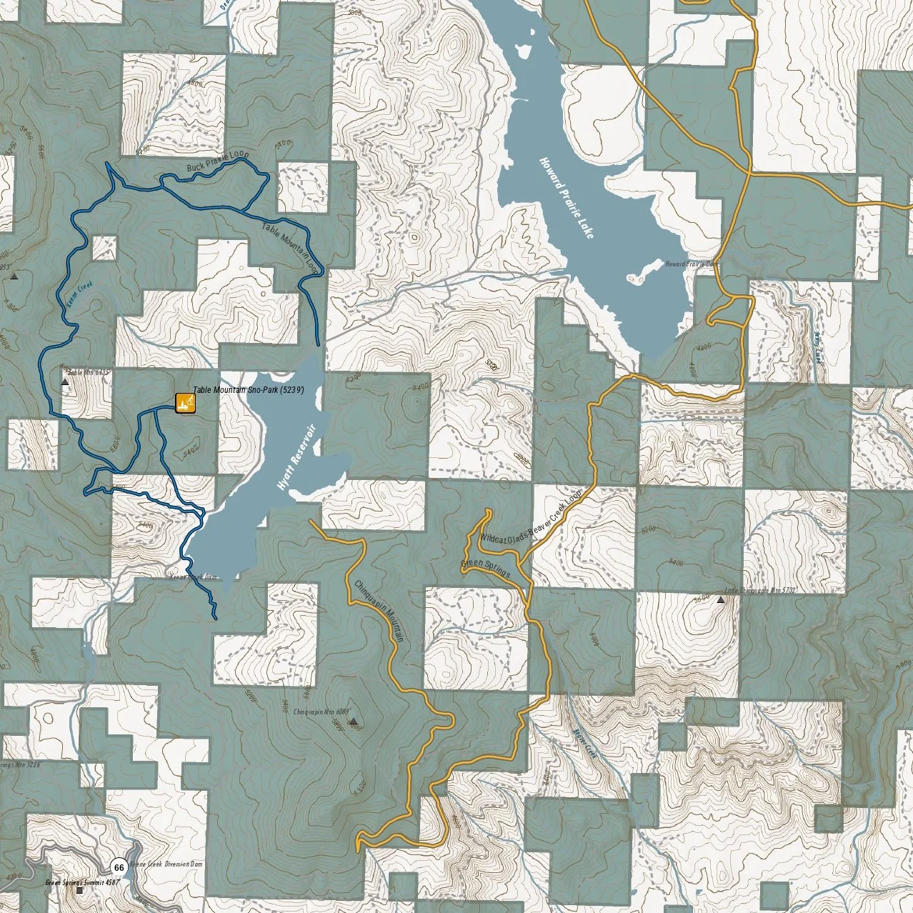 Image 3 of 5
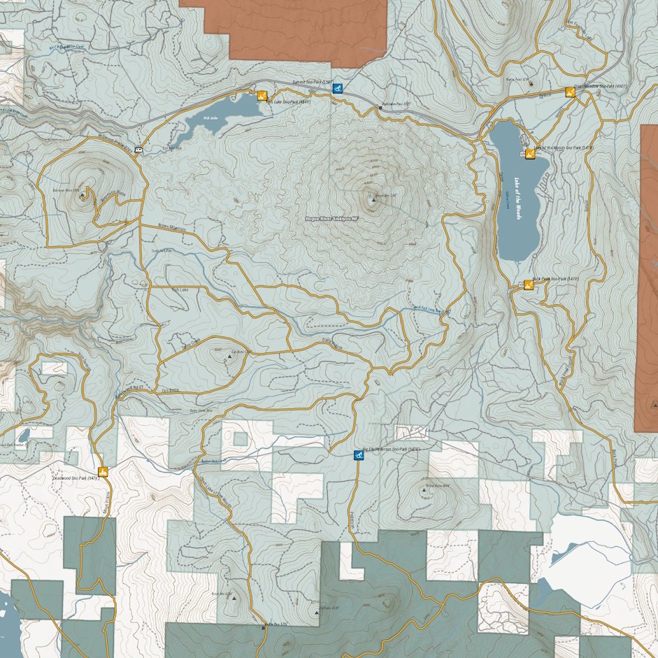 Image 4 of 5
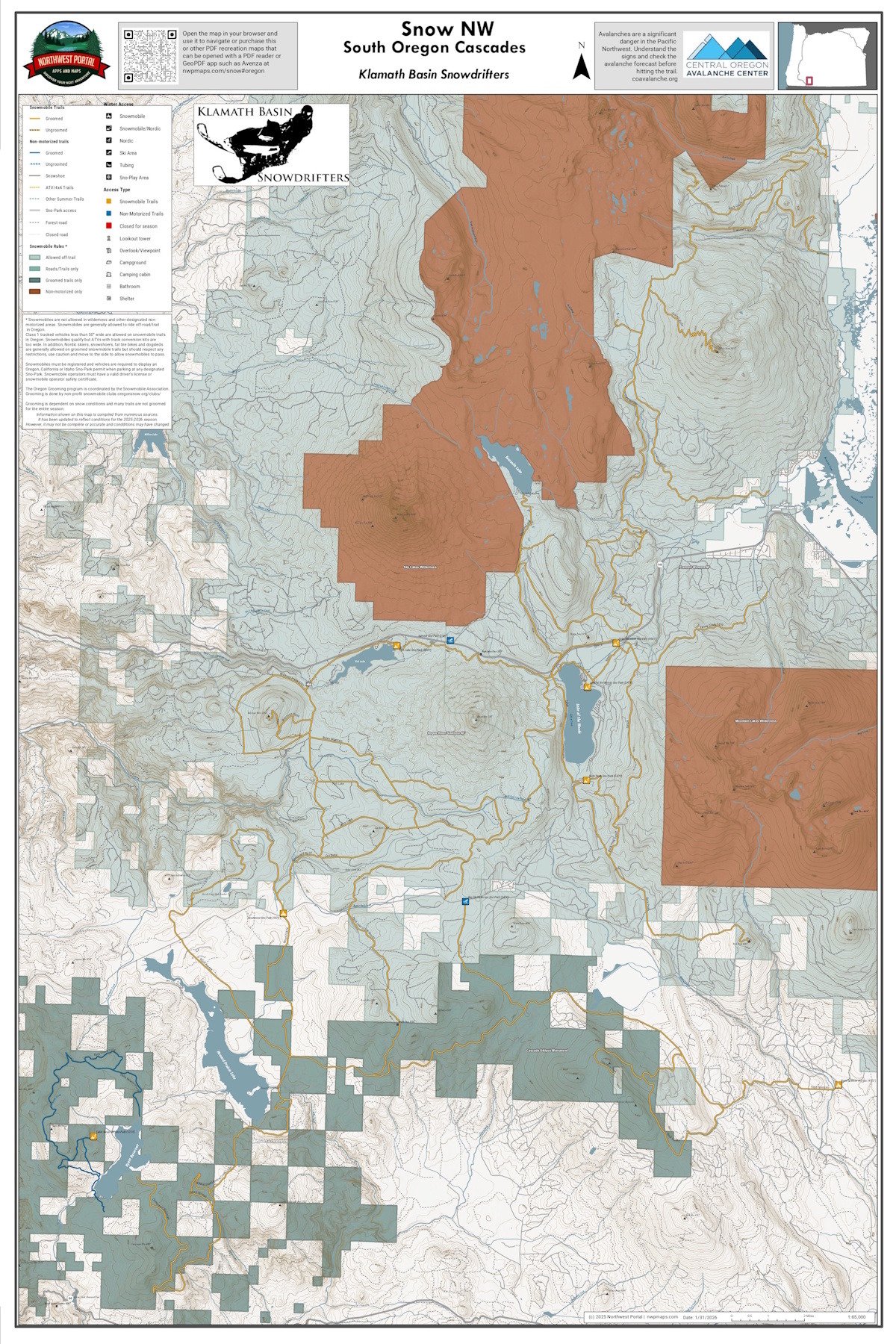 Image 5 of 5
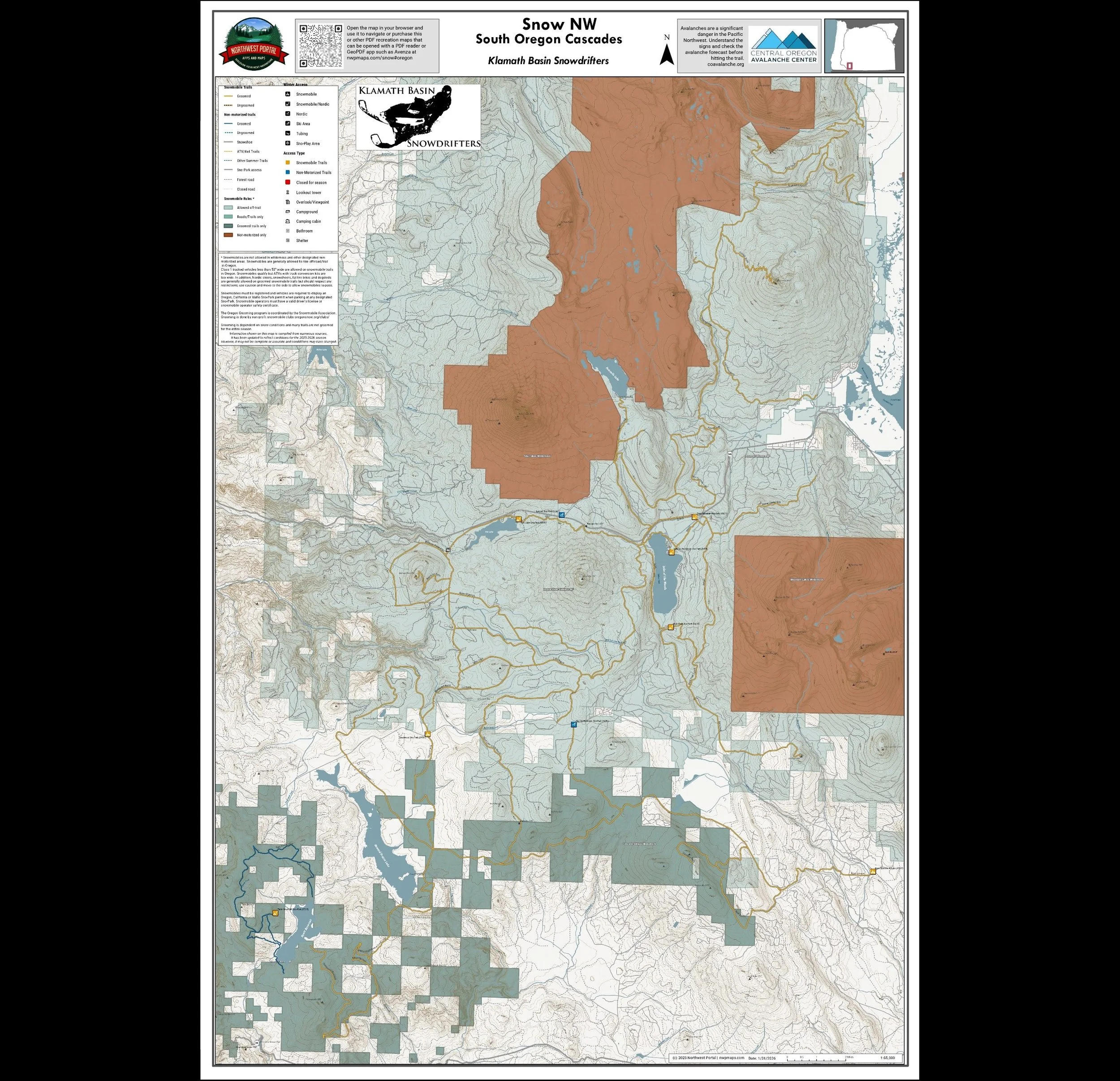
This map shows winter trails in Oregon’s Klamath Basin that are groomed by the Klamath Basin Snowdrifters. snowmobile clubs. It is part of a series of winter recreation map that show where you can ride your sled, ski or snowshoe in the Pacific Northwest. See which trails are groomed, what areas snowmobiles are allowed and where they are restricted. The maps, which were updated for the 2025-2026 season, include shelters, campgrounds, viewpoints, fire towers as well as summer trails and recreation roads, that are often utilized for winter recreation. This map shows trails served by Table Mountain, Deadwood, Buck Peak, Lake of the Woods, Great Meadow, Fish Lake, and Keno Spencer Sno-Parks. The map area includes areas in the Cascade Siskiyou National Monument and the Rogue-River-Siskiyou and Fremont-Winema National Forest in Jackson and Klamath counties. It is a poster sized (24x36”) PDF at a 1:65,000 scale that you can print or use with a GeoPDF app such as Avenza.
This map shows winter trails in Oregon’s Klamath Basin that are groomed by the Klamath Basin Snowdrifters. snowmobile clubs. It is part of a series of winter recreation map that show where you can ride your sled, ski or snowshoe in the Pacific Northwest. See which trails are groomed, what areas snowmobiles are allowed and where they are restricted. The maps, which were updated for the 2025-2026 season, include shelters, campgrounds, viewpoints, fire towers as well as summer trails and recreation roads, that are often utilized for winter recreation. This map shows trails served by Table Mountain, Deadwood, Buck Peak, Lake of the Woods, Great Meadow, Fish Lake, and Keno Spencer Sno-Parks. The map area includes areas in the Cascade Siskiyou National Monument and the Rogue-River-Siskiyou and Fremont-Winema National Forest in Jackson and Klamath counties. It is a poster sized (24x36”) PDF at a 1:65,000 scale that you can print or use with a GeoPDF app such as Avenza.